
 Worksheets
Unit 1 DTQ 1 Demonstration of Understanding
Total questions: 10
Worksheet time: 5mins
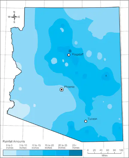
According to the map, which city receives the most rain in an average year?
Flagstaff
Phoenix
Tucson
Yuma
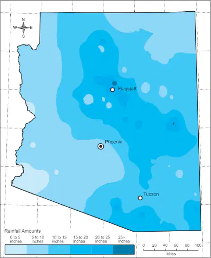
Going from Phoenix to Tucson you would travel in which direction?
North
South
East
West
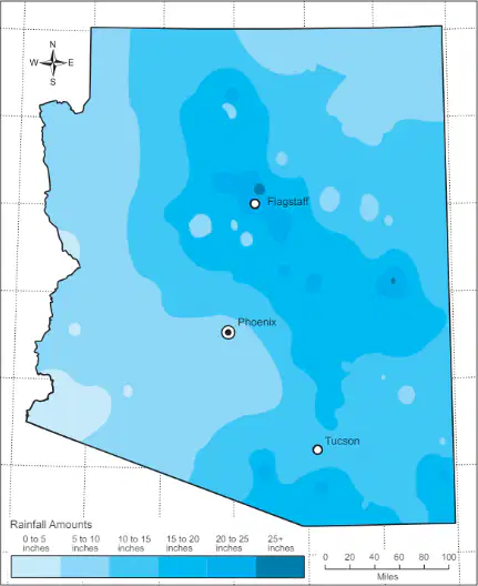
Which city on the map receives the least rainfall?
Phoenix
Tucson
Flagstaff
Yuma
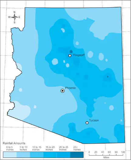
What is the average yearly rainfall in Northeastern Arizona?
10-15 inches
5-10 inches
15-20 inches
20-25 inches
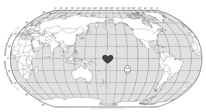
The smiley face on the map above is located at-
40° S, 160° E
60° N, 40° W
20° N, 120° W
20° S, 140° W
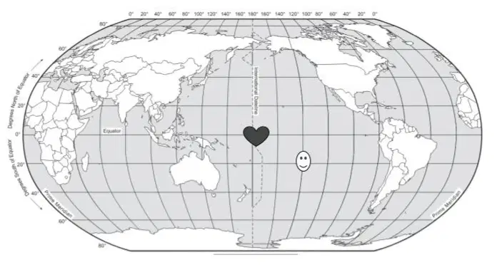
The heart on the map is located ________________ the smiley face.
Northeast
Southeast
East
Northwest
Question Six (6) is an example of what type of location?
Relative location
Absolute location
Physical location
Cultural location
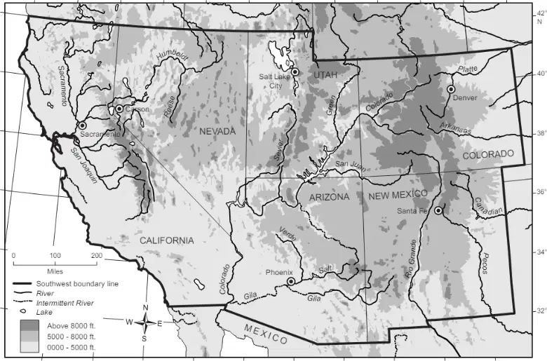
Which state on the map has the largest area of elevation above 8000 feet?
California
Nevada
Colorado
Arizona
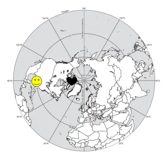
The heart on the map is located in which direction from the smiley face?
North
South
East
West
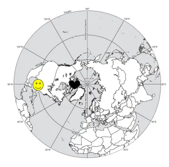
What are the coordinates of the smiley face’s location on the map? Use * in place of the degree sign.
(a)

