
NEW
Font size
 Worksheets
Map Skills Test
Total questions: 25
Worksheet time: 43mins
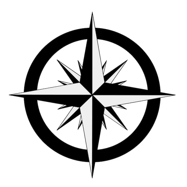
This map feature shows the cardinal directions and intermediate directions.
map key
compass rose
map scale
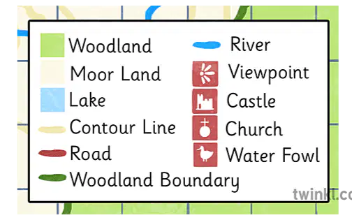
This feature explains what the symbols on a map stand for.
map key
compass rose
map scale

This map feature shows the relationship between map distances and real distances.
map key
compass rose
map scale
North, South, East and West are the _____________.
cardinal directions
primary colors
seasons of the year
types of clouds
Northeast, Northwest, Southeast, Southwest are the...
intermediate directions
primary colors
types of clouds
seasons of the year
This is a picture that stands for something real.
equator
longitude
symbol
latitude
The Imaginary circle that goes around the Earth and divides it into two equal parts North and South.
equator
longitude
symbol
latitude

Imaginary lines that go around the Earth west to east or side to side; also called parallels.
equator
longitude
symbol
latitude
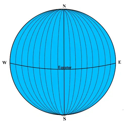
Imaginary lines that run around the Earth from North to South or up and down; also called meridians.
equator
longitude
symbol
latitude
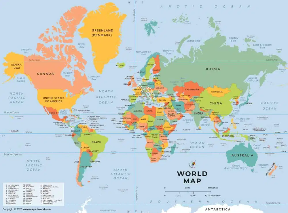
This type of map shows the borders between countries or states, and shows capitals and cities.
political map
physical map

This type of map shows landforms like mountains, rivers, oceans, and lakes.
political map
physical map
Latitude and Longitude are imaginary lines that are used to show:
the exact locations of places on earth
how many miles one inch stands for
the elevation of places above sea level
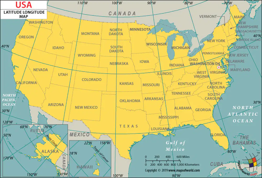
Use the Map of the United States to answer the following questions. Which state is located at 40°N latitude and 90°W longitude?
a. Illinois
b. Utah
c. Ohio
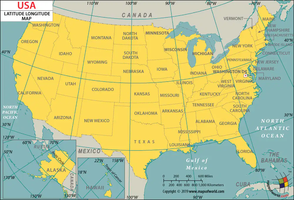
Which state is at 45°N latitude and 120°W longitude?
a. Ohio
b. Oregon
c. South Dakota
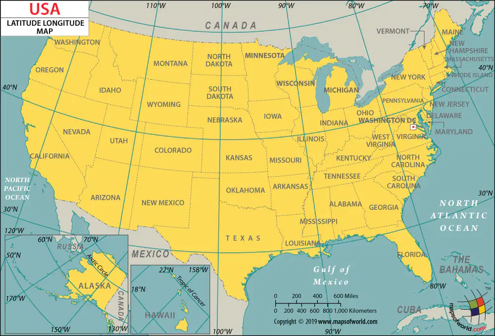
Which state is at 30°N latitude and 100°W longitude?
a. Florida
b. Mexico
c. Texas
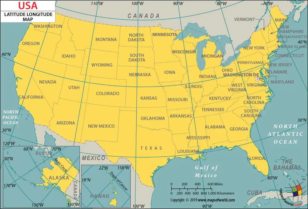
Which state is at 35°N latitude and 80°W longitude?
a. Arkansas
b. North Carolina
c. Colorado

What does a ★ stand for on this map?
State Capital
Mountain
River
City


What direction is indicated by the number 5?

What direction is indicated by the number 6?
north
east
south
west
What direction is indicated by the number 7?
north east
southeast
southwest
northwest
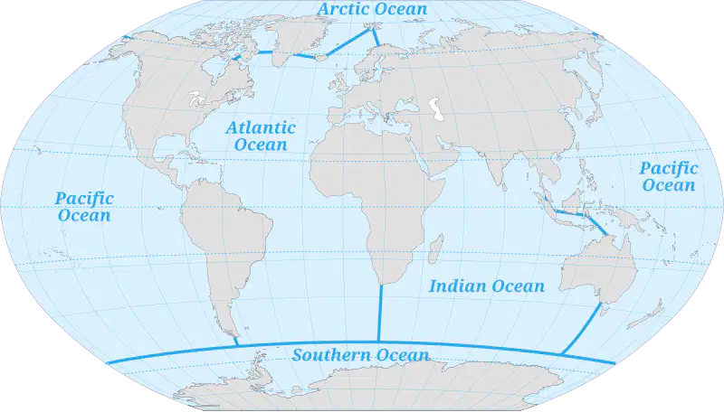
Why does it look like there are two Pacific Oceans?
There ARE two Pacific Oceans
The globe is round, so when you lay it out flat for a map, it makes it look like there are two Pacific Oceans
The Pacific Ocean has spilled over to the other side of the map
None of the above

