
 Worksheets
Geography
Total questions: 54
Worksheet time: 1hrs 2mins
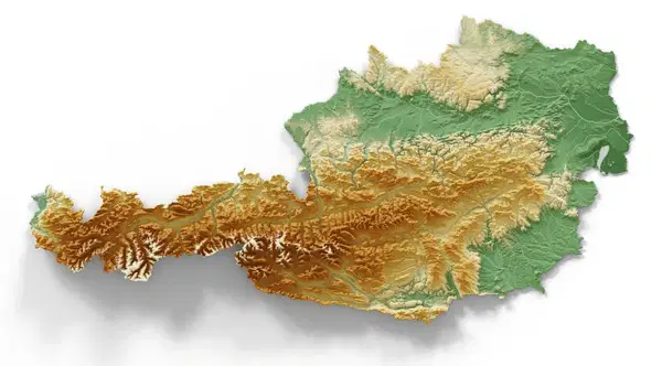
What does this relief map show?
Elevation
Gradient
Landscape
Waterways
Climate
The study of the structure, evolution and dynamics of the Earth and its natural mineral and energy resources.
(a)
What is the Climate?
average weather of a place over a long period of time
daily weather patterns in a region
how close a country is to the equator
average weather of the entire world over a long period of time
The NATURAL LANDSCAPE IS the original landscape that exists before it is changed by (a)
The longest river in Austria is the
Danube
Salzach
Inn
Enns
This Austrian river passes through Salzburg
Danube
Salzach
Inn
Enns
This Austrian river is mainly in Tyrol
Danube
Salzach
Inn
Enns
This Austrian river is mainly in Upper Austria
Danube
Salzach
Inn
Enns
Climate graphs usually measure what and what?
Rainfall in mm and temperature in celsius
Rainfall in cm and temperature in celsius
Rainfall and temperature
Rainfall in litres and temperature in census

Which month had the highest rainfall?
(a)

Which month had the lowest rainfall?
(a)

Which month had the highest temperature?
(a)

Based on this climate graph, what can you say about the overall climate of this area? What is the average temperature and rainfall? Does it have seasons? Is it in the northern or southern hemisphere?
Austria has five micro-climates: which one has...
central Alpine region with cold snowy winters and cool, wet summers (e.g Innsbruck)
Alpine Climate
Central European Transitional Climate
Highland Climate
Pannonian Climate
Illyrian Climate
Austria has five micro-climates: which one has...
northern Alpine foothills. Transitional conditions from the cooler, wetter west to the warmer and drier east (e.g Linz)
Alpine Climate
Central European Transitional Climate
Highland Climate
Pannonian Climate
Illyrian Climate
Austria has five micro-climates: which one has...
Located in the Granite and Gneiss highlands, which due to the high elevation causes this zone to have cool summers and lots of precipitation throughout the year (e.g Gmünd)
Alpine Climate
Central European Transitional Climate
Highland Climate
Pannonian Climate
Illyrian Climate
Austria has five micro-climates: which one has...
Located in the Eastern lowlands, the flat plains of this zone has hot, dry summers and cold winters with low precipitation throughout the year (e.g Vienna)
Alpine Climate
Central European Transitional Climate
Highland Climate
Pannonian Climate
Illyrian Climate
Austria has five micro-climates: which one has...
Located in the south-eastern Alpine foothills, this region is influenced by the Mediterranean Sea so it has warm, dry summers and mild, wet conditions in autumn and winter (e.g Feldbach)
Alpine Climate
Central European Transitional Climate
Highland Climate
Pannonian Climate
Illyrian Climate
What is the difference between weather and climate?
Climate is based on location due to how heat from the sun hits the Earth.
The most intense area is the
(a)
Why are the North and South Pole the coldest areas?
Due to the curvature of the Earth which spreads sunlight over a large area (ending at the poles)
They are the furthest points from the equator
They are closer to the moon which creates darkness and cold/ice
They are colder due to the magnetic field of the Earth
Which of the following factors affect climate?
Earth's curvature and amount of sunlight that hits an area
landscape like mountains, highlands, plains
location in relation to the equator
weather like snow and rain on a day to day basis
the time and the month
the process by which the land is covered by glaciers
glaciation
glacial period
interglacial period
glaciers
A large mass of ice that flows very slowly, under the force of gravity
glaciation
glacial period
interglacial period
glaciers
times with large ice sheets are known as ice ages or
glaciation
glacial period
interglacial period
glaciers
times without large ice sheets are known as
glaciation
glacial period
interglacial period
glaciers
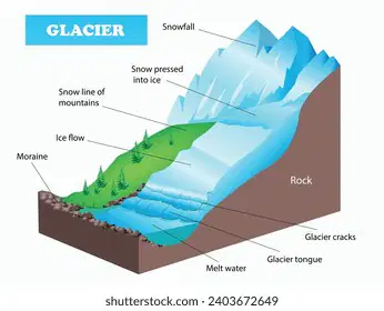
How are Glaciers formed?
Areas on a glacier where more ice is gained than lost are called zone of
Accumulation
Ablation
Erosion
Abrasion
Plucking
Areas on glaciers where more ice is lost than gained are called zones o
Accumulation
Ablation
Erosion
Abrasion
Plucking
Glaciers carry lots of energy and as they move, this energy can break down or (a)
When a glacier drops material due to having no energy it is called glacial (a)
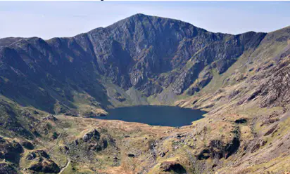
These landforms are created through erosion and occurs in highland areas (hollowed out crater-like hole often filled with a lake)
Cirques or Corries
Moraines
Arêtes
Erratics
Drumlins
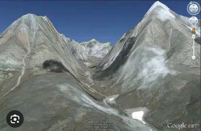
as they move downhill, the glaciers change V-shaped valleys into _________ as they fill the area
Cirques or Corries
U-Shaped Valleys
Arêtes
Erratics
Drumlins
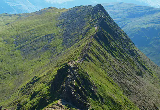
jagged ridge that forms as the glacier moves down the valley (located at the highest point of the highlands)
Cirques or Corries
Moraines
Arêtes
Erratics
Drumlins
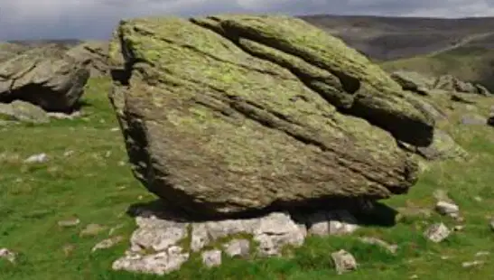
large boulders dumped by the melting ice (transported and deposited)
Cirques or Corries
Moraines
Arêtes
Erratics
Drumlins
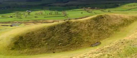
mounds of glacial material with a smooth shape as the ice moved over them
Cirques or Corries
Moraines
Arêtes
Erratics
Drumlins
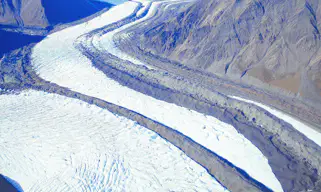
appear as slopes that have been bunched together. Formed when ice retreats and leaves behind the rocks and sediment it was carrying
Cirques or Corries
Moraines
Arêtes
Erratics
Drumlins
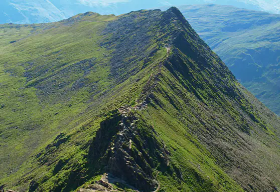
Which erosion based landform is shown?
(a)

Which erosion based landform is shown?
(a)
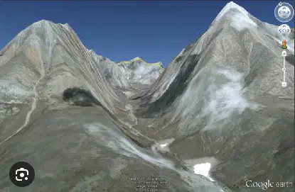
Which erosion based landform is shown?
(a)
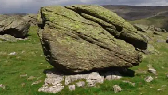
Which deposition based landform is shown?
(a)
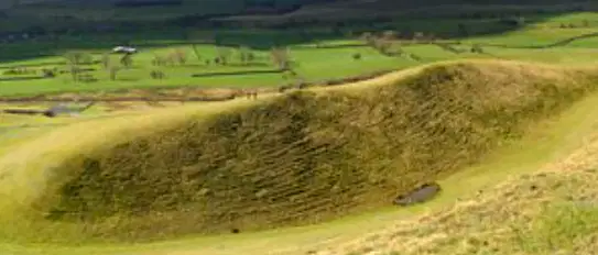
Which deposition based landform is shown?
(a)
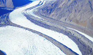
Which deposition based landform is shown?
(a)
How has glacial erosion and deposition changed the landscape of Austria?
It has shaped the valleys and mountain ranges in the Alps
Left behind glacial lakes and glaciers
Just 20,000 years ago, most of Austria was covered in ice
Glaciers still exist all over Austria
Just 200,000 years ago, most of Austria was covered in ice
Label the following Bundesländer (Federal states)

Farmland grazed by animals
Pasture
Pastoral
Arable
Arid
weak, crumbly, sedimentary rock
sandstone
limestone
slatestone
obsidian
Weak, loose, sedimentary rock
sandstone
limestone
slatestone
obsidian
Fragile, metamorphic rock
sandstone
limestone
slatestone
obsidian
Something that does not allow water to pass through it is called (a)
Large pieces of strong, hard, igneous rock that are resistant to erosion.
limestone
granite boulders
sandstone
slate boulders
slatestone
If something is dry, it is also called (a)
Levelled banks dug on slopes to slow down the flow of water (used in farming and for environmental control) are called ______ ________
(a)
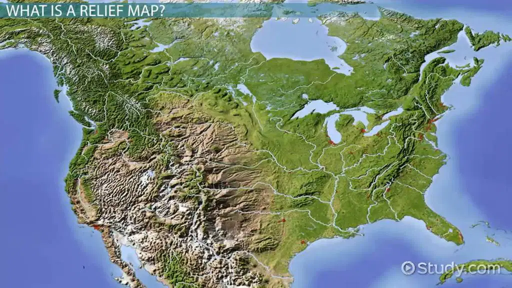
What can you tell about this continent from the relief map? Use cardinal directions like north, south, east, west. Is it landlocked?

