
 Worksheets
Exploring Geography Through Maps
Total questions: 35
Worksheet time: 35mins
What are the 5 themes of geography?
Location, Place, Human-Environment Interaction, Movement, Region
Latitude, Longitude, Equator, Prime Meridian, Hemisphere
Climate, Weather, Population, Culture, Economy
Mountains, Rivers, Deserts, Forests, Oceans
Which map projection is known for preserving the shape of landmasses but distorting their size?
Mercator Projection
Robinson Projection
Peters Projection
Conic Projection
What type of map would you use to find the elevation of a mountain?
Political Map
Contour Map
Climate Map
Road Map
If a map scale shows 1 inch equals 100 miles, how many miles would 3 inches represent?
100 miles
200 miles
300 miles
400 miles

Distance between Idaho and Nebraska?
600
300 mi
1200 mi
600 mi
Which coordinate represents the absolute location of the North Pole? (A2, A4, 3)
90°N, 0°E
0°N, 90°E
45°N, 45°E
90°S, 0°E
Which country would you be in at 60*N, 120*W?
United States
Canada
Russia
Australia

What is the primary use of a political map?
To show climate zones
To display physical features like mountains and rivers
To indicate governmental boundaries and major cities
To illustrate population density
If you are given the coordinates (34°N, 118°W), which city are you likely near? (A2, A3, 24)
New York City
Los Angeles
Chicago
Miami
Which ocean is located to the East of Africa?
Atlantic Ocean
Indian Ocean
Pacific Ocean
Arctic Ocean
How can a map help answer the question: "What is the shortest route from New York to Los Angeles?"
By showing the population of each city
By displaying the roads and distances
By indicating the climate of each region
By listing the resources and land uses
Which type of map would best help you understand the amount of rainfall in a region?
Political Map
Physical Map
Climate Map
Economic Map
What is the significance of the Prime Meridian in geography?
It divides the Earth into Eastern and Western hemispheres
It is the starting point for measuring latitude
It marks the hottest point on Earth
It is the longest line of latitude
What factors should be considered when selecting a site for a new hospital in a city?
Closeness to residential areas
Availability of open land
Availability to major roads and public transport
Proximity to landforms

Which type of map?
Political Map
Physical Map
Population Density Map
Climate Map

What is the main purpose of a contour map?
To show political boundaries
To display elevation and landforms
To indicate climate zones
To illustrate economic activities
Which of the following coordinates is closest to the Equator? (A2, A3, 3, 24)
45°N, 90°E
0°N, 30°E
60°S, 120°W
23°N, 45°W
What is the purpose of using a scale on a map?
To measure the temperature of a region
To determine the distance between two points
To identify the population density
To show the elevation of mountains
Which type of map would you use to find the location of a country's capital city?
Topographic Map
Political Map
Climate Map
Economic Map
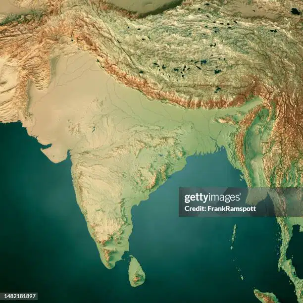
What is the main characteristic of a physical map?
It shows the political boundaries of countries
It displays natural features like mountains and rivers
It indicates the economic activities of a region
It highlights the cultural landmarks

What is the primary purpose of this map?
To show political boundaries
To display climate zones and weather patterns
To indicate population density
To illustrate economic activities
Which type of map would you use to identify the major rivers in a continent?
Political Map
Physical Map
Climate Map
Economic Map
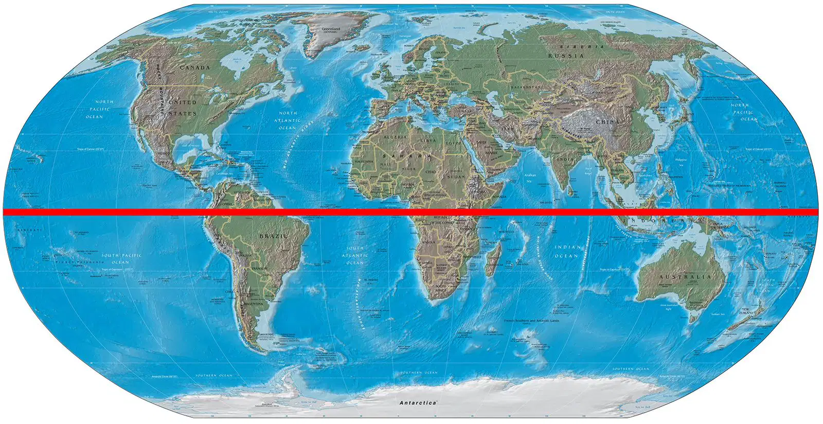
Which is not a significance of the equator in geography?
It runs through the middle of Africa
It is the starting point for measuring latitude
It marks the hottest point on Earth
It is the second measurement for finding absolute location

What is the purpose of this map?
Show the landforms of the area
Show the climates of an area
Shows the resources and land use of an area
Shows the political boundaries of the surrounding countries
Which line of longitude would be found in the United States?
0°,0°
23.5°S, 100°E
23.5°S, 20°W
66.5°N, 100°W
Which map projection is best known for representing a globe the best?
Goode's Projection
Mercator Projection
Robinson Projection
Which line of latitude is known as the Equator?
0° latitude
23.5°N latitude
23.5°S latitude
66.5°N latitude
Which line of longitude is known as the Prime Meridian?
0° longitude
23.5°E longitude
45°W longitude
90°E longitude
What type of map would you use to find the natural materials of a region that people use to survive?
Political Map
Resource Map
Climate Map
Topographic Map
Which continent is the Sahara Desert located in?
Asia
Australia
Africa
South America
Which continent is the Amazon Rainforest located in?
Asia
Australia
Africa
South America
"What is it like there?"
How does the theme of "Place" differ from "Location"?
"Place" refers to the physical characteristics only, while "Location" includes human characteristics.
"Location" is about where something is, while "Place" includes both the physical and human attributes that make a location unique.
"Place" and "Location" are essentially the same in geography.
"Location" focuses on human interactions, whereas "Place" does not.

What is the primary purpose of a map's legend?
To show the scale of the map
To explain the symbols used on the map
To indicate the map's orientation
To provide the map's title

Are you going to review the worksheets and study the notes out of your journal?
Nah... I can skate by on my looks and 6th grade skill forever
I can't, I have things to do... and stuff. Definitely stuff
Yes, just to review and make sure I know what's in them
Nah, I want the magical genie to just make the information appear in my mind

