
 Worksheets
Unit 2 Map Skills
Total questions: 61
Worksheet time: 40mins
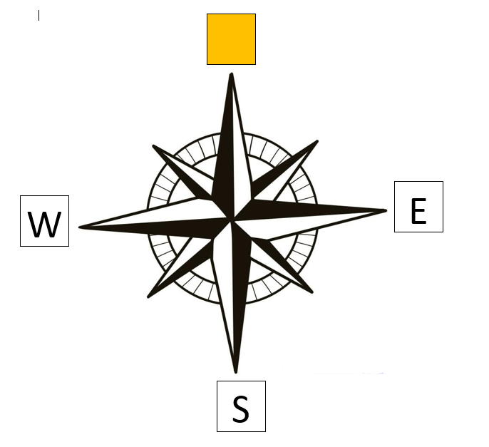
Which direction is missing?
North
East
Northwest
South
Northeast

Which direction is missing?
North
East
Southeast
South
Northeast

Which direction is missing?
North
East
Southeast
South
Southwest
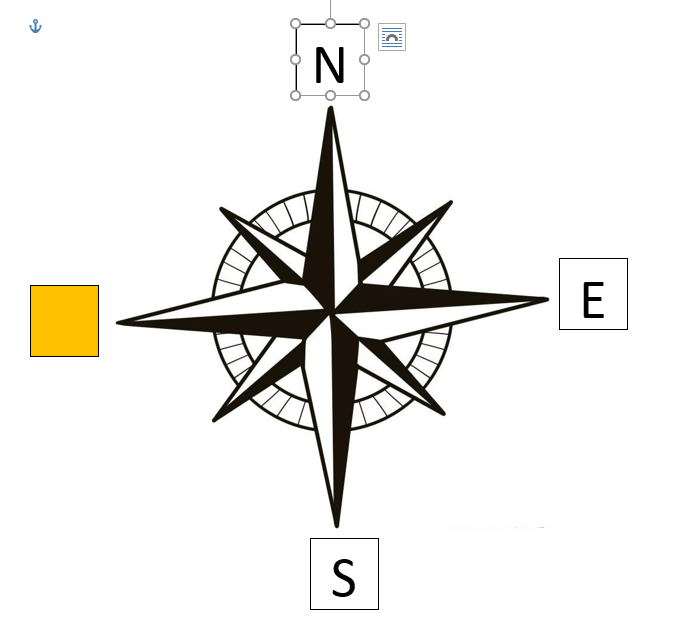
Which direction is missing?
West
Northwest
Southeast
South
Southwest

What is this symbol called?
Compass
Compass Rose
Map
Map Scale

What is this called?
Compass Rose
Map Key
Map Scale
Compass

What does the scale on a map show?
The conversion of distance or size to the size of the map.
How many people live in a country.
The difference between kilometers and millimeters.
The way to read a ruler.

The symbols shown are examples of items that would be found on a ______________________ of a map.
Legend
Compass Rose
Scale
Border

What ocean is located off the East Coast of America?
Atlantic
Pacific
Indian
Southern

What ocean is to the west of North America?
Atlantic
Pacific
Southern
Indian

What are the lines that run from east to west called?
Longitude Lines
Equators
Prime Meridians
Latitude Lines

What are the lines that go from north to south called?
Longitude Lines
Latitude Lines
Prime Meridians
Equators

What is the area above the equator called?
Northern Hemisphere
Southern Hemisphere
Eastern Hemisphere
Western Hemisphere

What is this map element called?
Legend
Star Guide
Cardinal Diamond
Compass Rose

What continent is shown in orange?
Europe
North America
South America
Asia

What continent is shown in red?
Australia
Canada
North America
Asia

What continent is shown in Green?
Egypt
Africa
Europe
Australia

What continenet is shown in purple?
Australia
Asia
Europe
South America

What continent is shown in yellow?
Australia
North America
South America
Africa

A sphere that represents the Earth is called:
A continent
A countour map
A globe
A map

What type of map is shown?
Physical Map
Political Map
Climate Map
Population Map

What type of map is shown?
Population Map
Climate Map
Physical Map
Political Map


True or false: Globes provide a three-dimensional view of the Earth. They provide the most accurate view of the world, but have limitations in their use.
True
False
True or false: Globes show more detail and are easier to transport than maps are.
True
False
True or false: All world map projections create distorted images of the Earth to some degree. These distortions relate to size, shape, direction, and distance.
True
False
True or false: The cartographer’s purpose and the projection used to create a map influence what information is accurate and what is distorted.
True
False
A way of representing the spherical Earth on a flat surface:
Projection
Distortion
Cartographer
A geographer who makes maps:
Cartographer
Distortion
Projection
A loss of accuracy:
Projection
Distortion
Cartographer
What is movement?
The how and why of how people, goods, and ideas travel from place to place.
People moving from place to place
Why ideas travel around the globe
How goods get from point A to point B.
What is Place?
Describing a location by using physical and human features.
Where something is
A place's address
What is Human-Environment Interaction?
The relationship between people and their environment.
The relationship between people and a place
The relationship between the environment and animals
What is Region?
A group of places that share a common physical or human characteristic or feature.
A place that only has physical features
A place that only has the same human features.
What is Location?
Where a place is located on the Earth using absolute or relative location.
The coordinates of a location
How we give directions
What is relative location?
The position of a place in relation to other places.
Somethings exact location on the Earth
Using a map to get from place to place.
Which below are all examples of human features?
Language, religion, culture
Landforms, language, water
Religion, vegetation, culture
Which below are examples of physical features?
Climate, vegetation, landforms
Vegetation, culture, and language
Climate, religion, and music
Which below is an example of how people impact the environment?
Clearing a forest to plant crops
A tornado hitting a city
A drought destroying crops
Which below is an example of how the environment can impact people?
A hurricane that causes flooding and wind damage.
Clearing farmland to build homes
Cutting down tree for lumber

Longitude lines run
through time
really fast in the 100 meter dash

