
 Worksheets
Open Journal 11/15
Total questions: 40
Worksheet time: 29mins

The latitude and longitude coordinates of New York City, the United States is 41° North, 74° West.
Human/Env. Interaction
Relative Location
Absolute Location

What is the name of this state that borders the Mississippi River?
Arkansas
Kentucky
Tennessee
Mississippi
Louisiana

Which mountain range is located in the western half of the United States?
The Sierra Nevada Mountain range is located in the western half of the United States.
The Appalachian Mountain range is located in the western half of the United States.
The Rocky Mountain range is located in the western half of the United States.
The Himalayan Mountain range is located in the western half of the United States.
The tool used by the Incas as their written language
glyphs
alphabet
heiroglyohics
quipu

These bodies of water are connected to each other and contain fresh water
Great Lakes
St. Lawrence River
Gulf of Mexico
Atlantic Ocean


What region is highlighted in RED?
Northeast
Midwest
Southeast
Southwest

set of strings with knots, called a _____, was a system of record keeping used by the ____
Quipu, Inca
Aqueducts, Mayans
Hieroglyphics, Egyptians
Ropes, Sami

What is the highlighted country?
Spain
France
United Kingdom
Germany

Letter B on the Map is which ocean?
Atlantic Ocean
Pacific Ocean
Southern Ocean
Arctic Ocean
Letter C on the Map is which ocean?
Arctic Ocean
Pacific Ocean
Southern Ocean
Atlantic Ocean

Which continent is this?
South America
North America
Africa
Europe
Asia

Which continent is this?
Africa
Australia
South America
North America
Asia
In what continent does 'Day of the Dead' primarily take place in?
Africa
Asia
North America
South America
Europe

Pick the country where Salsa music originated from
Yellow
Red
Green
Pink

First Black Republic lead by revolutionary Toussaint Louverture. Kreole language spoken.
What location is number 9?
Cuba
Jamaica
Haiti
Puerto Rico


If you were in the middle of Africa and you traveled north, what continent would you land on?
Asia
North America
Antarctica
Europe


Which two Central American countries border Mexico?
Honduras
Belize
El Salvador
Guatemala

Cimetière Père Lachaise
Les Catacombs
Disneyland Paris
La Sainte Chapelle
Which of the following is a European river?
Euphrates
Rhine
Yukon
Nile
Which mountain range separates France and Spain
Ural
Rockies
Alps
Pyrenees
A peninsula is totally surrounded by water
True
False

Continent to the EAST of Europe:
Russia
Africa
Asia
This peninsula contains the nations of Spain and Portugal:
Iberian
Italian
Scandinavian
Balkan

range in south-central Europe that stretches through France, Italy, Switzerland and Austria.
The Alps Mountains
Carpathian Mountains
Caucasus Mountains

Which country is marked by the star?
Germany
France
Italy
Spain

Which country is located at the star?
Spain
France
Germany
Italy

Which country is located at the star?
Italy
France
Germany
Spain

What country is located at the star?
Russia
Spain
Ukraine
United Kingdom

What country is located at the star?
Russia
Spain
Ukraine
United Kingdom
The Ural mountains separate the area where 2 continents meet in Eastern Europe and is called __________.
Eurasia
Asia Minor
Malaysia
Asia Major
Europa
Separates Great Britain from France. Is a busy route for shipping transportation on it and car and train travel under it
Rhine River
Westerlies
Alpine Mountains
English Channel
A vast, flat area stretching from France's coast to the Ural Mountains in Russia
Danube River
Ural Mountains
European Plain
Ukraine
On a map, the purpose of the compass rose is to show _______
relationship of actual size to map size
what symbols on a map mean or represent
cardinal and intermediate directions
what the map is about or the topic

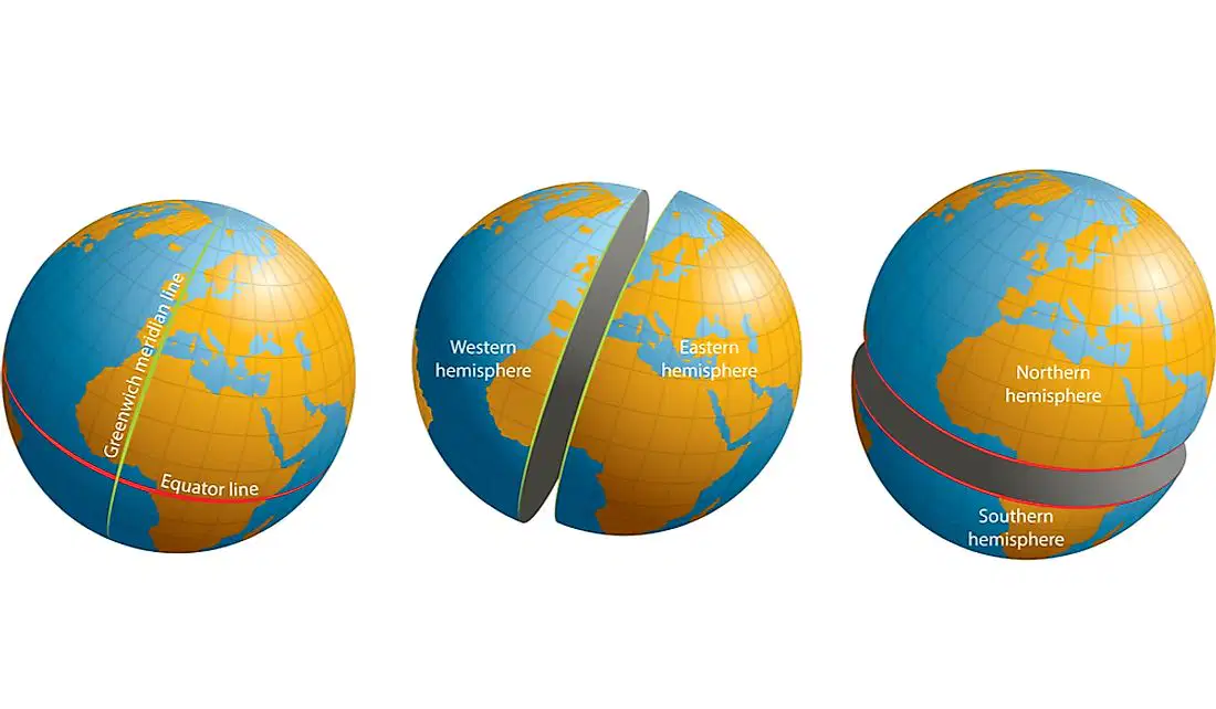
Hemisphere
Longitude
Absolute Location
Archipelago

Which letter is at Cusco, Peru?
F
B
C
D
E

