
Font size
 Worksheets
"Africa our continent (oceans, countries and main cities)"
Total questions: 25
Worksheet time: 28mins
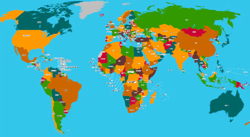
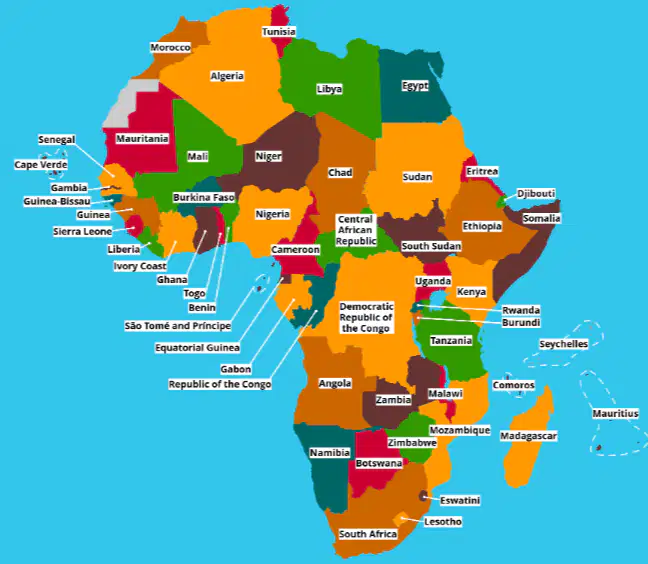
Identify the continent of Africa on this world map by listing the number different of colors that is shown on the continent.
(a)

Which continents are situated directly above Africa?
North America
Europe
Asia
Antarctica
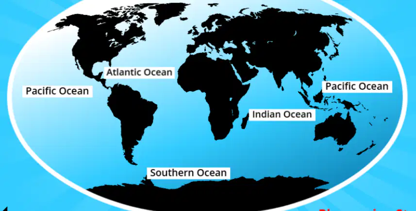
Which oceans surround the continent of Africa
Arctic
Pacific
Atlantic
Indian
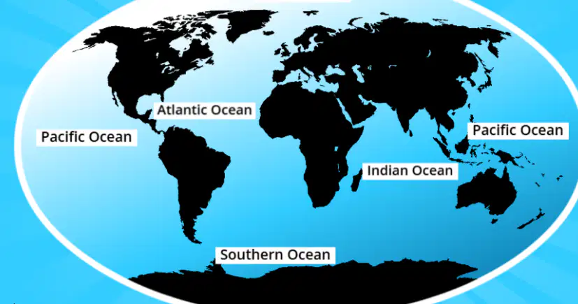
In which direction(s) is the Atlantic Ocean from the continent of Africa?
North-East
South-West
South-East
North-West
The equator divides the earth into 2 hemispheres and passes through the middle of Africa. Illustrate the position of the equator by drawing it on the map template
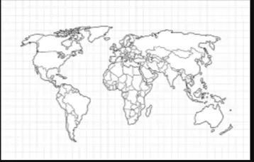
Borders are used to ________ countries that ________ each other.
(a)
Borders that pass through nations or countries are known as (a) .

What parts of nature can be sometimes found following international borders?
Rivers
Dams
Oceans
Mountains

What is the name of the legal document that you need to have when going into another country?
ID
Passport
Birth certificate
Draw an image of what you would like your passport to look like?


South Africa is located in the coordinates D(x-axis) 6(y-axis). Which other countries are part of these coordinates according to the map?
Namibia
Botswana
Zimbabwe
All of the above

The coordinates of Kenya are (a)
C5 and D5 are the coordinates of (a)

The country of Chad is Nort East of Cameroon and (a) of South Sudan.
The country that is North of North Sudan and East of Libya is (a)

South Africa has a coastline. Which 3 other countries have coastlines?
Gabon
Namibia
Zambia
Mali
Somalia
Landlocked countries are countries only surrounded by land with no coastline. Which 2 countries are landlocked?
Democratic Republic of Congo
Mozambique
Uganda
Nigeria

Which countries are North (above) of the equator?
Niger
Angola
Ghana
Malawi
Mauritiana

Countries that lie on the equator besides the Democratic Republic of Congo are (a) .

Give any 2 countries that are South (below) of the Equator.
An island is a piece of land that is surrounded by the sea. Draw what an island looks like and name it.

According to the map, which island has the coordinates F6?
Canary Islands
Seychelles
Mauritius
Ascension Island

There are islands that are also countries on their own. Which country in Africa is also an island?
(a)

Some countries have their own islands which are just islands. Which country has their own island?
Equatorial Guinea
Zanzibar
Djibouti
Senegal

Which country in Africa would you like to visit one day?

