
 Worksheets
Unit 2, Cluster 1
Total questions: 56
Worksheet time: 33mins

Where is the Ring of Fire located?
Pacific Ocean
Atlantic Ocean
Indian Ocean
Black Sea

There are more volcanoes and earthquakes in the Ring of Fire than anywhere else in the world.
True
False
Which image is Japan?


What bodies of water DO NOT surround Japan?
Arctic Sea
Sea of Japan
Yellow Sea
Pacific Ocean
True or False. An archipelago is an island group, or chain of islands.
True
False

True or False. Japan is located in the Pacific Rim of Fire.
True
False
What type of land feature is Korea?
island
plateau
peninsula
steppe
Which is the largest country in East Asia?
Taiwan
Japan
China
Mongolia

Letter F represents what country?
South Korea
North Korea
Japan
North Carolina

Which letter is Taiwan on the map?
A
B
C
E
What river flows into the Yellow Sea, and is named for the yellow silt (dirt) that it carries?
Huange He River
Yangtze River
Mekong River
Mississippi

What information in this map could explain why there is such a large population in East China?
Much of the land in East China could be used for agriculture.
There is a lack of water in East China.
There is limited agriculture in East China.
This map does not help explain why there is a large population in East China.
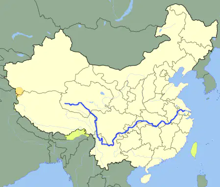
The map shows the ______River.
Yellow
Nile
Yangtze
Niger

Located in southwestern China, the Earth's largest and highest plateau. Often referred to as "the roof of the world."
Plateau of Tibet
Gobi Desert
Korean Peninsua
Himalayas


Name this physical feature.
Sahara Desert
Tibet Plateau
Gobi Desert
Rocky Desert

Which capital city is the number "8"?
Taipei
Tokyo
Seoul
Beijing

Which capital city is the number "15"?
Seoul
Beijing
Pyongyang
Taipei

Which capital city is the number "21"?
Taipei
Tokyo
Beijing
Ulaanbaatar

Which capital city is the number "7'?
Ulaanbaatar
Taipei
Tokyo
Seoul

Which capital city is the number "16"?
Ulaanbaatar
Seoul
Beijing
Taipei

Which capital city is the number "14"?
Tokyo
Taipei
Seoul
Ulaanbaatar

Which Asian country is this?
Thailand
Singapore
Malaysia
Cambodia

Which Asian country is this?
Cambodia
Thailand
Singapore
Indonesia

Which Asian country is this?
Myanmar
Thailand
Indonesia
Brunei

Which Asian country is this?
Malaysia
Myanmar
Singapore
Brunei

Which Asian country is this?
Singapore
Indonesia
Malaysia
Brunei

Which Asian country is this?
Indonesia
Malaysia
Thailand
Myanmar

Which Asian country is this?
Brunei
Bhutan
Timor-leste
Philippines

Which Asian country is this?
Philippines
Brunei
Timor-leste
Vietnam

Which Asian country is this?
Vietnam
Timor-leste
Philippines
Singapore

Which Asian country is this?
Laos
Vietnam
Cambodia
Thailand

Which Asian country is this?
East Timor
Cambodia
Brunei
Indonesia
Which of the following is not an island?
Indonesia
Singapore
Laos
Brunei

What physical feature is south of China and east of Vietnam?
Yellow Sea
Korean Penninsula
South China Sea
Sea of Japan
What is Krakatoa and where is it located?
A. a volcano in the Philippines
B. a small island country just off the southern tip of the Malay Peninsula
C. a volcano in Indonesia
D. the largest island in the Japanese archipelago

Describe where the Taklamakan desert is in relation to the Gobi Desert & Himalayan Mountains.
West of the Gobi, North of the Himalayas
West of the Gobi, South of the Himalayas
North of the Gobi, East of the Himalayas
South of the Gobi, West of the Himalayas


Define the word peninsula.
an archipelago
a piece of land surround by water on two sides
a thin strip of land that connects two larger bodies of land
a piece of land surrounded by water on three sides

What is the capital of Vietnam?
Vientien
Hanoi
Ho Chi Minh City
Yugoslavia
Southeast Asia consists of BOTH islands and mainland countries.
True
False

What body of water is located at D?
Sea of Japan
South China Sea
Bay of Bengal
Yellow Sea
What is an archipelago?
A chain of islands
The belief that spirits live in the natural world
Dried coconut meat
A line of volcanoes along the Pacific Ocean

Rich YELLOW soil along a riverbank is called
yolo
loess
chaos
calligraphy

a flat area of land carved into the side of a hill or mountain by farmers so they can grow crops
Delta
Terrace
Tsunami
Typhoon
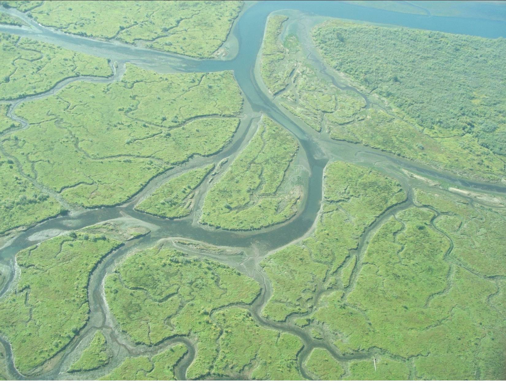
Why do the Chinese call the Huang He "China's Sorrow"?
because it is dirty and polluted
because it is yellow in color
because it is now dried up
because its flooding has drowned many people
What is a canal?
A river that connects different regions of the country
Any body of water used for trade
A man made river that connects existing bodies of water
A large lake
What is a tsunami?
A large storm with very high speed winds
A tropical cyclone that occurs in the Pacific Ocean
A large and powerful ocean wave
A type of tornado
An earthquake that causes significant damage
Man-made wall to hold back water.
observatory
chinampa
dike
basin

