
Font size
 Worksheets
5.6 Land and Climate
Total questions: 19
Worksheet time: 14mins
What ocean is to the east of China?
Indian Ocean
Arctic Ocean
Pacific Ocean
Atlantic Ocean
Which direction does China's relief generally slope downwards(向下傾斜)?
East to West
South to North
North to South
West to East
What type of climate(氣候) is suitable for growing wheat(小麥)?
Cold and wet
Cold and dry
Hot and dry
Hot and wet
Which type of climate(氣候) is suitable for growing rice?
warm and wet
warm and dry
cold and dry
cold and wet
What is raised in the vast grasslands of western China?
tigers and bears
apples and pears
Livestock(家畜), such as sheep and cows
Crops(農作物) like rice and wheat
What are the main types of landforms(地形) in China?
Islands, beaches, wetlands, and fjords.
Mountain ranges, plateaus, plains, hills, and basins.
Rivers, lakes, valleys, and swamps.
Canyons, cliffs, forests, and tundras.
How is the climate in China different in the North and South?
South: warmer and wetter
North: colder and drier
South: colder winters
North: warmer winters
North: more rainfall
South: less rainfall
South: drier and more extreme temperatures
North: wetter and less temperature change
Which is most suitable for raising in west and northwest China with vast grassland(草原)?
wheat(小麥)
vegetables
livestock(家畜)
fish
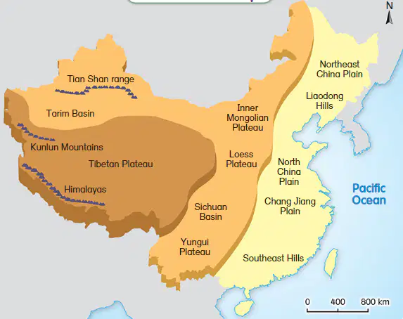
This map shows China's (a) . There are (b) types of different landforms. We can see that there are (c) levels of land in China. Mountain ranges appear in the (d) of China. Plains and hills are mainly located in the (e) area.
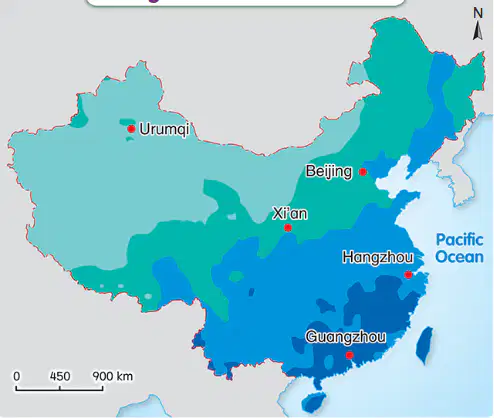
This map shows China's (a) . Air that is close to the sea is (b) , and becomes (c) as it moves inland. Therefore, there is more rain in (d) areas, and less rain in (e) areas.
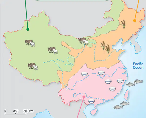
This map shows us China's farming and fishing industries. The northwest area is full of vast grasslands(草原) and suitable for raising (a) . The (b) area is cold and dry, suitable for planting (c) . The southern area is hot and wet, suitable for growing (d) .
Match the descriptions of landforms with their correct picture

mountain range

basin

plateau

plain

hill
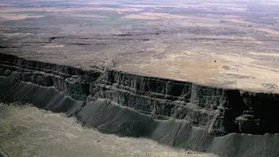
What is a large area of flat highland called?
mountain range
plain
hill
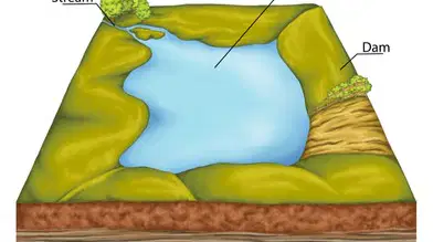
A low-lying area surrounded by mountains is called a...
hill
plateau
plain
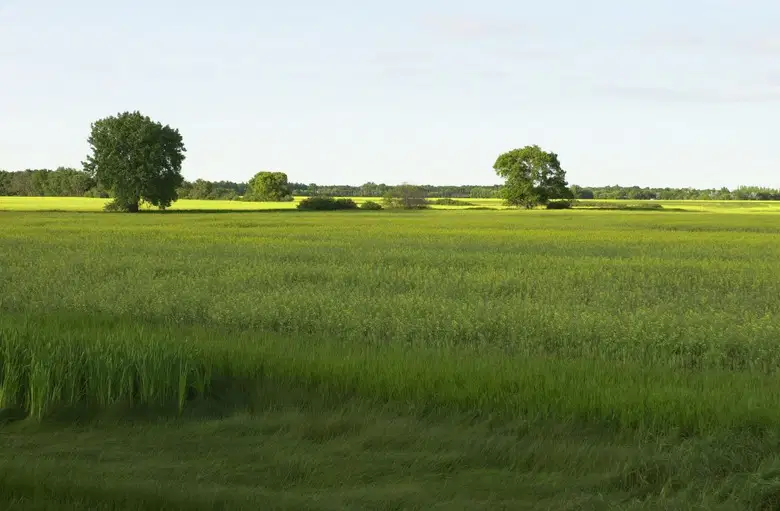
A large area of flat lowland is called a...
plateau
mountain range
hill

An adjoining series of mountains is called a ...
mountain range
hill
plain
plateau

An area that is high in the middle and has a rounded summit is called a .
mountain range
plain
basin
Which continent(大洲) is China in?
Africa
Europe
Asia
Oceania
Where is there plenty of fish in China?
Inland areas
Coastal areas
desert areas
polar regions

