
 Worksheets
Geography Talent Test AY 2024-2025 Junior
Total questions: 65
Worksheet time: 3570secs
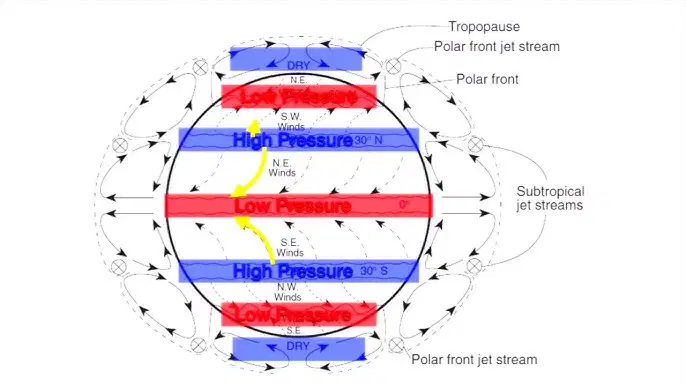
The planetary winds always blow from
They are deflected only in the tropical region
Blow from high pressure to low pressure
Don’t flow in a definite direction
They are not permanent winds
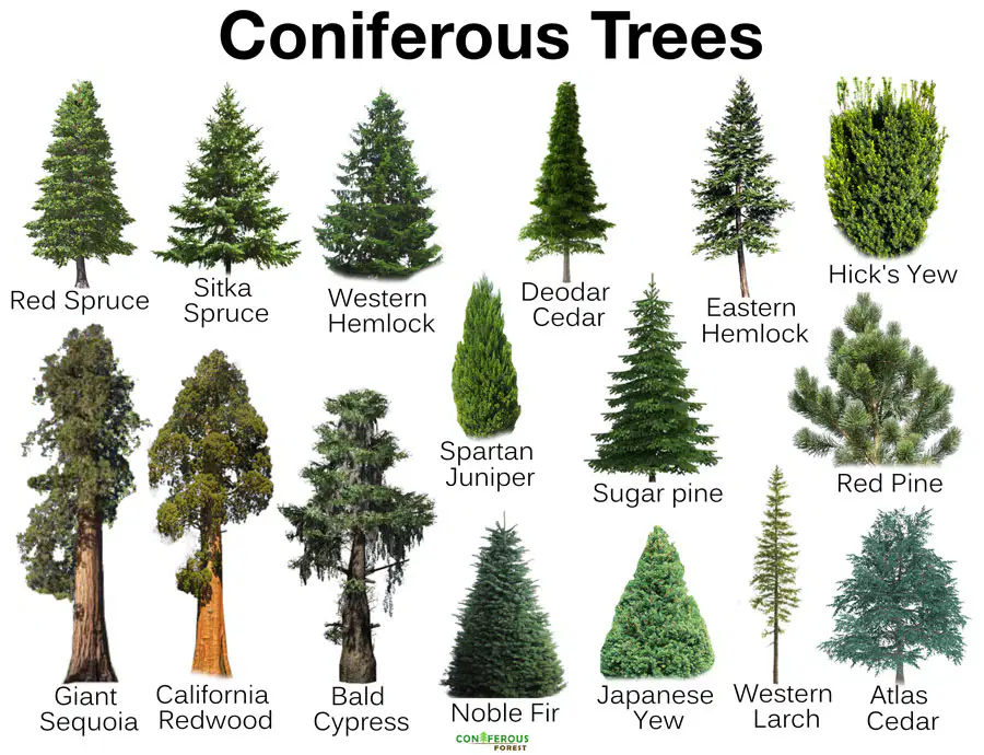
Coniferous trees are
Broad - leaved trees
Soft Wooded trees
Grown in the Tropical Region
Short and Sturdy trees

Soil erosion can be checked by
Deforestation
Cultivating the same crops
Building small earth dams
Rearing cattle

Nagarhole in Coorg district of Karnataka is famous as a

Birds reserve

Tiger reserve

MIning centre

Coffee plantation

The art of making paper was first introduced by

Egyptians

Indians

Chinese

English
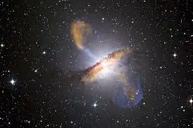
Stars are mainly made up of
Oxygen
Hydrogen and Helium
Carbon
Nitrogen
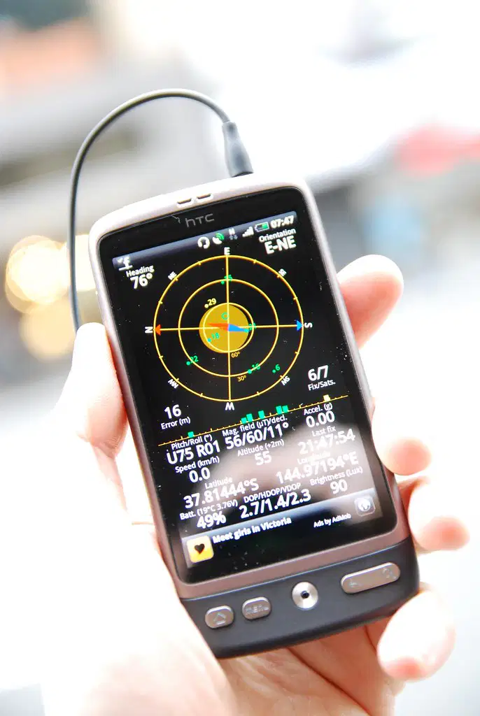
Nowadays the navigators do not use the Mariners compass, but use one of the following
Remote sensing
Global adjustment system
Global Positioning system (GPS)
All of these
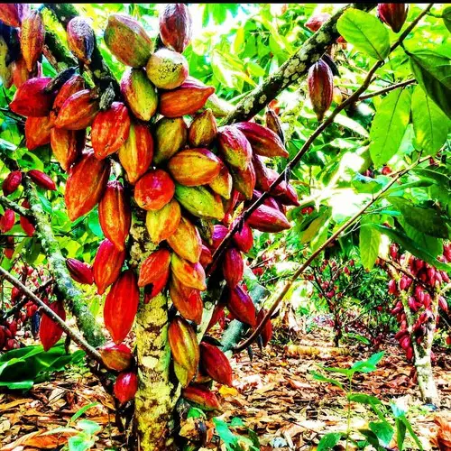
The cacao plant is mainly cultivated in

Central America

South America

Australia

West Africa

The famous Opera House is a landmark in one of the following cities in Australia

Adelaide.

Brisbane

Sydney.

Melbourne
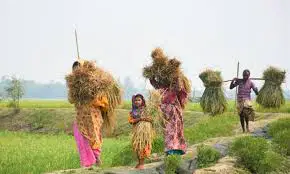
The cultivation of crops for the farmer's family is called

Commercial farming

Subsistence farming

Plantation agriculture

Extensive agriculture
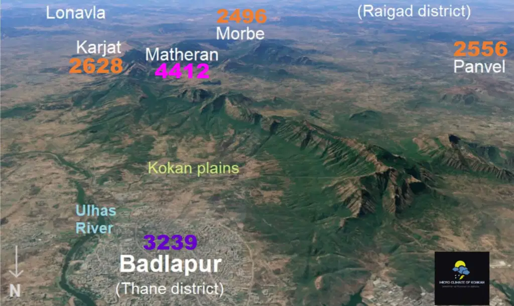
Sahyadri are ranges found on the

Western Ghats

Eastern Ghats

Himalayas

Vindhya Mountains

This Northern State of India has two capitals

Kashmir

Tamil Nadu

Andhra Pradesh

Assam
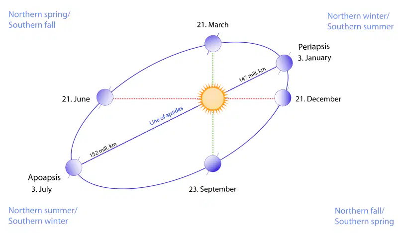
March 21st and September 23rd are known as

Equinox

Solstice

Polar nights

Midnight sun
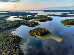
The Country that is called a Land Of Thousand Lakes is

Canada

Finland

Denmark

Norway
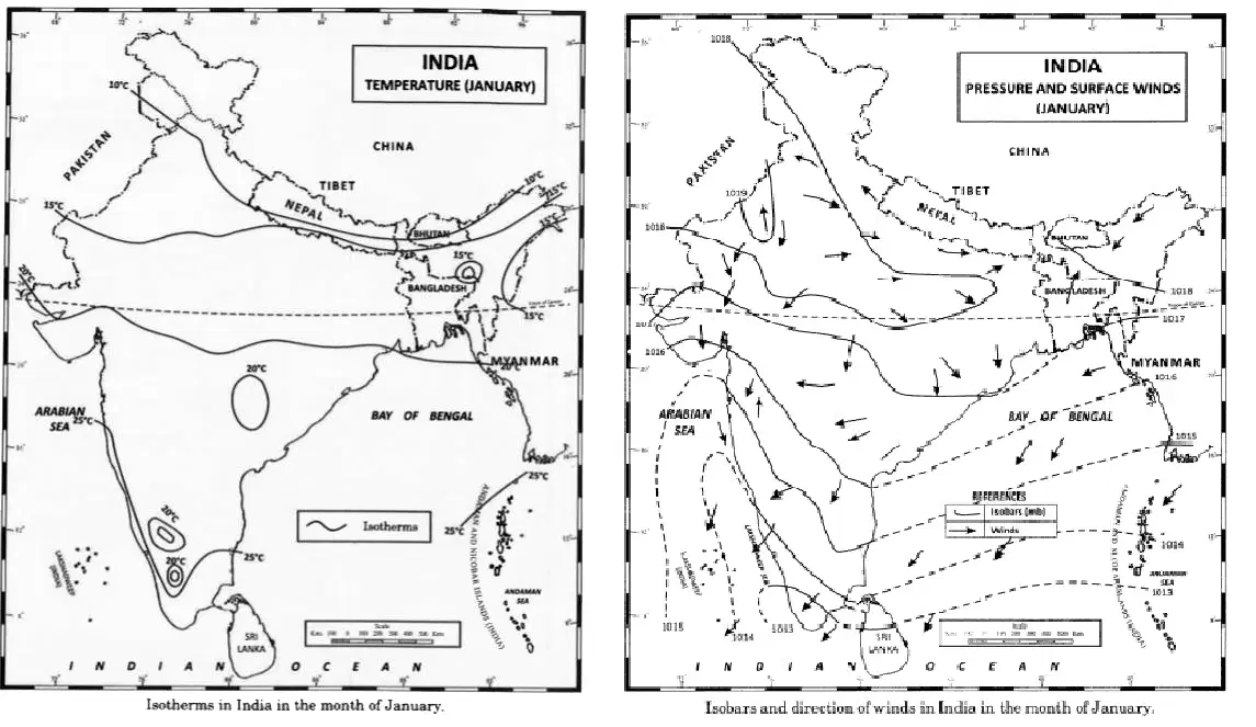
A Map that shows Isotherms and Isobars is a

Physical map

Climatic map

Road map

Political map

A Map Key is a box found on the right bottom of the map which gives details about
The theme of the map
The symbols used in the map
The names of physical features
Only the scale of the map
Which of the following activities describe decomposition?
A mushroom digests and absorbs nutrition
A sunflower using nutrients from the soil to make proteins
A snail scraps the algae from the rock in an aquarium
A hawk eating and digesting a rat
What are the four agents of erosion?
Gravity, Wind, Landslide, River
Glaciers, Wind, Waves, Sun rays
Rivers, Gravity, Air, Waves
Glaciers, Water, Winds, Waves

The states where election to the state assembly was held in November 2024
A Maharashtra
B Jharkhand
C Kerala
D Tamil Nadu
A&B
B&C
C&D
None of these
Where is the Black Forest located
Germany
France
Italy
Austria

A group of islands is called
(a)
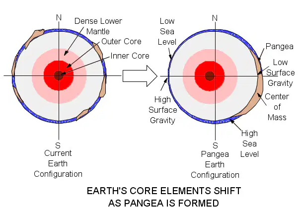
The outer surface of the earth is called
(a)
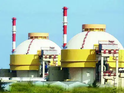
The atomic power station near Chennai
(a)
The Southern tip of Tamilnadu as well as India
(a)
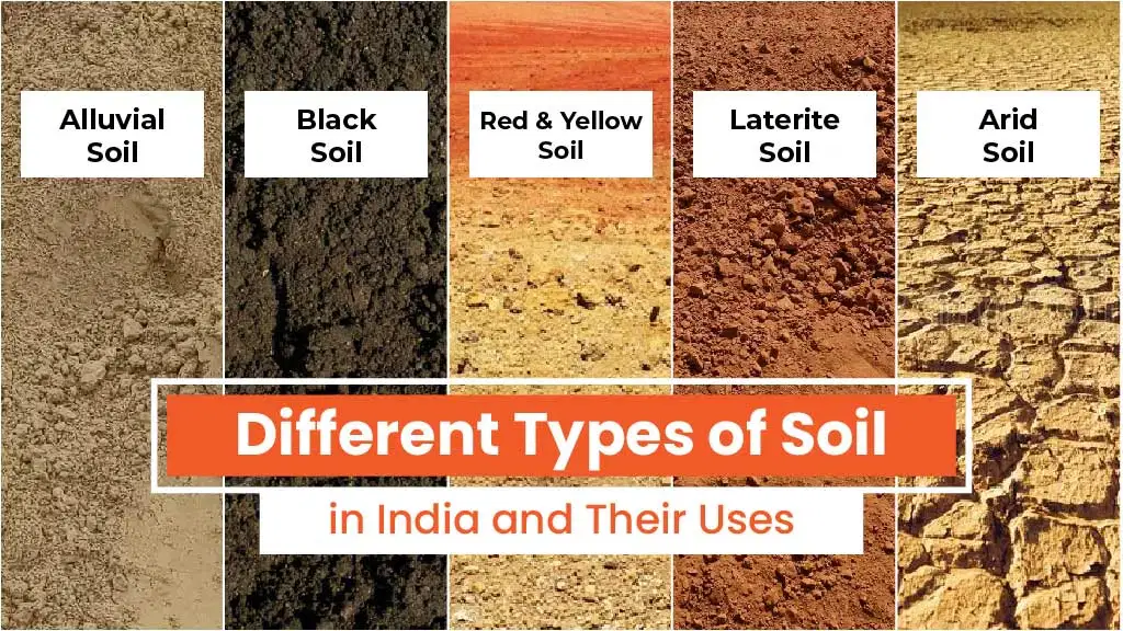
The soil that is very suitable for growing cotton?
(a)
Which is the source of most of the rivers in South India ?
(a)

The bridge that is constructed recently connecting India with Sri Lanka
(a)
Islands which are found off the coast of India in Arabian sea
(a)
The waves along the coast is high on a New moon days and a Full moon days. This vertical movement is called as
(a)
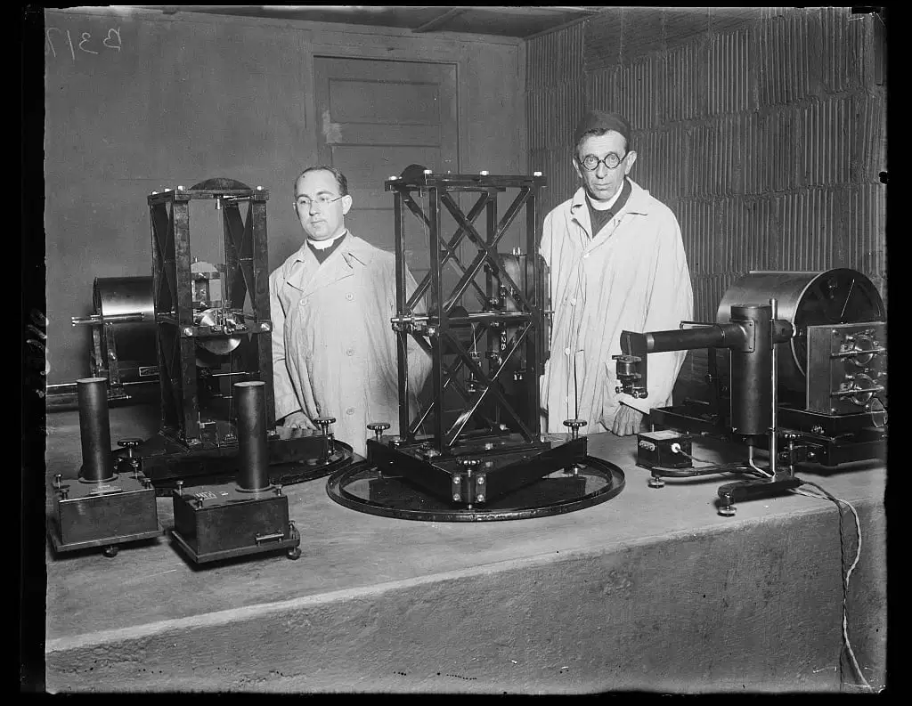
The study of earthquakes is known as
(a)

The shape of the orbits of the planets in the solar system is
(a)
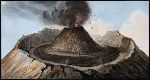
Funnel shaped opening at the top of a volcano
(a)
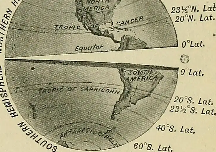
The angular distance of a place from the equator.
(a)

The study of population.
(a)

Height above sea level.
(a)
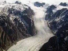
The river of ice.
(a)
The mountain range that separates two drainage system
(a)
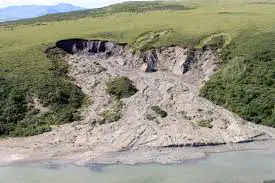
Movement of large masses of earth downhill
(a)
Movement of ocean water caused by friction due to winds
(a)
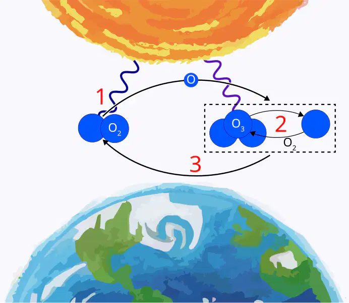
The gas in the atmosphere that protects the earth from the ultraviolet radiation
(a)
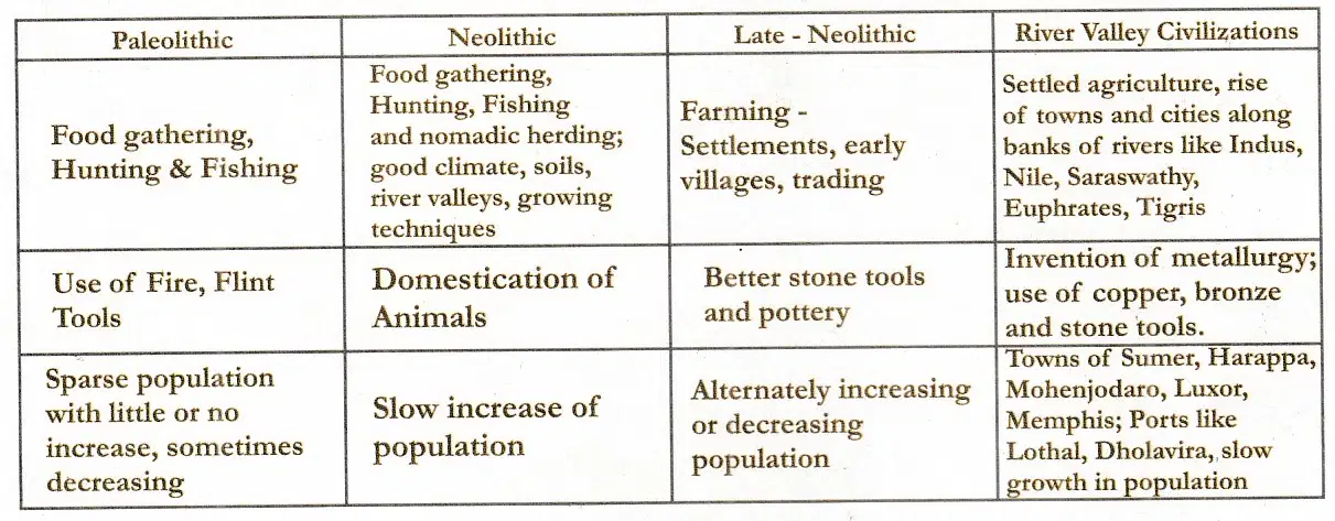
Study the Table given here and answer the following Questions
A) The Late Neolithic period was developed due to the knowledge of farming.
True
False
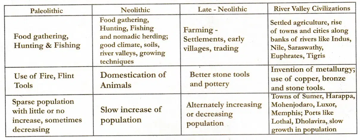
B)The Indian towns/cities that developed during the river vallay civilizations are
Lothal and Harappa
Luxor and Dholavira
Sumer and Memphis
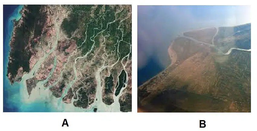
A) What are the features shown in diagram a and b
A - Estuary, B - Delta
A- Delta, B - Estuary
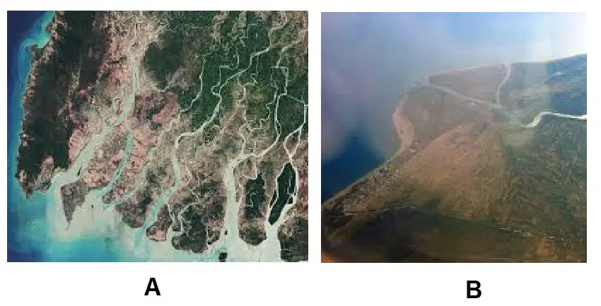
B)Read the following statements and tick the correct answer
a) Estuary is a funnel-shaped river opening into the sea.
b) Delta is a triangular-shaped river deposition before joining the sea.
c) The flow of the river is slow in the estuary
d) The flow of the river is fast in the delta
a) and c) are true
b) and d) are True
a) and b) are True
All these are True
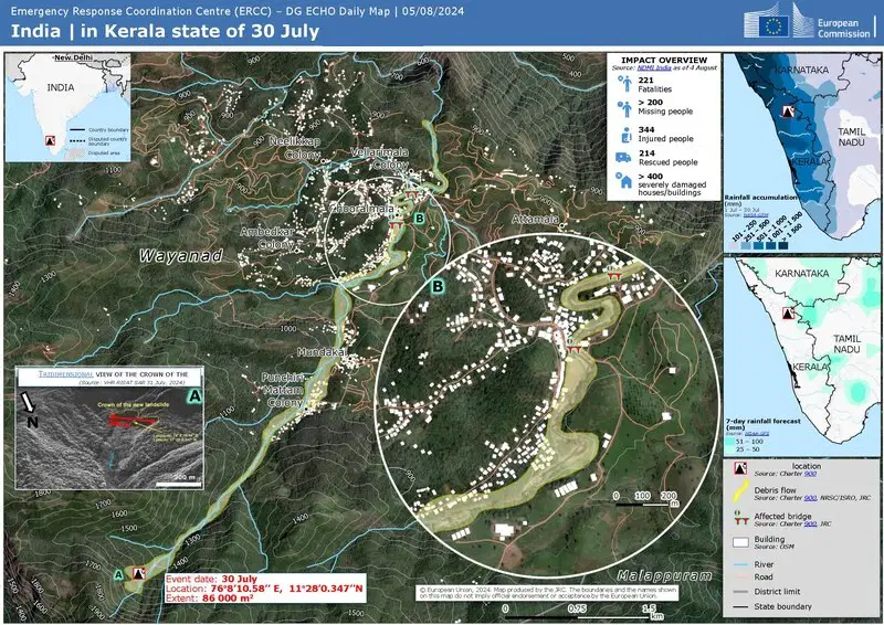
Read the map and answer the following question.
A) What happened here on 30th July 2024?
(a)
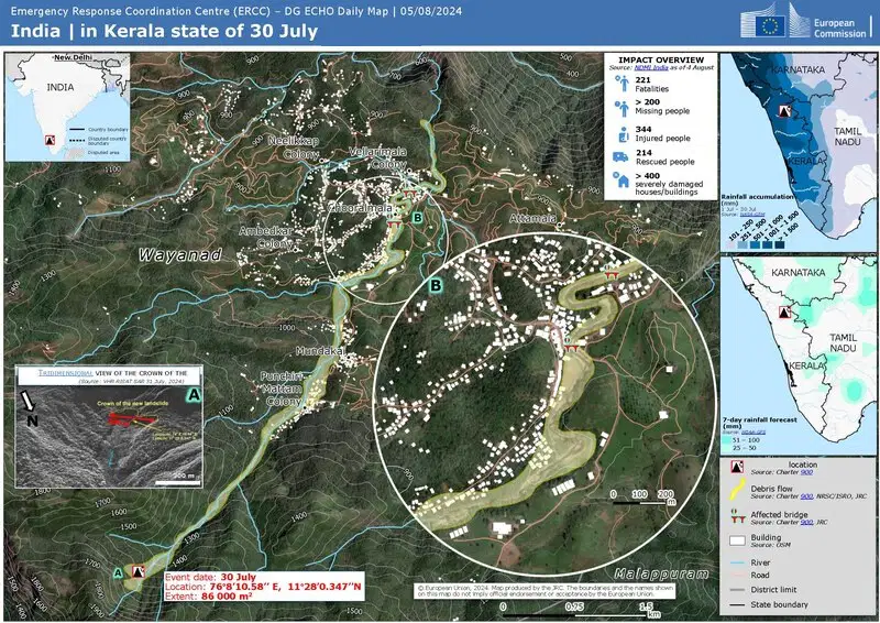
B) What was the immediate cause of the Wayanad disaster?
(a)
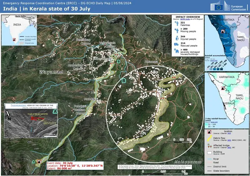
C) What reasons are attributed to Wayanad disaster?
(i) The population of Wayanad increased by 11-fold in 100 years
(ii)More tourists visiting this spot
(iii)Major deforestation in the last 100 years
(iv)All the above
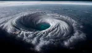
An intense circular storm that originates over warm tropical oceans and is characterized by low atmospheric pressure, high winds, and heavy rain.
(a)
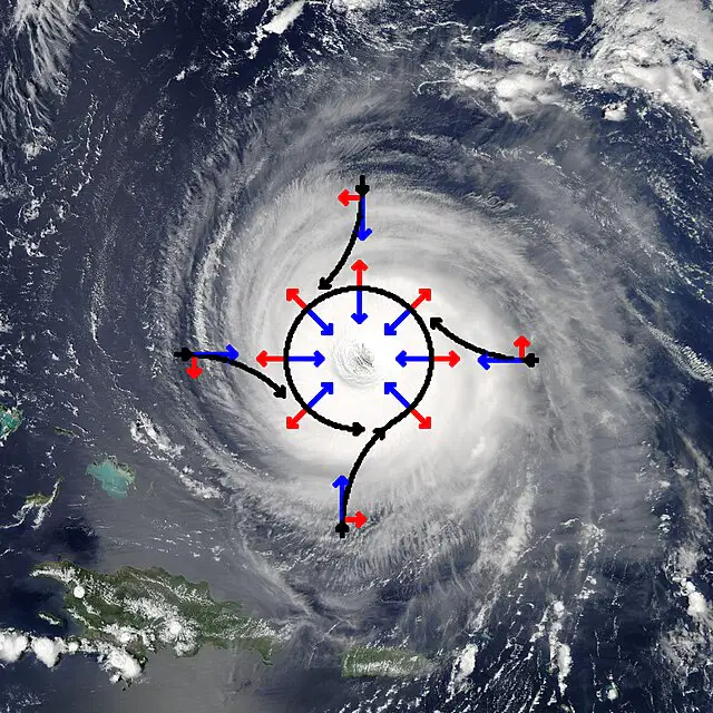
The direction of rotation of the Tropical cyclone in the Northern Hemisphere
(a)

A central region of clear skies, warm temperatures, and low atmospheric pressure.
(a)
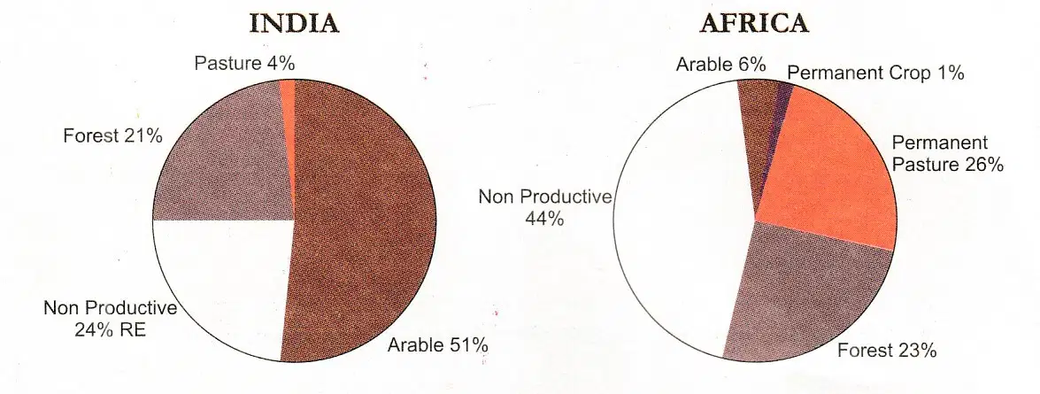
A) Which land use is the same percentage in India and Africa?
(a)
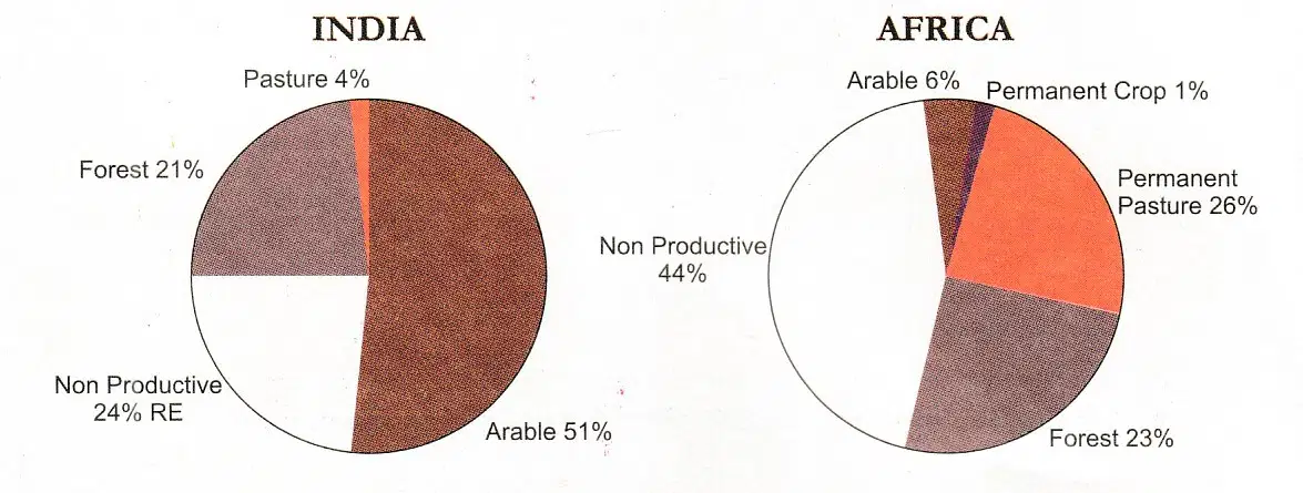
B) What does permanent pasture indicate?
Animal husbandry
Agriculture
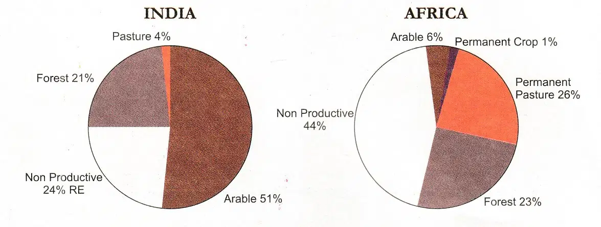
C)There is more waste land in India than in Africa.
True
False
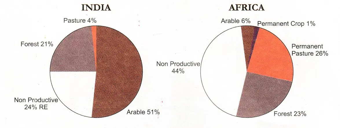
D) Where is agriculture practiced more? In India or in Africa?
(a)
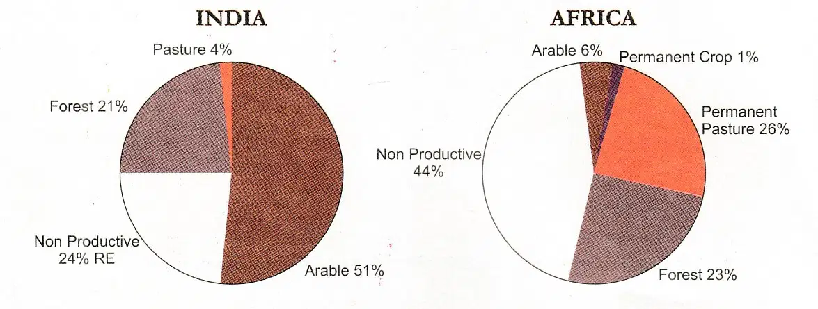
E) How many times more of arable land is found in India than in Africa?
(a)

With the help of clues name rivers
A) The River that rises between the Palani Hills and Varushanad Hills and drains into Palk Strait
Vaigai
Thamaraparani
Palar
Kollidam

B) The River that rises in the southernmost slope of the Western Ghats
and flows into the Gulf of Mannar
(a)

C) The northernmost river shown on the map which rises in Karnataka is?
Vaigai
Palar
Thamarapari
Cauvery

D) The tributary of Cauvery that flows through Trichirapalli is
(a)
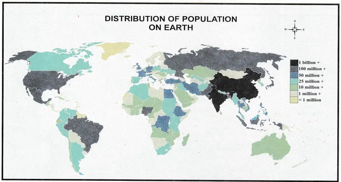
Observe the given Distribution of the Population Map of the World and answer the following Questions
A) Which areas are densely populated?
Coastal areas
Mountain areas
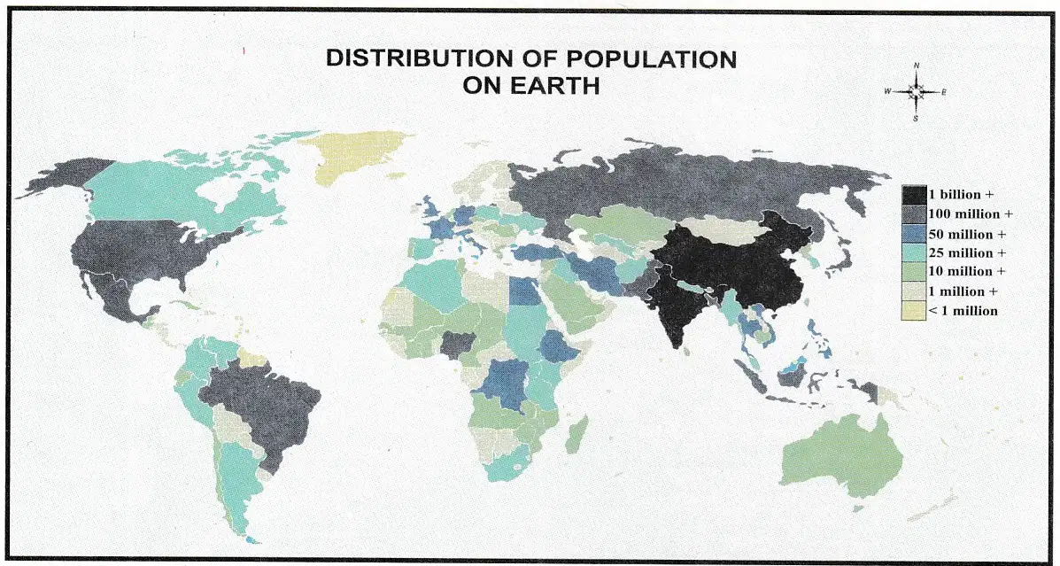
B) Are areas with more than 1 billion people in Asia or South America?
Asia
South America
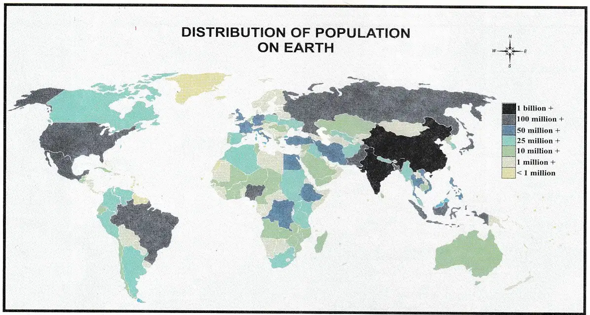
C) Areas with less than 1 million population are more in Africa or Australia?
Africa
Australia
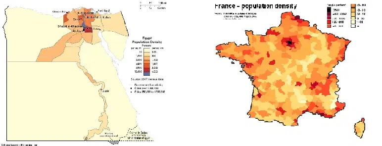
D) Which country has more population?
(a)
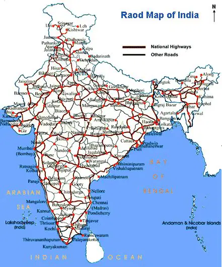
Distance between two towns shown in an atlas will expressed in terms of
Killometer
Meter
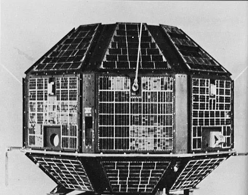
The first satellite of India is
(a)

