
NEW
Font size
 Worksheets
Geological Features Due to Plate Tectonics
Total questions: 20
Worksheet time: 7mins
The movement of the tectonic plates is caused by
the rotation of the Earth.
convection currents in the Asthenosphere
the gravity of the iron-nickel core.
the Moho discontinuity.
In some areas of the world, like California and Japan, earthquakes are a common occurrence. How can this best be explained?
The strong ocean currents are undermining both areas causing earthquakes.
Both areas are located near the edge of the Pacific Ocean, the unstable sand causes earthquakes.
Both areas are subjected to strong ocean wind and waves that causes earthquakes.
Both areas are on the boundary of active plates, the motion of the plates causes earthquakes.
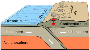
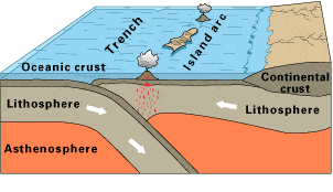
Observe this diagram of a plate boundary. One statement BEST describes what is happening. It is that
the oceanic crust is melting.
the denser ceanic crust is subducting under the less dense oceanic crust
volcanic islands are forming.
the tectonic plates are moving away from each other.
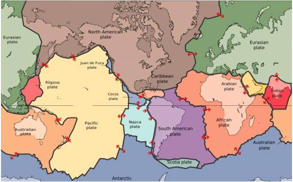
The map in the picture shows tectonic plate boundaries. This map would be useful in predicting the location of future
droughts
hurricanes
earthquakes
tornadoes
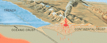
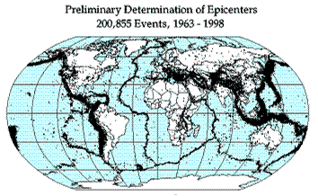
Earthquake epicenters (center of where the earthquakes started) were mapped for a 35 year period in the diagram above. The black dots indicate these epicenters. The black dots appear along what feature on Earth?
hot spots
plate boundaries
rift zones
sea floor spreading
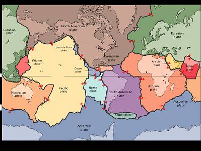
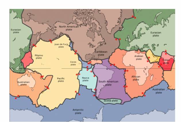
Where are earthquakes MOST LIKELY to occur?
close to the equator
close to the center of tectonic plates
at divergent or convergent plate boundaries
at transform plate boundaries
The 2004 Indian Ocean tsunami was caused by a shift in two plates that pushed one section of the sea floor under another section of the sea floor by 5 meters. What type of boundary is this?
divergent
convergent
transform
metamorphic
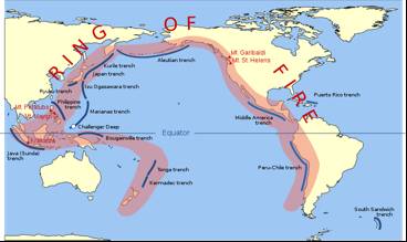
___________ currents in the Earth's asthenosphere cause plate to shift at their boundaries. This movement also causes earthquakes and volcanic activity.
conduction
convection
radiation
ocean
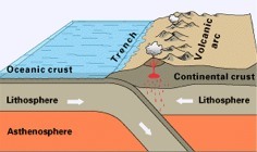
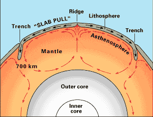
What is the source of energy that drives plate movement?
the subducton of the sea floor
the different densities of the oceanic and crustal plates
convection currents in the asthenosphere
the friction force between the plates that move past each other
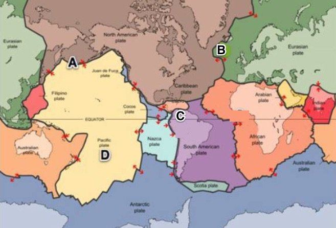
Where would sea floor spreading most likely occur?
At convergent boundaries (oceanic vs. oceanic)
At convergent boundaries (oceanic vs. continental)
At divergent plate boundaries (oceanic vs. oceanic)
At transform plate boundaries
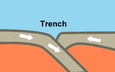
The Marianas Trench, where the Pacific Plate descends under the leading edge of the Eurasian Plate, is the deepest sea floor in the world. These ocean trenches form when two oceanic plates collide
and the older, less dense of the two plates rides over the edge of the older plate.
when convection currents in the mantle force the older plate downward.
and the younger, denser of the two plates, rides over the edge of the older plate.
and the plates are approximately the same age and density.

