
 Worksheets
Social studies: relief and human activities
Total questions: 50
Worksheet time: 30mins
What is a relief map?

A map that shows the compass rose
A map that shows the different shapes and sizes of landforms
I’m up that shows all the best tourist locations
A map that shows mountains only
Which of the following is not a landform?
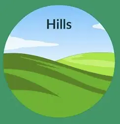
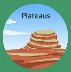

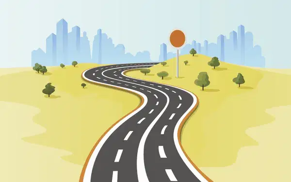


Natural or Man-made?


Natural or Man-made?


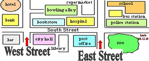


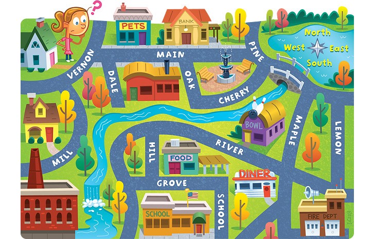

What direction do you need to travel to get from the swing set to the food market?
East
North
Southeast
West

What direction do you need to travel to go from the ferris wheel to the Food Market?
South
North
Northwest
East


What direction is indicated by the number 6?
north
east
south
west
What is the name of the tool that shows cardinal and intermediate directions?
line of longitude
compass rose
map
key
A series, group or line of connected mountains are called
Mountain Range
Mountain Peak
Mountain Slope
Mountain Summit
What is the topmost part or highest area of a mountain called?
peak
slope
hill
rugged
The highest mountain in the world is
Mount McKinley
Mout Kilimanjaro
Mount Mitchell
Mount Everest

Which colour would represent hills on a relief map?
green
yellow
brown
purple
Which of these statements describe valley?
found between two mountains or hills
a series of connected mountains
highlands between 200m and 600m
round shaped highlands
Highest mountain in Jamaica is the _________________
John Crow Mountain
May Day Mountain
Blue Mountain
Mocho Mountain
Highland with flat tops that are usually steep on one side are characterised as
plateau
mountain
hill
mountain range

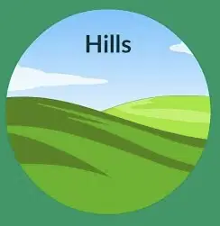
What type of landform is shown in the picture?
hill
mountain
valley
plain
Which of the following can be classified as a lowland?
valley
mountain
plateau
Cliff
Which of the following statements is true about landforms.?
Plains are not the best landforms for farming
Mountains are taller than hills
A valley is a flat piece of land that is on a highland
An area of flatland located between two mountains or hills is called a river

Physical features that are ?
Mountains, Rivers, plains and Valleys
Roads, buildings, bridges and airports
Dogs, cats, rats and other animals
Plants

Which country is directly east of Jamaica?
Cuba
Venezuela
Haiti
Honduras

If you traveled south east from Jamaica what is the first country you would find?
Venezuela
Believe
Aruba
Puerto Rico
Jamaica is surrounded by which major water body?
The Caribbean ocean
Arctic ocean
The Indian Ocean
The Caribbean Sea

Diego went on a field trip with his class grade 4. While crossing a bridge, Diego notice a tractor plowing soil, and a river nearby. What human activity is the land being prepared for?
Recreation
Farming
Tourism
Building a house
You can find all of these on a plain except”
Airport
Town
Farm
Observatory
An area of entry to the island from the sea is called a?
Airport
Train station
Port
Beach
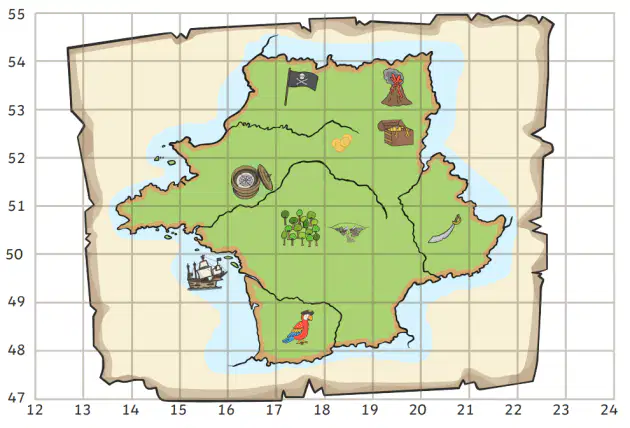
Starting at 51, 14 what direction would I walk to get to the pirate flag?
North south
North east
South west
North west
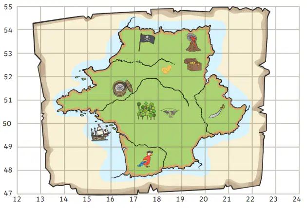
Starting at 48, 19 what direction will I travel to reach the volcanoes
North
North east
North west
South east
Which landform is most ideal for farming?
Dorothy lives in the capital city Mandeville, what is the name of the parish that Dorothy lives in.
Manchester
St. Thomas.
Port Antonio
Spanish town
In which parish did the Spanish first settle when they came to Jamaica?
Port Royale
ST. James.
ST. Andrew.
ST. Ann
The parish of Saint Ann used to be a?
Fishing village
Airport
Capital city
Garden
Capitals are either located on the coast or they are (a)
Inland capitals, we are located near the center of the parish because?
They were closer to beaches
They were located near mountains
They were a equal distance away from each small town
the to be closer to the coast
A plain is the perfect landform for all except?
Farm
Airport
Zip line
factory
which two options are the perfect reasons why coastal capitals exist?
They give traders access to a port which allows them to do business easily
They give tourists access to coastal features as well as give access to businesses to increase commerce.
They make it easier to go fishing
They make it harder for people to leave
The capital of St. Ann is
(a)
What is the capital of St. Catherine
Espana
Spanish Town
Port Maria
Westmorlamd
What is the capital of Hanover
Kingston
Half-Way-Tree
Savana-la-mar
Trelawny
Lucea
How did the counties of Jamaica get their names? They were named after ___.
after the British Monarchs
after counties in England
by Christopher Columbus
by Jamaican politician
Villa de la Vega, also known as Santiago de la Vega, was renamed to
(a)
Port Royale is made into the temporary capital after Villa de la Vega or Spanish town was what?
Destroyed by an earthquake
Destroyed by a hurricane
Destroyed by the British, who burned it down when they discovered there was no gold.
Destroyed by the Indians, who were tired of indenture ship
All of the following were capitals of Jamaica except?
Spanish town
Port Royale
ST. Andrew.
Kingston

