
 Worksheets
Physical Map / Westward Expansion
Total questions: 20
Worksheet time: 3hrs 20mins

Identify the river.
Ohio River
Missouri River
Mississippi River
Rio Grande

Identify the river.
Missouri River
Ohio River
Mississippi River
Rio Grande

Identify the river.
Missouri River
Ohio River
Mississippi River
Rio Grande

Identify the body of water.
Rio Grande
Gulf of Mexico
Atlantic Ocean
Pacific Ocean

Identify the body of water.
Pacific Ocean
Atlantic Ocean
Rio Grande
Gulf of Mexico

Identify the body of water.
Rio Grande
Gulf of Mexico
Pacific Ocean
Atlantic Ocean

Identify the land feature.
Appalachian Mountains
Great Plains
Rocky Mountains
Gulf Coastal Plains

Identify the land feature.
Great Plains
Rocky Mountains
Gulf Coastal Plains
Appalachian Mountains

Identify the land feature.
Gulf Coastal Plains
Appalachian Mountains
Rocky Mountains
Great Plains

Identify the area in blue.
Rocky Mountains
Great Lakes
Sierra Cascade Mountains
Rio Grande River

What is A?
Rocky Mountains
Sierra Nevada Mountains
Himalayan Mountains
Appalachian Mountains
What is L?
Pacific Ocean
Atlantic Ocean
Indian Ocean
Gulf of Mexico
What is C?
Pacific Ocean
Atlantic Ocean
Chesapeake Bay
Gulf of Mexico


A ______________ is a hill of sand created by the wind.
dune
delta
sediment

A fan-shaped area where a river meets the ocean is called a ____________. This is formed when sediment and rock is deposited at the end of the river.
dune
delta
weathering
sediment
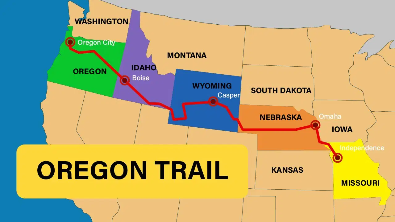
Where did the travellers of the Oregon Trail originally set out from?
Nebraska
Idaho
Wyoming
Missouri
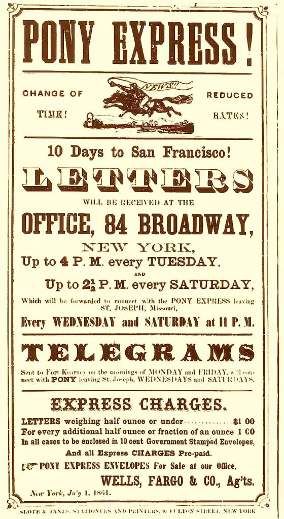
Why was the Pony Express created?
It was a quick way to get mail delivered to the people living in the West
To find new routes for young men who were expert riders
To map out the area for future development
To provide new jobs for young men who were expert riders
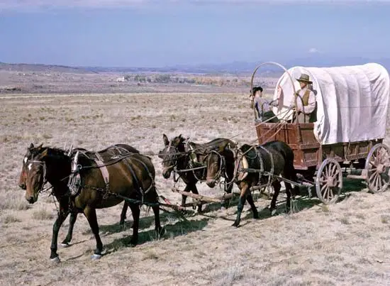
What was the main vehicle used to carry belongings by pioneers on the Oregon Trail?
Train
Steamboat
Covered Wagon
Car

