
NEW
Font size
 Worksheets
Eastern Hemisphere Study Guide
Total questions: 50
Worksheet time: 25mins
Geography is the study of Earth and its peoples, places, and _____.
equator
physical features
maps

What is the name of the line of latitude that is equally distant from the North Pole and the South Pole?
the Prime Meridian
the Equator
the Tropic of Cancer
the International Date Line
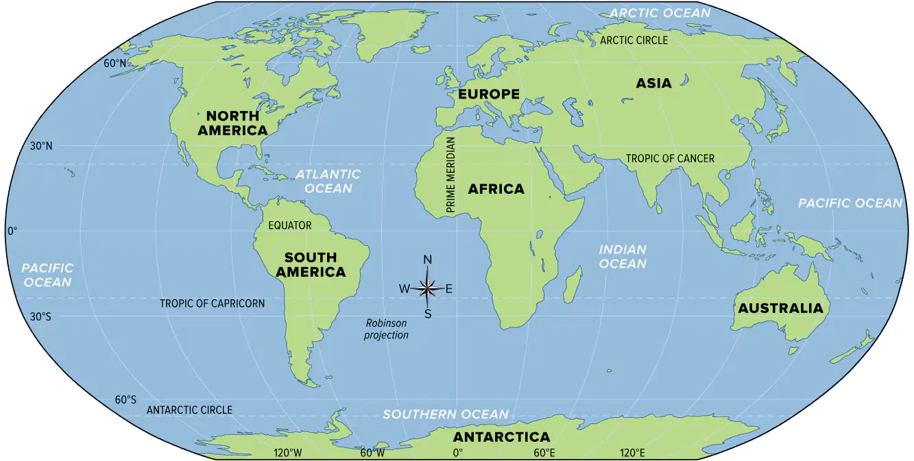
Which line is used as a starting point to measure longitude, also defined as 0 degrees longitude?
the Prime Meridian
the Tropic of Cancer
the Equator
the South Pole
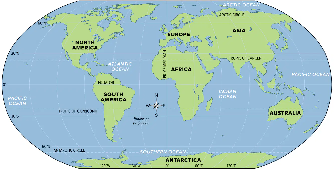
Which of the following correctly list Earth's oceans from smallest and largest?
Southern, Indian, Arctic, Atlantic, and Pacific
Pacific, Atlantic, Southern, Indian, and Arctic
Arctic, Southern, Indian, Atlantic, and Pacific
Atlantic, Pacific, Arctic, Southern, and Indian
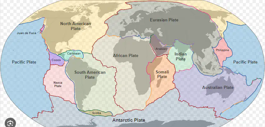
Which of the following moves over Earth's mantle, creating changes of Earth's surface features?
faults
continents
tectonic plates
tsunamis
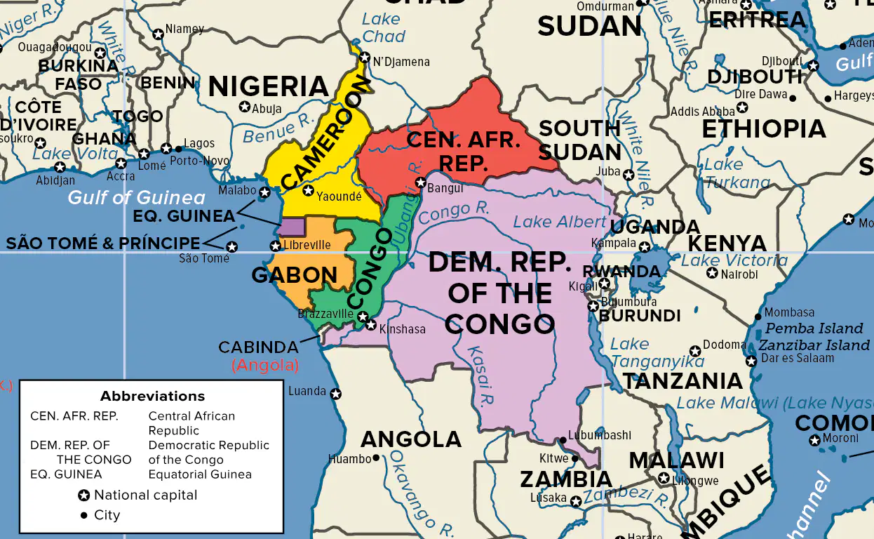
What type of map is this?
Physical
Political
Population Density
Climate
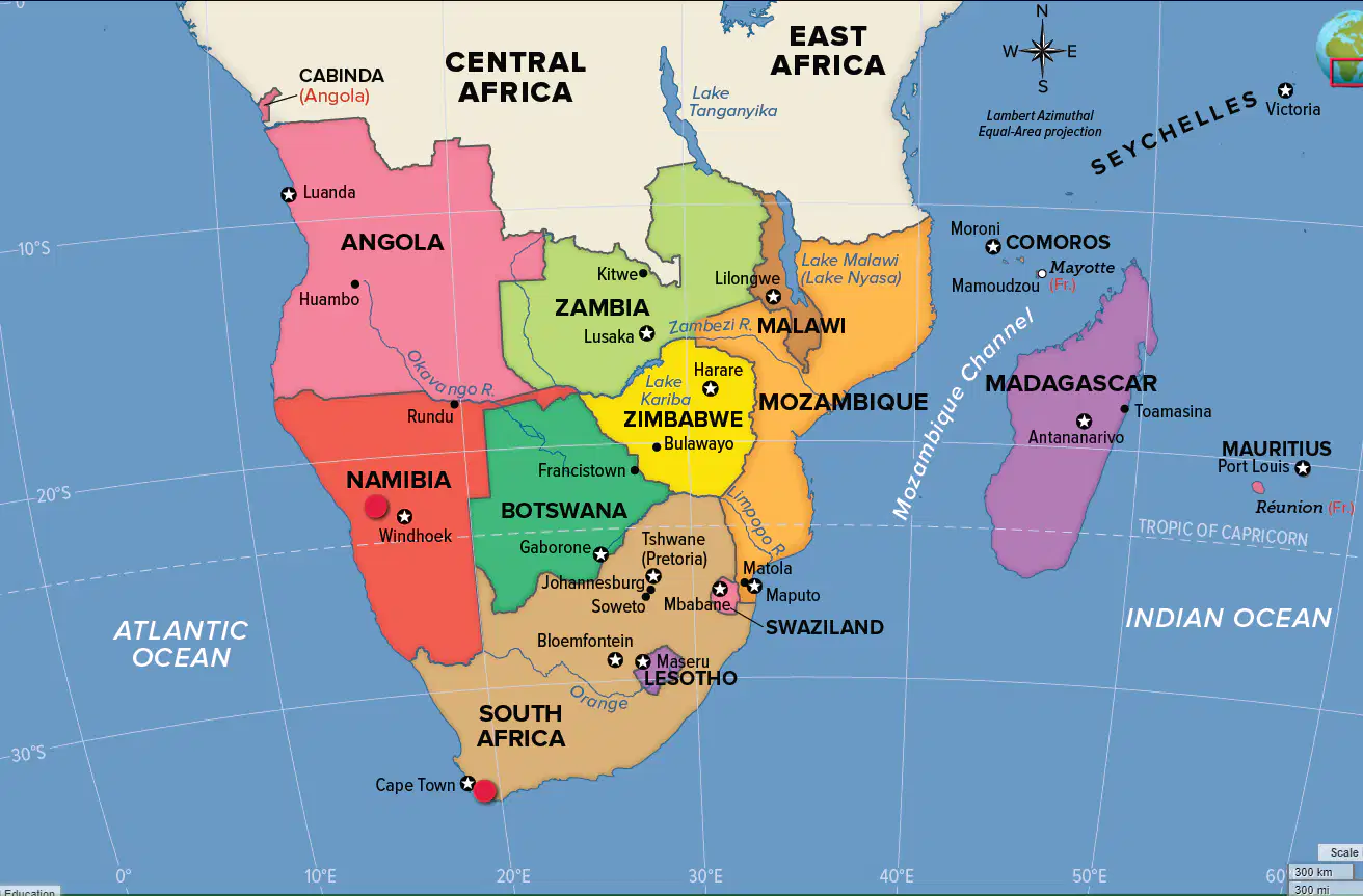
What type of map is this?
Political
Physical
Population Density
Climate
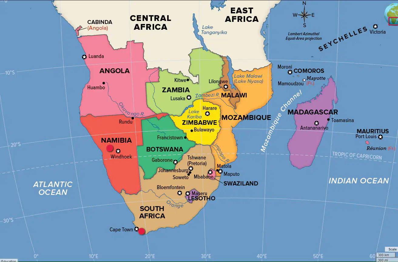
Which country falls on 20 degrees South latitude?
Namibia
Angola
Tanzania
South Africa
Which country does NOT fall on the Tropic of Capricorn?
Mozambique
Zimbabwe
Botswana
South Africa
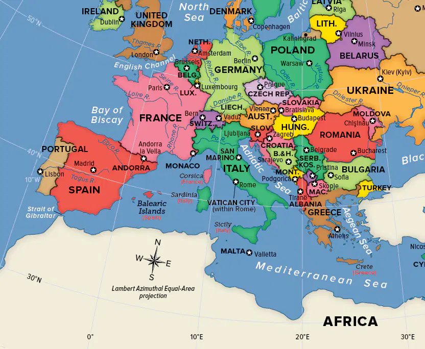
Which European country falls on 10 degrees east longitude?
Poland
Spain
France
Italy
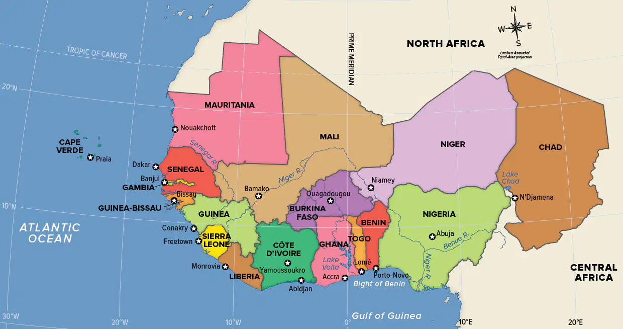
Which of these Western African countries falls along the Prime Meridian?
Chad
Ghana
Niger
Senegal
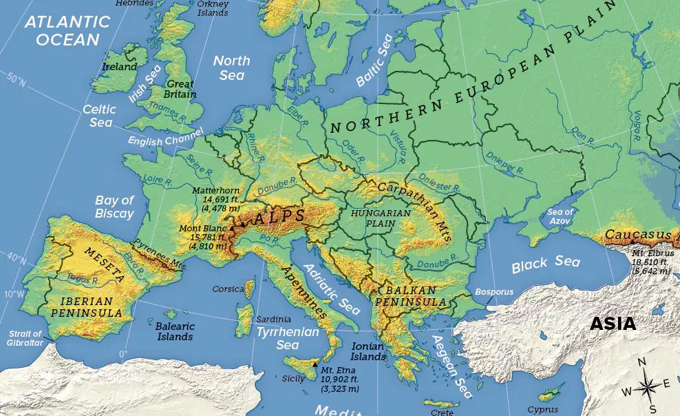
What mountain range forms the northern border of Italy and also covers most of Switzerland and Austria?
the Alps
the Pyrenees
the Apennines
the Carpathians
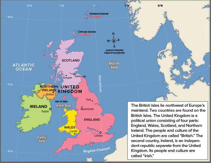
The United Kingdom is made up of England, Wales, _____, and Northern Ireland.
Ireland
Scotland
Belgium
Luxembourg
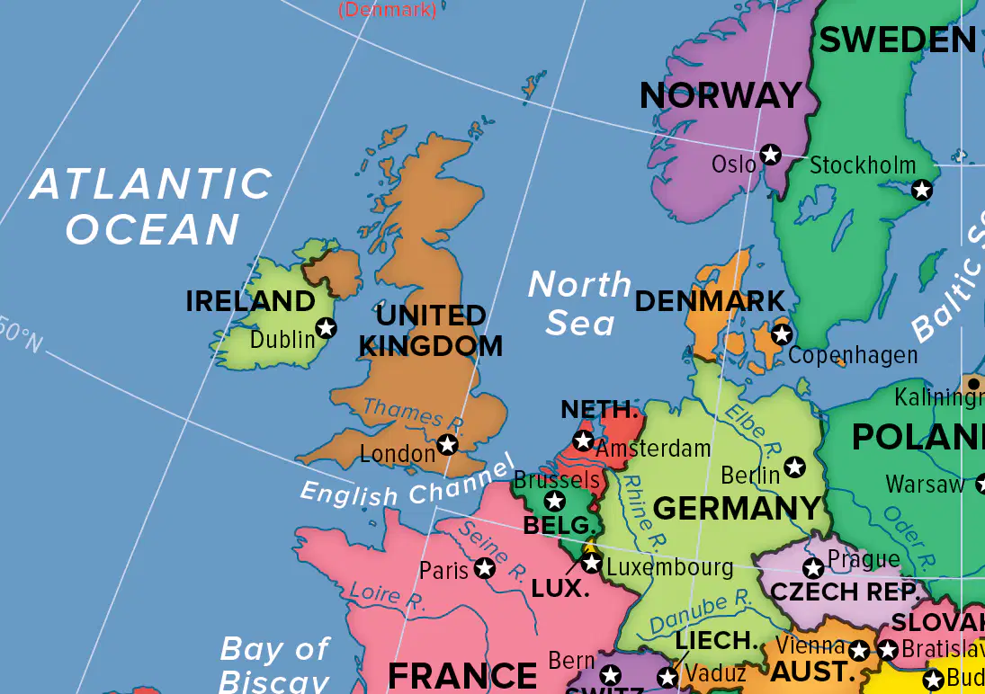
The English Channel is a busy sea route that connects the _____ with the Atlantic Ocean.
Thames River
Elbe River
North Sea
Black Sea

Which body of water borders southern Europe?
Pacific Ocean
Mediterranean Sea
Black Sea
Atlantic Ocean
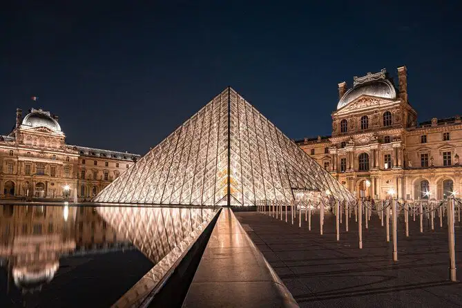
The _____ in Paris, France, is one of the most visited art museums in the world.
Hermitage
Metropolitan
Louvre
Bilbao
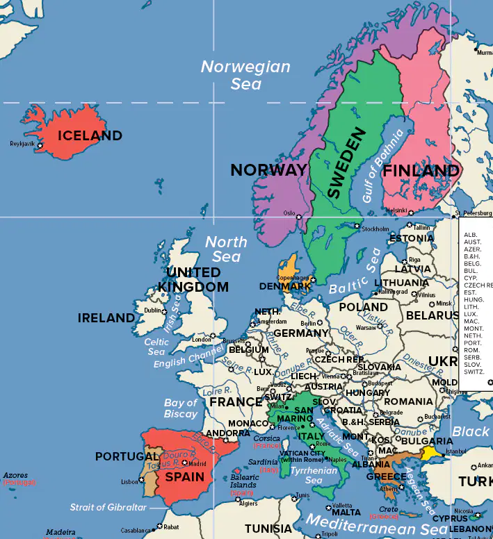
The five Nordic countries are Denmark, Sweden, Finland, Iceland, and _____.
Spain
Portugal
Norway
Greece
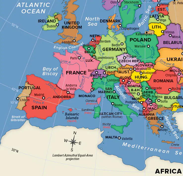
What is the opening to the Mediterranean called that separates the southern tip of Spain from Africa?
Strait of Gibraltar
Adriatic Sea
English Channel
Bay of Biscay
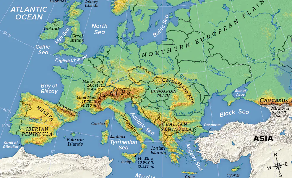
Which two countries form the Iberian Peninsula?
Spain and Italy
Spain and Portugal
Norway and Sweden
Denmark and Finland
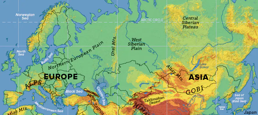
Which mountains form a boundary between Europe and Asia?
the Alps
the Carpathians
the Urals
the Balkans
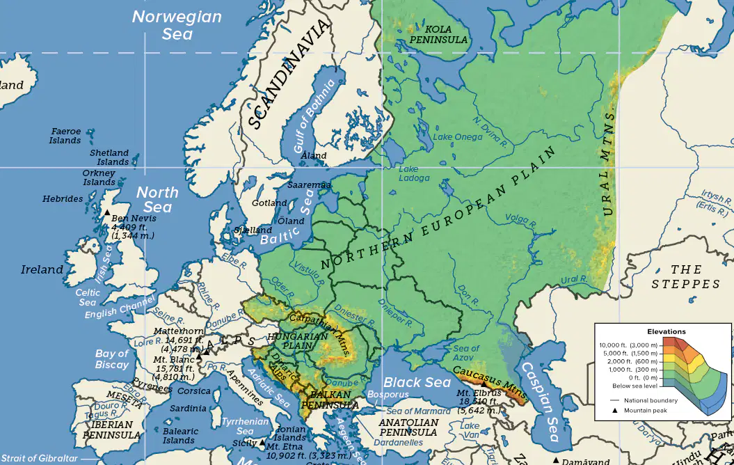
Eastern Europe and Western Russia are located mostly on a group of _____, or large expanses of land that are flat or have a gentle roll.
islands
plains
plateaus
mountains

What sea is the world's largest inland body of water and Europe's most southeastern point?
Caspian Sea
Black Sea
North Sea
Adriatic Sea

The Himalaya reach their highest point at _____, which is the highest mountain in the world.
Mount Lhotse
Mount Everest
Mount Manaslu
Mount Annapurna

Which landform is a well-known symbol of Japan?
Mount Fuji
Mount Kita
Mount Haku
Mount Takao
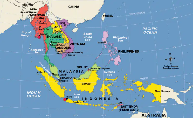
The Malay Peninsula and Indonesia's Sunda Isles represent the boundary between what two oceans?
the Pacific and Atlantic Ocean
the Atlantic and Indian Ocean
the Pacific and Indian Ocean
the Indian and Southern Ocean
What is the name of the seismically active zone around much of the Pacific Ocean?
Ring of Fire
archipelago
Mid Atlantic Ridge
Java Trench

The megalopolis of Jakarta in _____ is one of the largest in the world. It's also the capital.
Vietnam
Indonesia
Singapore
Thailand
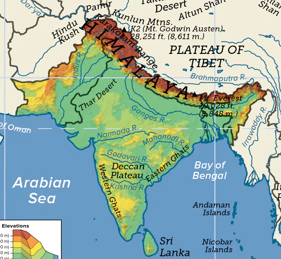
Which of the following forms the northern border of South Asia?
Ganges River
Bay of Bengal
Thar Desert
Hindu Kush,Karakoram, and Himalaya mountain ranges
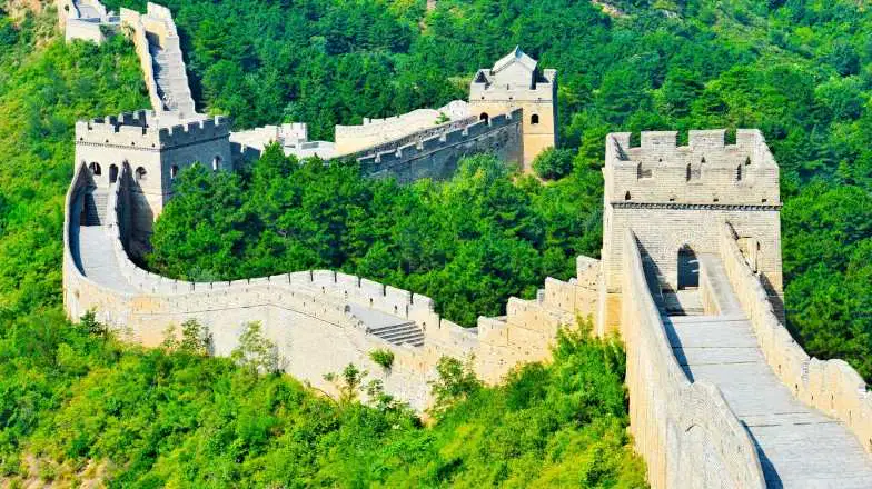
The Chinese built the ___________ about 2,200 years ago to defend themselves from foreign invaders that threatened from the north.
Eiffel Tower
Taj Mahal
Great Wall of China
Pyramids of Giza

What famous landmark in India was built by the Mughal emperor in memory of his wife?
Eiffel Tower
Great Wall of China
Machu Picchu
Taj Mahal
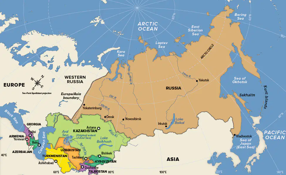
The part of Russia that is in Asia is called ______.
Siberia
The Caucasus
Central Asia
tundra

What human-made feature, located in Egypt, has contributed greatly to the Red Sea becoming one of the world’s busiest waterways?
Strait of Hormuz
Suez Canal
Kuwait refinery complex
hydroelectric dam

Which country is NOT located on the Arabian Peninsula?
Saudi Arabia
Yemen
Oman
Iran
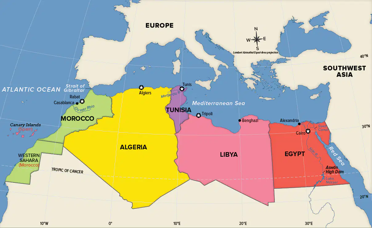
North African countries are located on the southern shore of the _____.
Nile River
Mediterranean Sea
Red Sea
Atlantic Ocean
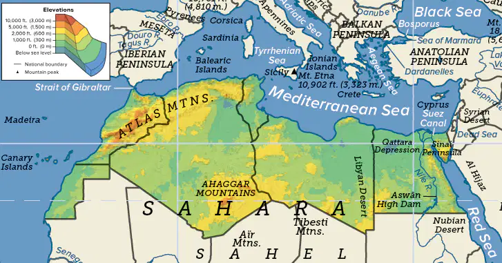
Which mountains form the longest mountain chain in Africa?
Caucasus Mountains
Ahaggar Mountains
Bale Mountains
Atlas Mountains
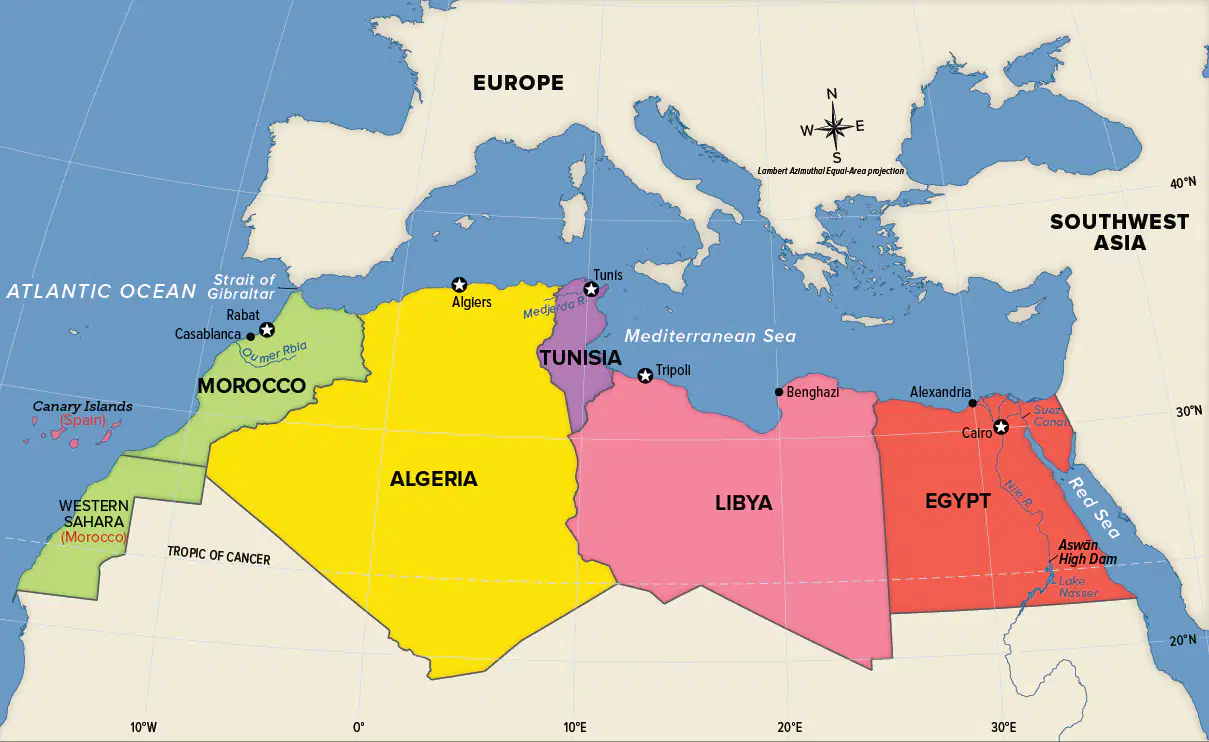
What city is both the largest in North Africa and the capital of Egypt?
Algiers
Cairo
Casablanca
Tunis
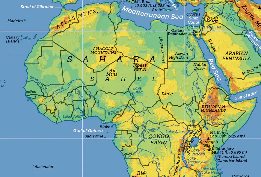
Located in Africa, what is the longest river in the world?
Amazon River
Nile River
Mississippi River
Tigris River
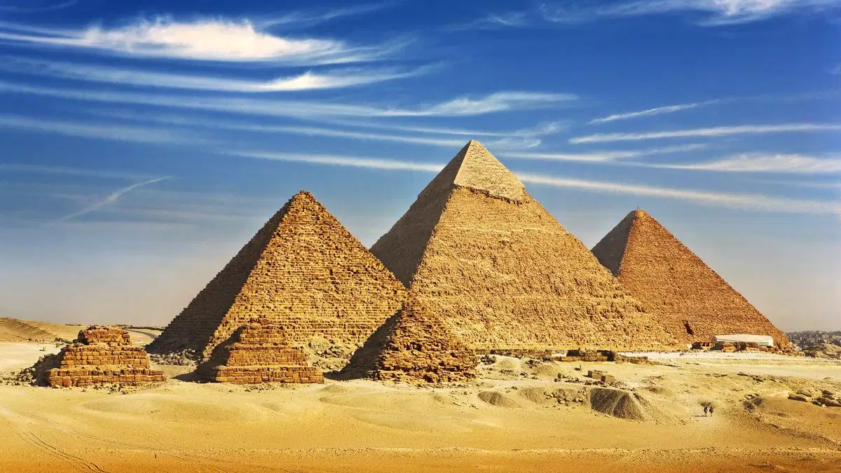
In Egypt, _____ were built as monuments to house the tombs of ancient pharaohs.
pyramids
theatres
temples
ruins
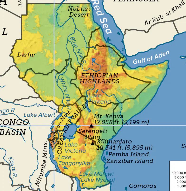
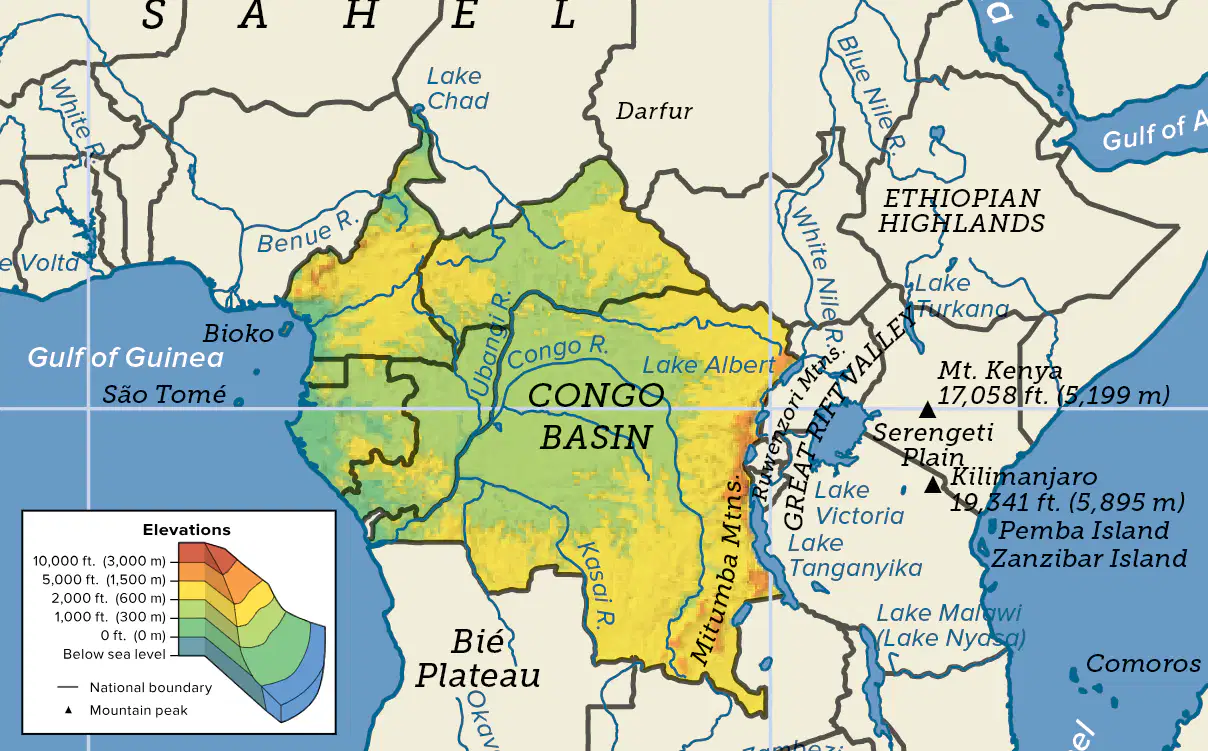
Located on the border between Kenya and Tanzania, the tallest mountain in Africa is _____.
Mount Everest
Kilimanjaro
Mount Kenya
Jebel Marra
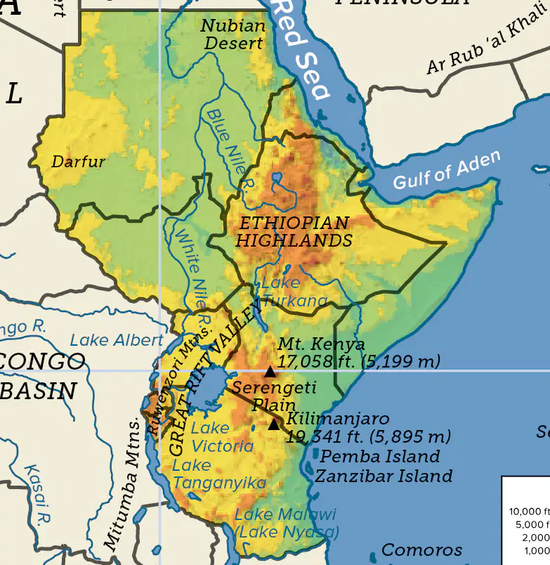
The largest lake on the continent of Africa is _____.
Lake Tanganyika
Lake Malawi
Lake Turkana
Lake Victoria
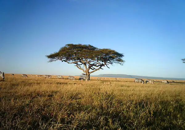
Located in Tanzania, ______ National Park is one of the most famous in the world because of its wildlife and African scenery.
Serengeti
Masai Mara
Hwange
Liwande
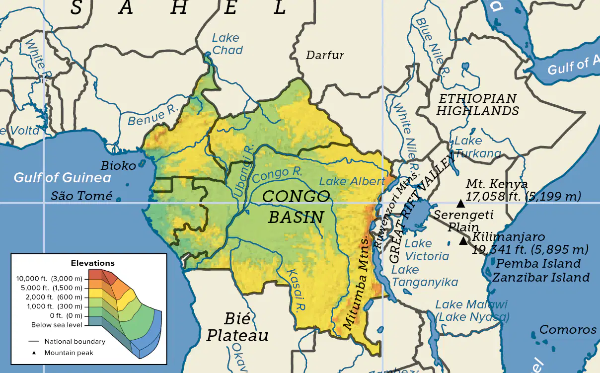
Which landform runs along the eastern edge of Central Africa?
Congo Basin
Atlantic Ocean
Great Rift Valley
Ubangi River
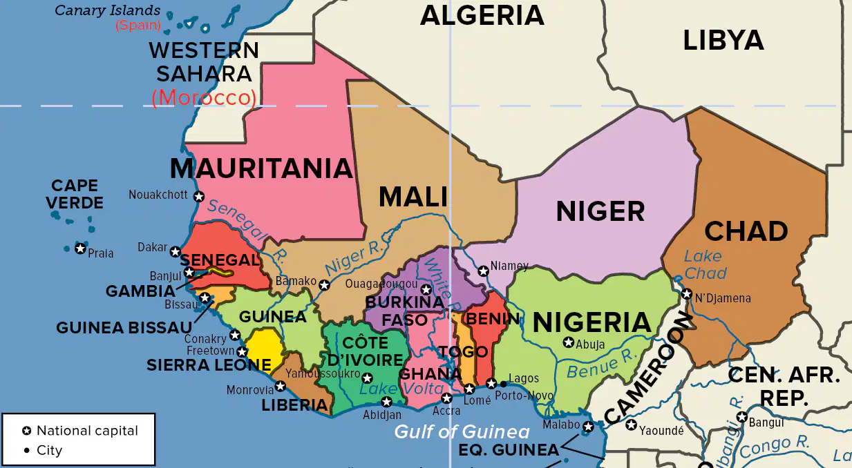
What do the countries of Mali, Niger, and Chad have in common?
They all have a coastline on the Atlantic Ocean.
No mountains are located within their borders.
They are all landlocked countries.
The are all island nations.
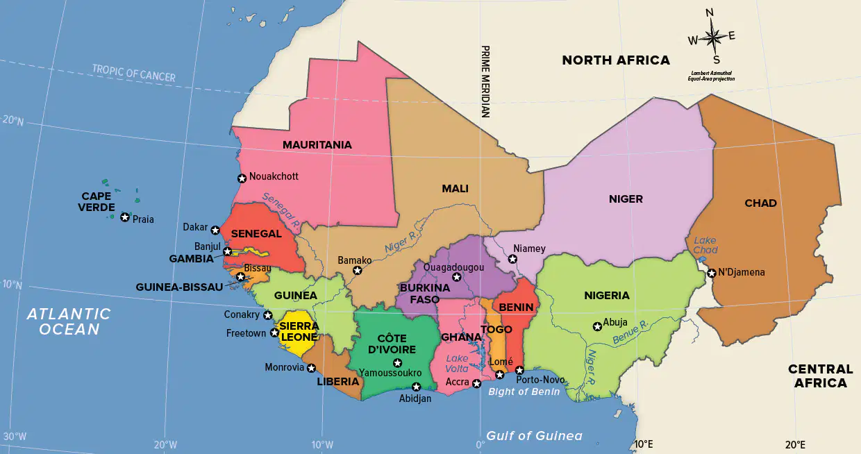
Many of the countries in Western Africa have coastlines along what ocean?
Atlantic
Pacific
Indian
Southern

Southern Africa is bordered by the _____ on the east and the Atlantic Ocean on the west.
Pacific Ocean
Indian Ocean
Arctic Ocean
Southern Ocean

Based on the map, which of the following cities has a population of two to five million?
Port Elizabeth
Cape Town
Lusaka
Walvis Bay
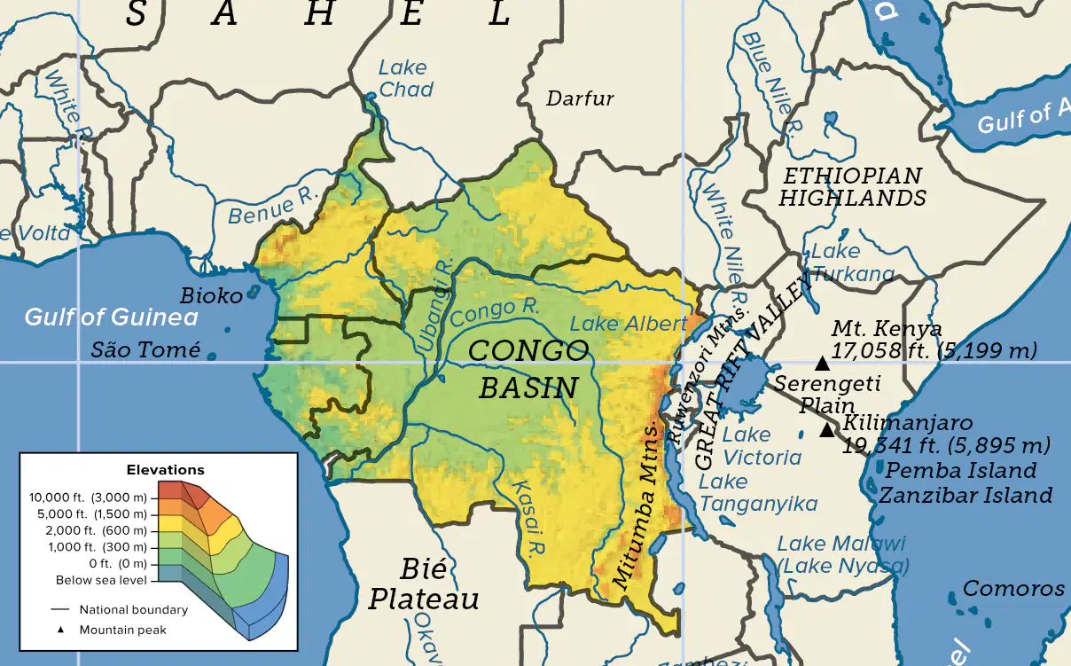
Because Central Africa straddles the Equator, the climate in much of the region is _____.
Mediterranean
arid
mild
tropical
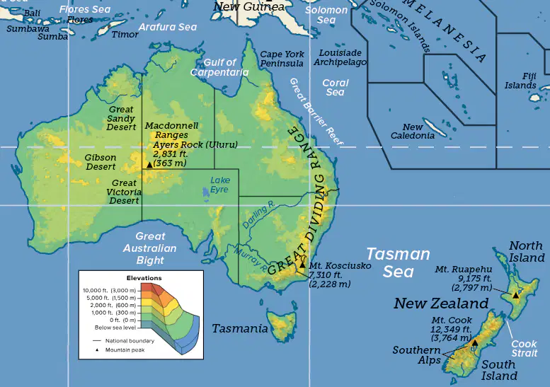
One of the most spectacular and complex ecosystems on Earth is the ________. Located just off the shores of Australia, it is a living coral reef.
Great Barrier Reef
Maldives Coral Reef
Belize Barrier Reef
Red Sea Coral Reef
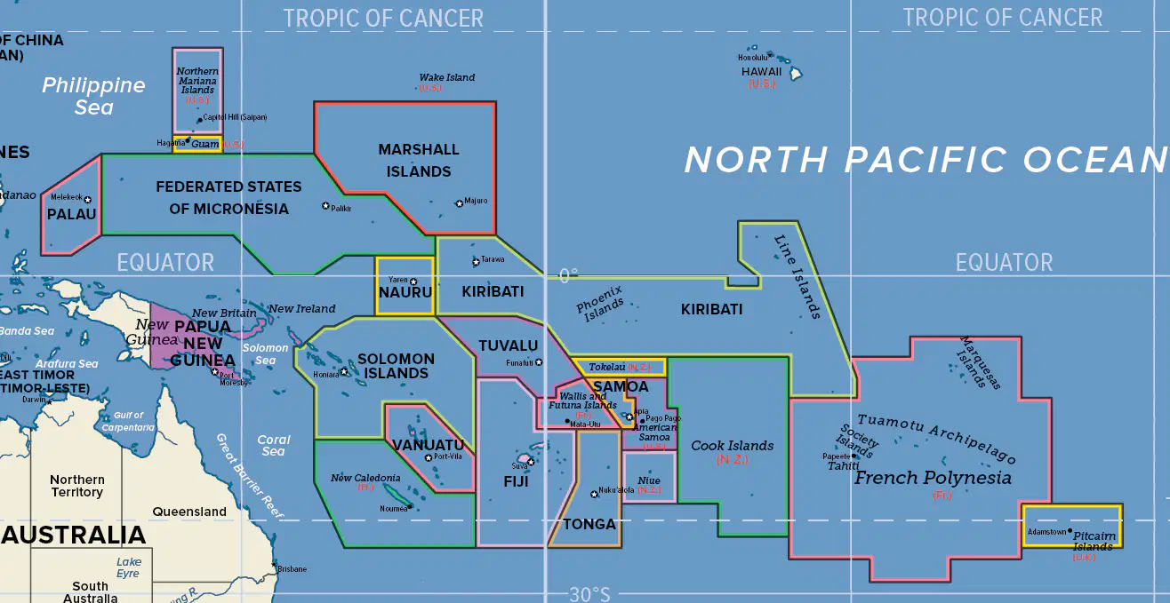
Oceania is made up of about 10,000 islands located in the ______ ocean, between Australia and Hawaii.
Atlantic
Indian
Pacific
Southern
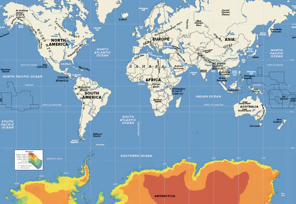
Antarctica is surrounded on all sides by the _____.
Southern Ocean
Pacific Ocean
Arctic Ocean
Atlantic Ocean

