
 Worksheets
2025 HONORS World Geography : Unit 10 - Southeast & East Asia 1
Total questions: 13
Worksheet time: 7mins
The eastern portion of China is densely populated, while the west is very sparsely populated. Which of the following geographic feature of western China most accounts for this settlement pattern?
Mountainous terrain
Threat of earthquake
Lack of access to water
Political conflict with Tibet
One way that both China and Japan have modified the environment has been by building infrastructure needed to —
bring water to remote villages
manage pollution created by industry
repair damage done by volcanic activity
supply energy to large, growing populations
Why has Singapore served as an important location for globalization in the world?
It is a center of agriculture production, exporting rice and wheat to the region.
It is an international port city, connecting trade across the Indian and Pacific Oceans.
It has the world's busiest airport, providing connections to Australia and the Asian mainland.
It serves as a major center for education, with many people traveling from across Asia to attend its schools and universities.
What is one way the governments of China and the United States operate differently?
In China the electorate only has one party to choose from and in the United States there are multiple political parties.
In China elections are only conducted on the provincial level and in the United States elections are held on the national level.
In China the executive leader is elected by a legislative body and in the United States the executive leader is chosen by popular vote.
In China legislative representatives are chosen from groups of local leaders and in the United States legislative representatives generally have served as state governors.
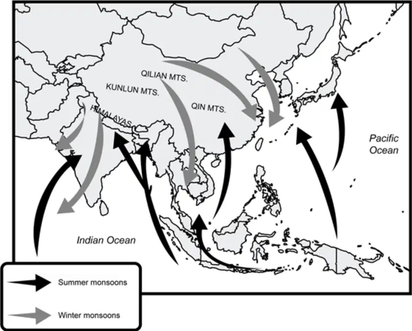
How do summer monsoon winds affect the climate of southeastern China?
The winds cause violent storms similar to hurricanes.
The winds are dry and have contributed to the area being a desert.
The winds are full of moisture and have contributed to the area being flooded often.
The winds are cold and have contributed to the area being covered in tundra and permafrost.
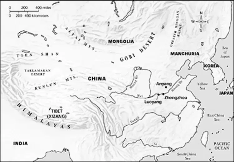
Based on the map, tell how the physical features of China affect the climate patterns of the region.
The Himalayas have an impact on the amount of precipitation in Tibet.
The climate of coastal China is more arid than that of the Tibetan Plateau.
Coastal China’s climate is impacted more by the Himalayas than other parts of China.
The mountain ranges in Asia have little impact on China’s climate patterns.
Which physical process is most responsible for the formation of islands in the Pacific Ocean?
Erosion
Landslides
Flood deposits
Tectonic activity
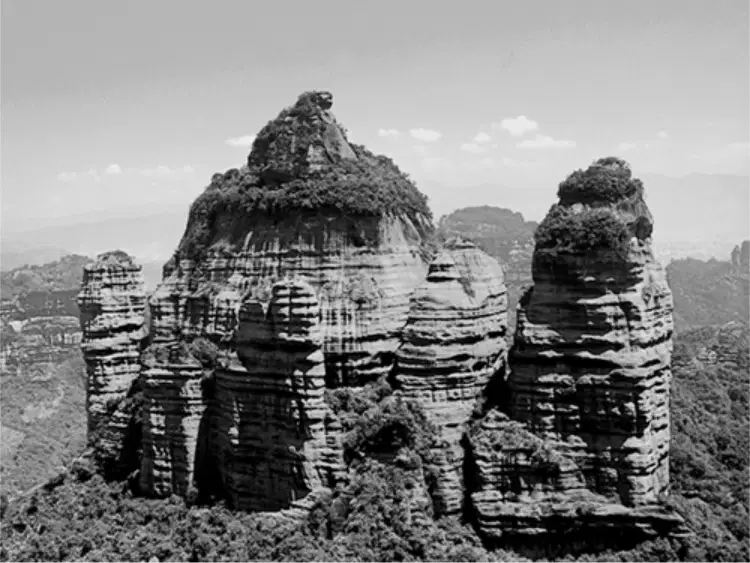
Which physical process is most likely responsible for this landform?
Erosion
Monsoons
Volcanic activity
Tectonic divergence
The arid and semi-arid climate of much of Southwest Asia creates biomes that are characterized by —
taiga and tundra
temperate forests
tropical rainforests
grasslands and desert
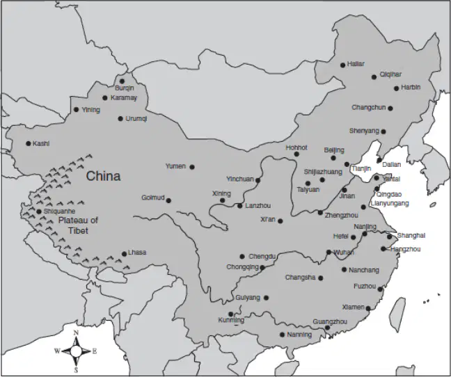
According to the map above, which statement most accurately describes the distribution of cities shown above?
The population density is greatest along China’s inland borders.
Urban development is more heavily concentrated in eastern China.
Rice farming is most successful in the mountains of southwestern China.
Extreme temperatures in northeastern China make the region unsuitable for human habitation.

What is the country that corresponds to the number 3?
Japan
Taiwan
North Korea
South Korea
What is the country that corresponds to the number 4?
Japan
Taiwan
North Korea
South Korea
What is the country that corresponds to the number 2?
China
Taiwan
North Korea
South Korea

