
 Worksheets
Review Quiz
Total questions: 25
Worksheet time: 2hrs 5mins
Which part of the map shows directions?
Compass Rose
Scale
Grid Lines
Title
What is the highest peak on Panay Island shared by Aklan and Antique?
Mount Nangtud
Mount Madia-as
Mount Igmatindog
Mount Baloy
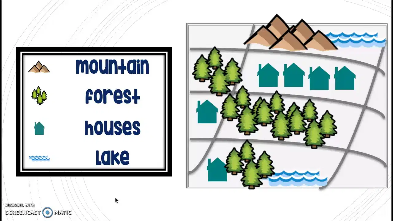
What part of the map tells what each symbol means?
Compass
Scale
Title
Legend
If you are in Kalibo, which province known for its woven products and lively Ati-Atihan festival are you visiting?
Antique
Capiz
Aklan
Iloilo
What is the capital of the province known as "The Heart of the Philippines"?
Kalibo
Iloilo City
Roxas City
Jordan
What tells us what the map is all about?
Scale
Title
Compass
Legend
Which landform is known as Iloilo's "Little Baguio"?
Pan de Azucar
Mount Napulak
Bucari
Mount Madia-as
This capital is the home of Capiznons and is also a coastal city popular for seafood.
Kalibo
Dumarao
Roxas City
Jordan
This province's nickname is based on the natural resources found in its waters and land. Its capital is Roxas City.
Capiz
Aklan
Antique
Iloilo
Which province is located in the center of the Philippine archipelago?
Guimaras
Aklan
Iloilo
Capiz
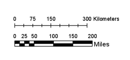
Which of the following shows how far distances are on a map?
Compass Rose
Title
Scale
Symbol
A map that shows mountains, rivers, and lakes is called a:
Political Map
Economic Map
Physical Map
Climate Map
You are visiting San Jose de Buenavista. While there, you see mountain ranges meeting the sea. Which province are you in?
Capiz
Guimaras
Antique
Iloilo
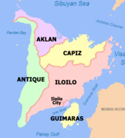
What province lies to the west of Aklan?
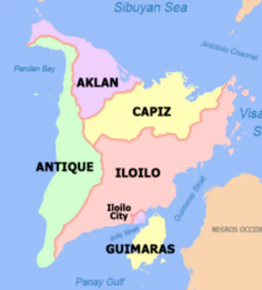
If you're in Aklan and go south, which province do you reach?
Which capital city shares the same province as Mount Napulak and Pan de Azucar?
San Jose de Buenavista
Iloilo City
Kalibo
Jordan
You are traveling in a province called "The Land of Sand, Sound, and Fiber." What is the capital of this province?
Kalibo
Passi City
San Jose de Buenavista
Roxas City
What is the purpose of grid lines on a map?
To decorate the map
To measure distance
To locate points easily
To tell the story
Which of these capital cities belongs to the island province famous for its sweet mangoes and marine resources?
Jordan
Kalibo
Estancia
Iloilo City
Which province has its capital in Jordan and is separated from Panay Island by the Iloilo Strait?
Aklan
Guimaras
Capiz
Antique
If you cross the Iloilo Strait going south, what province do you reach?
Which map type would help you understand where factories and farms are located?
Climate Map
Economic Map
Political Map
Physical Map
What does a climate map usually show?
Languages
Capital Cities
Temperature and rainfall
Trade routes
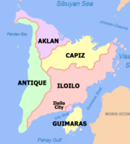
If you are in Iloilo and travel west, what province will you reach?
What island province is separated from Panay by the Iloilo Strait?
Aklan
Guimaras
Capiz
Antique

