
 Worksheets
Map Knowledge Quiz
Total questions: 69
Worksheet time: 57mins
What are maps based on?
Longitudinal measurements
Temperature readings
Population data
Historical events
How do maps help us?
By predicting the weather
By specifying routes and indicating places
By showing TV channels
By displaying food recipes
What has made the design of maps easier in recent times?
Hand-drawn sketches
Aerial and satellite photographs
Ancient manuscripts
Animal tracking
What does a topographic map show?
Human-made features like roads and buildings
Physical features of the land
Weather patterns
Population density
Which of the following is a characteristic of physical features shown on a topographic map?
They are formed by human activities
They include landforms and bodies of water
They show political boundaries
They represent economic data

Which continent is located at the southernmost part of the Earth?
South America
Africa
Antarctica
Australia

Which continent is directly south of North America?
Europe
Africa
South America
Asia
Which oceans are east and west of North America?
Pacific Ocean
Indian Ocean
Southern Ocean
North Atlantic Ocean
Arctic Ocean
How many oceans are there?
3
4
5
6
What is another name for a map legend?
Map symbol
Map key
Map scale
Map guide
What does a map legend help you understand?
The weather conditions
The colors, symbols, and geographical details on the map
The history of the map
The distance between two points
How are the terms "legend" and "key" used in relation to maps?
They are used to describe different parts of a map
They are used interchangeably
They are used to describe the map's history
They are used to describe the map's size
What might a "legend" include that a "key" focuses on differently?
The map's title
The map's history
The scale or source information
The map's author
What are the intermediate directions on a compass rose?
North, South, East, West
Northeast, Southeast, Southwest, Northwest
Up, Down, Left, Right
Forward, Backward, Sideways, Diagonal

Which direction is opposite to Southeast (SE) on a compass rose?
Northwest (NW)
Northeast (NE)
Southwest (SW)
North (N)
What is a compass rose used for on a map?
To show the scale of the map
To indicate the map's title
To display cardinal and intermediate directions
To provide a legend for symbols
Which of the following is a cardinal direction?
Northeast
Southeast
North
Southwest
Which direction is not an intermediate direction?
Northwest
Southeast
East
Southwest
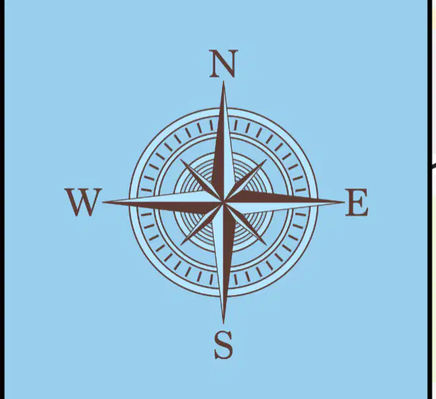
If you are facing East, which direction will be on your left?
North
South
West
East

What does the word "Piedmont" mean in Italian?
Foot of the mountain
Top of the hill
Valley of the river
Peak of the mountain
What geographical feature does "Piedmont" refer to?
Foothills
Riverbanks
Plateaus
Deserts
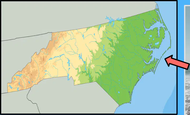
What percentage of the state does the Coastal Plain cover?
30%
45%
60%
75%
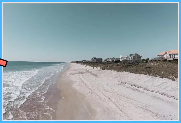
Which of the following is a feature of the Coastal Plain?
Mountainous terrain
Low-lying, flat terrain
Desert landscape
High cliffs
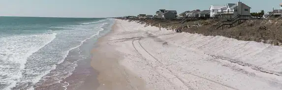
What is another name for the Outer Coastal Plain?
Highland region
Tidewater region
Desert region
Plateau region
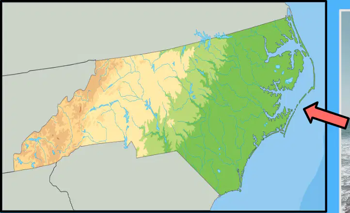
Which ecosystems are found in the Coastal Plain?
Deserts and canyons
Barrier islands, sounds, marshes, and river systems
Rainforests and savannas
Tundras and glaciers
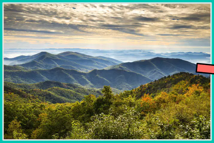
Where are the mountains located in relation to the Piedmont and Coastal Plain regions?
To the east
To the west
To the north
To the south
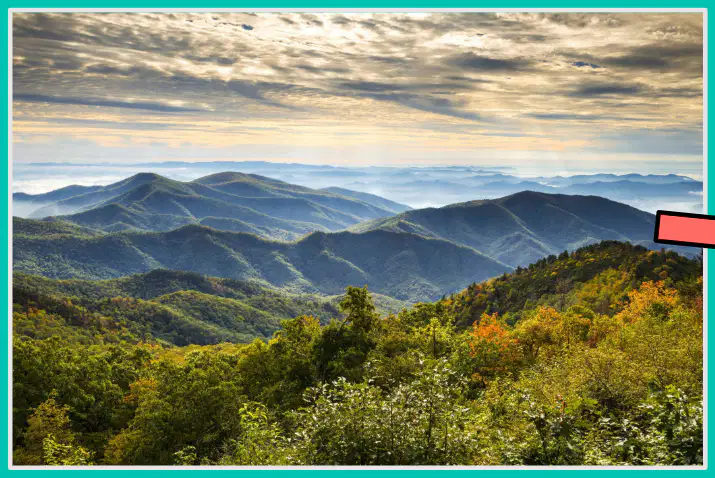
Which mountain ranges are found in North Carolina?
Rocky Mountains and Sierra Nevada
Blue Ridge Mountains and Great Smoky Mountains
Appalachian Mountains and Andes
Himalayas and Alps
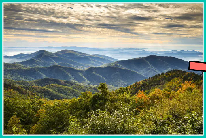
What is the highest peak in the eastern United States?
Mount Everest
Mount Mitchell
Mount Kilimanjaro
Mount McKinley
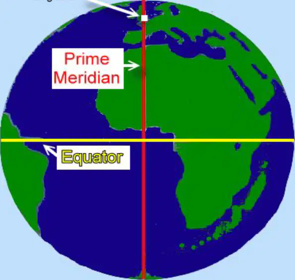
What is the Equator?
An imaginary vertical line dividing the Earth into eastern and western hemispheres.
An imaginary horizontal line dividing the Earth into northern and southern hemispheres.
The longest line of longitude on Earth.
A real line that can be seen from space.
Why is the Equator considered the longest line of latitude?
Because it is closer to the North Pole.
Because it is equally distant from both the North Pole and South Pole.
Because it is a real line that circles the Earth.
Because it is the shortest line of latitude.
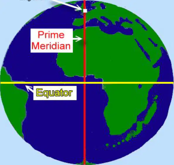
What is the Prime Meridian?
An imaginary horizontal line at the equator
An imaginary vertical line from the North Pole to the South Pole
A real line that circles the Earth
A line that divides the Earth into northern and southern hemispheres
What does the Prime Meridian divide the Earth into?
Northern and Southern Hemispheres
Eastern and Western Hemispheres
Upper and Lower Hemispheres
Inner and Outer Hemispheres
What is the longitude of the Prime Meridian?
90° longitude
180° longitude
0° longitude
45° longitude
What are the names of the oceans?
What are the intermediate directions on the compass rose?
What are the cardinal directions on a compass rose?

What is the primary purpose of a map's legend?
To show the scale of the map
To explain the symbols used on the map
To indicate the map's orientation
To provide the map's title
What is the main purpose of a compass rose on a map?
To show the map's scale
To indicate directions
To provide the map's title
To explain the map's symbols
What is the primary purpose of a map's legend?
To show the scale of the map
To explain the symbols used on the map
To indicate the map's orientation
To provide the map's title
How can you find a city on a map using latitude and longitude?
By using the map's scale
By identifying the coordinates
By reading the map's title
By interpreting the map's symbols


What are the names of the seven continents?

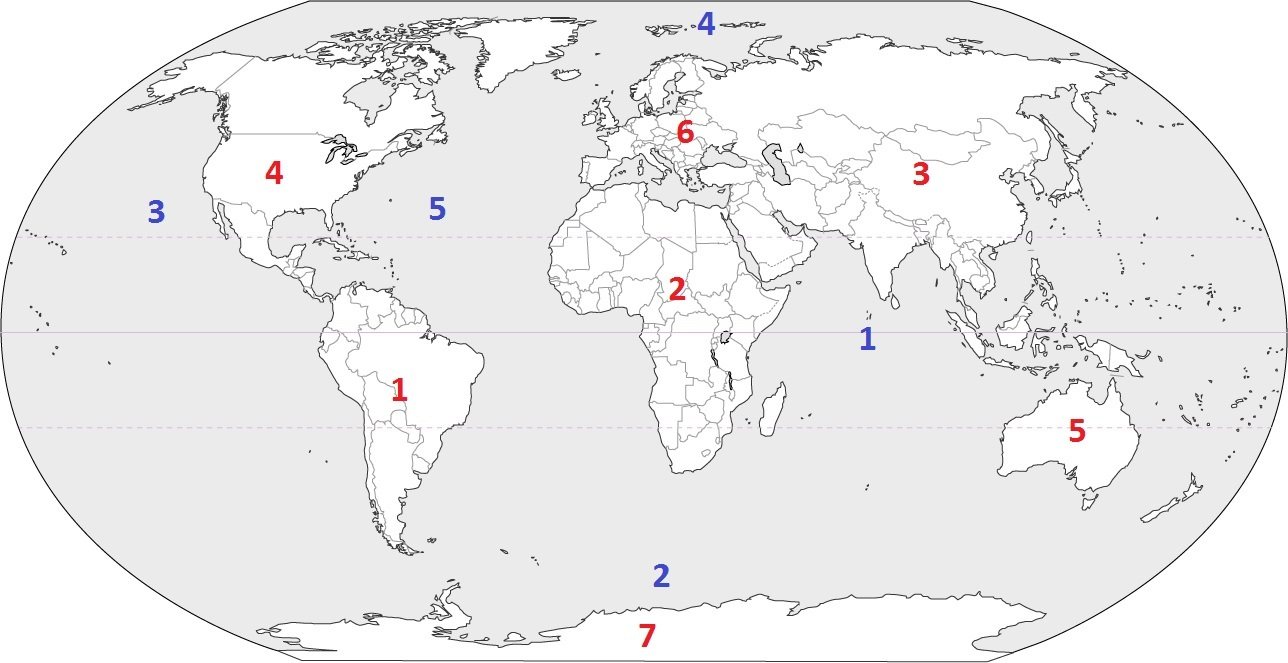

Which continent is west of the Atlantic Ocean, east of the Pacific Ocean, and North of South America?
Asia
Antarctica
Africa
North America


What contient is this?
Africa
Asia
Europe
Australia


What ocean is to the west of North America?
Atlantic
Pacific
Southern
Indian

What continent is shown in orange?
Europe
North America
South America
Asia
What 2 oceans border the USA?
Atlantic and Arctic
Arctic and Pacific
Atlantic and Pacific
Atlantic and Southern

Which 2 of the following is a physical feature?
river
state
population
mountain

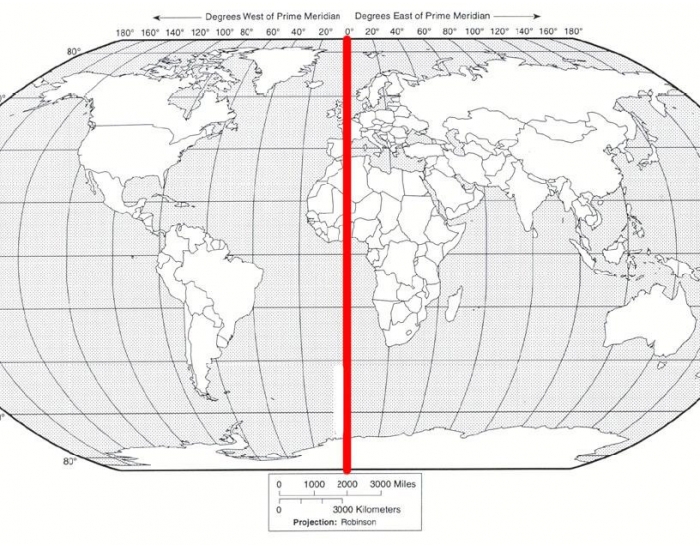
What is the imaginary line that divides the Earth East and West?
Equator
Dividing Line
Prime Meridian
Axis

What do we call the line at 0 degrees longitude?
Equator
Prime Meridian

10) Which point on the diagram correctly locates 15° S and 30° W?
Z
Y
X
W

Look at the map. What city is located at 45°N, 75°W?
Brasilia
Ottawa
London
Beijing
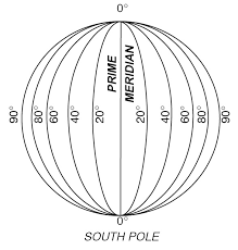


If I told you to meet me at 75 degrees West and 30 degrees North, where would we meet?
The large landmasses are known as the
Continents
Oceans
Sea water

