
NEW
Font size
 Worksheets
Tools of Geo P2 Review
Total questions: 16
Worksheet time: 9mins
What is an atlas?
A collection of maps, graphs, and charts
A geographical encyclopedia
A digital map application
A global positioning system
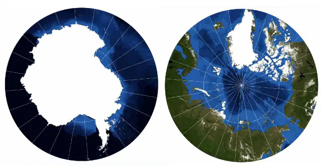
This map is an example of which map projection?
Mercator
Robinson
Polar
Conical
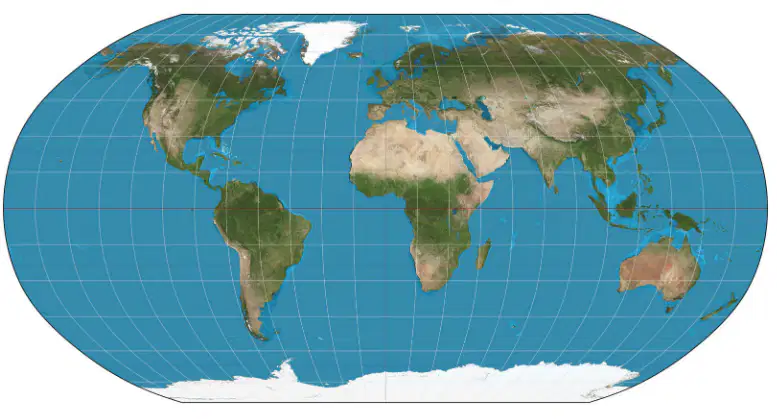
This map is an example of which map projection?
Mercator
Robinson
Polar
Conical
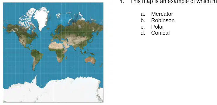
This map is an example of which map projection?
Mercator
Robinson
Polar
Conical
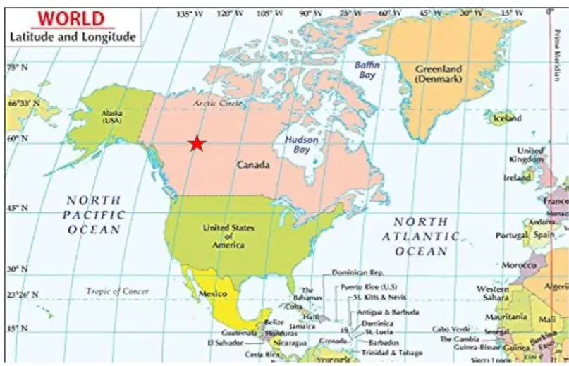
Find the coordinates of the point marked on the map:
60°S, 150°W
120°W, 60°N
60°N, 120°W
60°E, 120°W

Find the coordinates of the point marked on the map:
40°N, 80°W
45°N, 90°E
85°W, 30°N
50°N, 100°W
Which imaginary line runs around the globe and marks the center of the lines of latitude (0° N/S)?
Prime meridian
Equator
Tropic of Cancer
Tropic of Capricorn


This map is a...
physical map
road map
political map
thematic map

Identify the map above and identify which of the following descriptions most accurately describes the map.
Mercator: The shape and size of land masses are distorted, but direction is accurate
Robinson: Distortion is only happening with the size of the land masses, shape and direction are accurate
Mercator: Land mass size is accurate due to distortion being spread across all aspects of the map
Goode Homolosine: Does not use cardinal directions, minimizes distortion but is confusing to read
Robinson: Distortion is evenly spread out across shape, size, and direction making it less noticeable
Which of the following is an example of RELATIVE location?
A 2 dimensional graphic of the earth or parts of the earth is called a:
map
globe
projection
compass

A collection of maps, graphs, and charts is called:
a globe
a map
an atlas
a textbook
Which imaginary line runs around the globe and marks the center of the lines of longitude (0° E/W)

