
 Worksheets
Basic Map Terms
Total questions: 45
Worksheet time: 38mins
Main directions (N,S,W,E)
intermediate directions
cardinal directions
compass rose
pacific directions
in between directions (NW,NS,SW,SE)
cardinal directions
map scale
map symbols
intermediate directions
shows the relationship between distances on a map and real distances
locator map
map scale
map symbols
relief map
tells the reader about the subject of the map and what area the map covers
grid system
map symbols
compass rose
map title
A map symbol that shows the cardinal directions and intermediate directions
compass rose
legend
grid system
locator map

Which part of the map is this?
Map key
Map Scale
Compass Rose
Border

Which part of the map is this?
Map key
Map Scale
Compass Rose
Border

What continent is number 7 on the map above?
Australia
Europe
Antarctica
Africa
What continent is number 6 on the map above?
Australia
Europe
Antarctica
Africa
What continent is number 2 on the map above?
Australia
Europe
Antarctica
Africa
What continent is number 4 on the map above?
Australia
Europe
Antarctica
Africa
What continent is number 1 on the map above?
South America
North America
United States of America
Asia
What continent is number 5 on the map above?
South America
North America
United States of America
Asia
What continent is number 3 on the map above?
South America
North America
United States of America
Asia

What ocean is number 12 on the map?
Arctic
Atlantic
Pacific
Indian
What ocean is number 11 on the map?
Arctic
Atlantic
Pacific
Indian
What ocean is number 10 on the map?
Arctic
Atlantic
Pacific
Indian
What ocean is number 9 on the map?
Arctic
Atlantic
Pacific
Indian
What is the name of the ocean for number 8?
Antarcitc Ocean
Southern Ocean
South Pole Ocean
Zook Ocean
the angular distance north or south from the
equator of a point on the earth’s surface
equator
latitude
longitude
prime meridian
the angular distance east or west from the Prime Meridian of a point on the earth’s surface
equator
latitude
longitude
prime meridian
Scale
This tool on a map shows you how to convert the distance on the map to the real distance, like 1" = 1 mile.
This tool is used to measure the area of a map.
This tool helps in identifying the symbols used on a map.
This tool indicates the direction of north on a map.
Prime Meridian
Imaginary line that divides the earth into eastern and western hemispheres.
A physical line that marks the equator of the Earth.
A line of latitude that runs parallel to the equator.
The boundary between the Arctic and Antarctic regions.
Equator
An imaginary circle around the earth that divides the earth into the northern and southern hemispheres.
A line of latitude that is 90 degrees north of the equator.
The longest line of longitude on the earth.
A region where the sun is directly overhead at noon throughout the year.


The United States of America is a continent
TRUE
FALSE
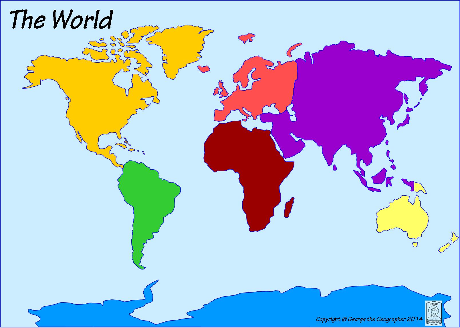
The United States of America is a country located on which continent?
South America
Europe
Africa
North America

The dark green continent is...
Europe
Australia
South America
North America

What continent is this?
South America
Africa
North America
Asia

What continent is this?
Antarctica
Australia
Africa
South America

What continent is this?
Asia
Europe
Africa
Antarctica

What continent is this?
Europe
Africa
Asia
South America
Lines of Latitude run
East and West
North and South
East to North
West to South
Imaginary line that divides Earth into the Northern and Southern hemisphere.
Equator
Prime Meridian
Axis
Lines of Longitude
How many hemispheres does Earth have?
4
6
2
8
What hemisphere is nearest to the South Pole?
Southern
Northern
Western
Eastern
What line divides the Eastern and Western hemispheres?
Prime Meridian
Equator
The symbol "o" stands for
degree
access
axis



Which hemisphere is this?
Northern Hemisphere
Southern Hemisphere
The half of the Earth that is south of the equator is in this hemisphere.
Northern Hemisphere
Southern Hemisphere
Europe is found in this hemisphere.
Northern Hemisphere
Southern Hemisphere

