
 Worksheets
Geography Skills Handbook
Total questions: 10
Worksheet time: 15mins
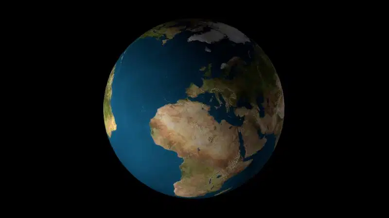
Which of these best shows the true shape of the Earth and the continents and oceans?
Political map
Physical map
Globe
Equator

Why are there fewer animals in the brown colored area on the map?
The forest doesn't provide enough plant life to support animals.
The desert has less water and plants to support animal life.
The desert has a lot of water and plant life so can allow for a lot of animals.
There is more room for snakes, lizards, and cactus to live.

Which of the following is true about the map? Select ALL that apply!!
Cotton can be found in all of the states except New Mexico (NM).
Gold can be found in all of the states in the Southwest Region.
Much of our oil in the SW Region comes from along the Gulf of Mexico.
Cattle is the main resource in the Northeast corner of Oklahoma.
A map scale shows a relationship between ______ .
The distance on the map and the distance on Earth.
The path the Hurricane took as a tropical storm vs as a Hurricane once it made landfall.
The drawing of a map and how far you'd have to drive.
The direction you need to travel to get to a new location.
Using pg. SSH 5 in your book, about how many miles did Hurricane Sandy travel as a tropical storm once it made landfall in the United States?
Cuba
About 150 miles
About 600 miles
About 300 miles
What are the four cardinal directions?
What are the four intermediate directions?
Use page SSH 6 in your book. What is the capital of South Dakota? Remember to capitalize since it's a proper noun!
Use page SSH 7 in your book. What is the tallest Mountain peak in the Northeast?
Mt. Marcy
Mt. Washington
Mt. Katahdin
Appalachian Mountains
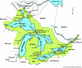
Use page SSH 7 in your book. Which of the Great Lakes is the furthest south?
Chesapeake Bay
Lake Ontario
Lake Erie
Lake Superior

