
 Worksheets
Unit 1- Mapping Skills
Total questions: 40
Worksheet time: 20mins
Maps allow people to know location: _______ and _______.
relative and absolute
north and south
latitude and longitude
east and west
Maps help people understand the world in a ________.
simple way
confusing manner
difficult process
complex theory
What does a political map show?
Landforms and physical features
Clear borders between countries, states, cities, counties, etc.
Climate zones
Population density
Political maps are helpful when you need to distinguish clear ________ lines.
political
weather
elevation
population
What do physical maps show?
Political boundaries
Physical features of an area
Population density
Climate zones
Physical maps are helpful when you need to examine ________ and/or elevation changes.
topography
climate
population
language
What is the definition of Special Purpose/Thematic Maps?
Maps that show only physical features
Maps that reveal specific information
Maps that show only political boundaries
Maps that show only weather patterns
Which of the following is NOT an example of data that can be shown on a Special Purpose/Thematic Map?
Life expectancy
Literacy rate
Pollen count
Map scale
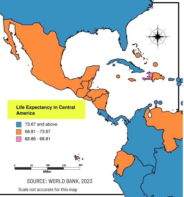
________ gives the viewer an idea of what the map represents.
Title
Scale
Compass rose
Legend
What does a KEY or LEGEND help people do when looking at Special Purpose Maps and Physical Maps?
Draw maps
Interpret maps
Color maps
Travel to places
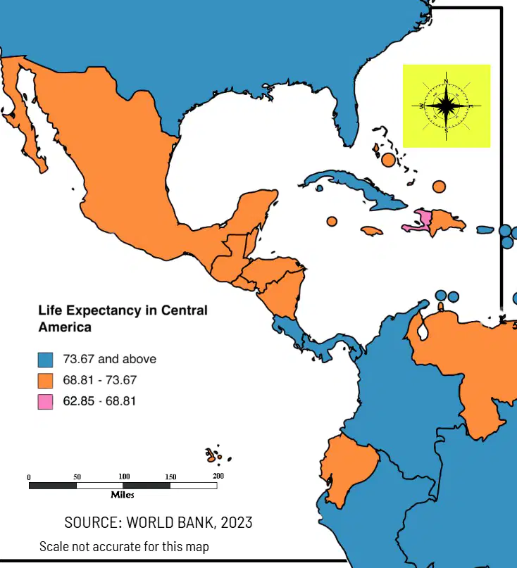
COMPASS: Shows the viewer the cardinal directions. Which of the following is a cardinal direction shown by a compass?
North
Apple
Triangle
Circle
What does the scale on a map show?
The population of a country
The distance on a map versus real distance
The temperature of a region
The elevation of mountains
Scale is usually measured in ______ per mile or centimeters per kilometer.
inches
meters
yards
feet
Fill in the blank: The process of making a map requires the ________ (or map maker) to transform the latitudes and longitudes in order to have a flat plane.
cartographer
geologist
astronomer
biologist
Depending on the projection you are viewing, land might appear larger or smaller than it actually is.
True
False
What does the Mercator projection do?
Turns the globe into a cone and then transforms it into a flat surface
Turns the globe into a cylinder and then transforms it into a flat surface
Turns the globe into a pyramid and then transforms it into a flat surface
Turns the globe into a cube and then transforms it into a flat surface
What is the main advantage (pro) of the Mercator projection?
Best used for navigation
Shows true size of land
No distortion at the poles
Best for showing population
What is the main disadvantage (con) of the Mercator projection?
Difficult to use for navigation
Increased land distortion at the poles
Shows true shape of continents
No distortion at the equator
What is the main characteristic of the Peters Projection?
Presents countries in their true proportion to one another
Minimizes distortion in area, direction, and distance
Makes a complete rectangle
Distorts the shape of land at the equator
What is a con of the Peters Projection?
Best used for navigation
Increased land distortion at the poles
Minimizes distortion in area
Makes a complete rectangle
The goal of the Winkel Tripel Projection is to minimize distortion in area, direction, and distance by not making a _________?
complete rectangle
perfect circle
straight line
square grid
Fill in the blank: The grid system is a system of ________ lines that reveal distance and give exact locations.
imaginary
parallel
visible
permanent
The grid system divides the world into how many hemispheres?
Four hemispheres
Two hemispheres
Six hemispheres
Eight hemispheres
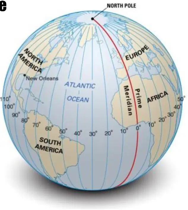
The grid system divides the world into the four hemispheres: North, South, East, and _____?
West
Central
Polar
Equator
The NORTHERN and SOUTHERN hemispheres are divided by the _______.
Prime Meridian
Equator
Tropic of Cancer
Longitude
Equator is an imaginary line of latitude, measured at __° and runs west and east.
0°
90°
45°
180°
The Equator is a line of _________.
Longitude
Latitude
Altitude
Hemisphere
Lines of latitude run parallel (they never touch) around the world.
True
False
The WESTERN and EASTERN hemispheres are divided by the _________.
Prime Meridian
Equator
Tropic of Cancer
International Date Line
The Prime Meridian is an imaginary line of longitude, measured at __° and runs north and south.
0°
90°
45°
180°
The Prime Meridian is a line of:
Latitude
Longitude
Altitude
Equator
Lines of longitude generally divide the world into _________.
Time Zones
Continents
Climate Zones
Countries
Lines of latitude generally divide the world into _________.
Time Zones
Continents
Climate Zones
Countries
Fill in the blank: The Tropic of Cancer is measured at _______ North.
23 1/2°
30°
15°
10°
Fill in the blank: The Tropic of Capricorn is measured at _______ South.
23 1/2°
15°
30°
45°
Why are both of the tropics 23 1/2° away from the equator?
Because the earth tilts on an axis at 23 1/2°
Because the earth is flat
Because the equator moves
Because of the moon's gravity
What is the climate like in the low latitudes/tropics (0° - 23 1/2°)?
Cold and dry
Hot and humid
Mild and rainy
Cool and windy
What is the climate like in the Middle Latitudes?
Hot and humid
Very cold
Ranges from hot to cold
No seasons
What is the climate like in the High Latitudes?
Very cold
Hot and humid
Moderate with seasons
No clear seasons
Which of the following also affects climate?
Elevation
Wind
Ocean Currents
Landforms
All of the choices

