
NEW
Font size
 Worksheets
SS IA 1 Review
Total questions: 15
Worksheet time: 8mins
What did the Navajo Code Talkers do during World War II?
Built houses for soldiers
Sent secret messages using the Navajo language
Cooked food for the army
Fought battles with swords
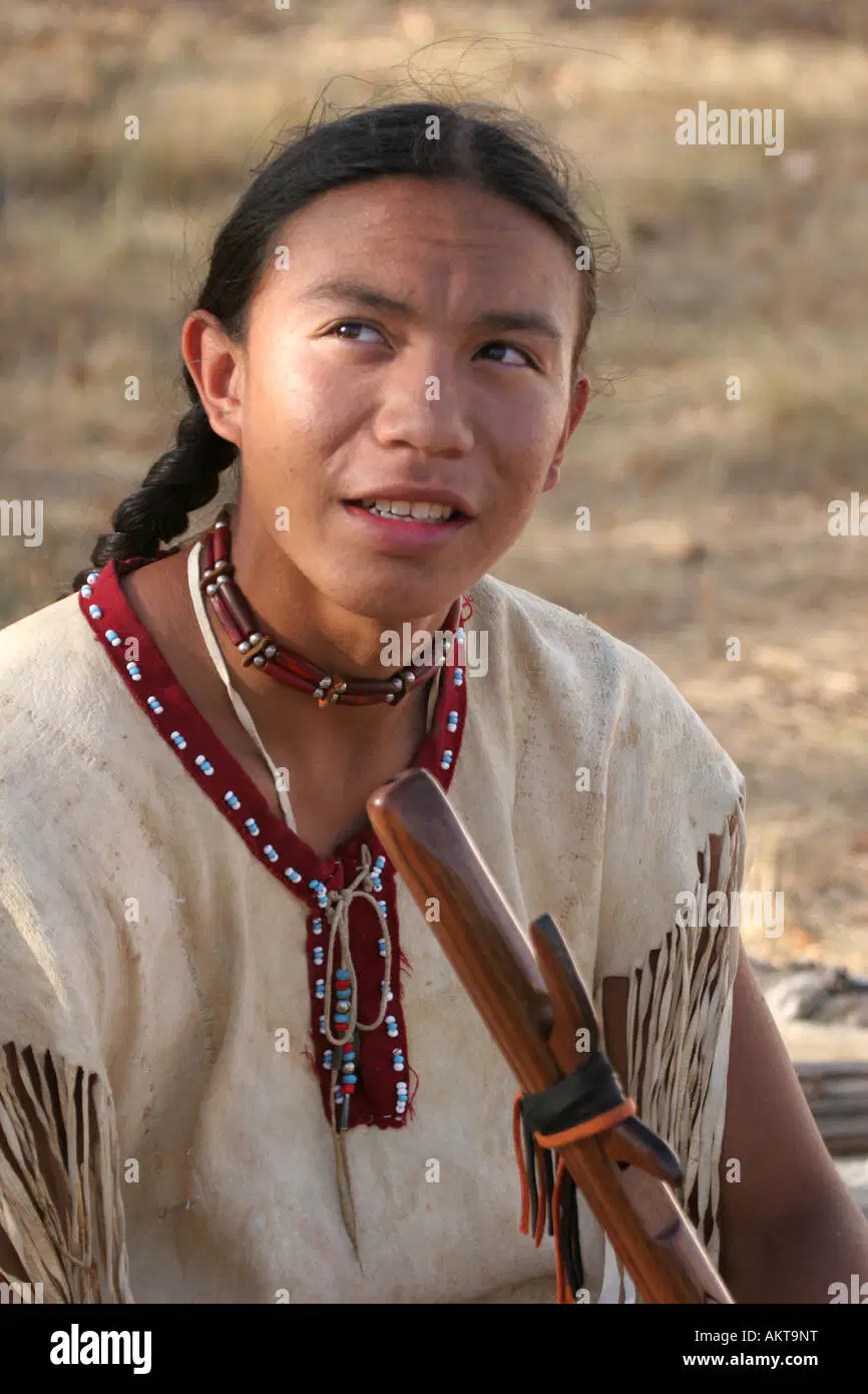
Observe this photo of Native Americans. What are their clothes made from?
animal skin
Target
plants
cardboard

Which globe shows lines of longitude? A or B
A
B
Most traveling American Indian tribes lived in the Great Plains.
Why did they move from place to place?
To follow the buffalo
To go fishing in the ocean
To farm in one spot
To mine for gold
What kind of transportation did Native Americans use and contribute to American culture?
airplane
canoe
train
car
Why were sources of water like rivers important to the Native Americans?
for fishing
for watering crops
for making ships
for swimming laps
Because the Southwest is hot and dry, what kind of homes did the Pueblo Indians build?
Igloos
Clay brick (adobe) homes
Teepee
Wooden homes
The Northeast region had thick forests, and the Native Americans built what type of house?
teepee
adobe
longhouses
igloos
Native American art included
Video Games
Cartoon characters
Modern building
Respect for nature
What did Arctic American Indians do in the summer to get food?
Stayed in their village all the time
Traveled to hunt and fish where food was available
Went to school
Built tall buildings
Why were teepees important for the Plains Indians?
They were easy to move and set up
They were very tall
They were made of stone
They were used to store water
What materials did the Arctic Indians use to build their homes in the winter?
Tree for longhouses
Animal skin for teepees
Snow and ice for igloos
Clay and mud for adobes
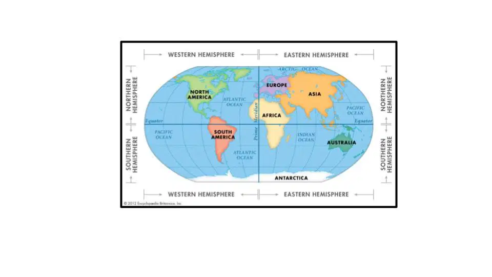
Which continent is located entirely north of the equator and west of the prime meridian?
Australia
North America
Africa
Antarctic
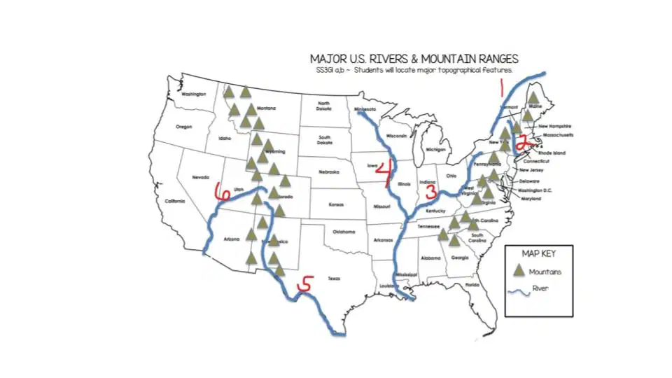
Which number on the map represents the Rio Grande?
5
1
6
3
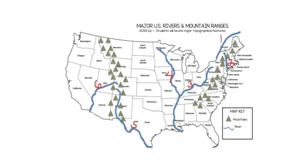
Which number on the map represents the St. Lawrence?
5
6
1
3

