
NEW
Font size
 Worksheets
Unit 1 SS DBA Review
Total questions: 48
Worksheet time: 2hrs 22mins

Use the map of Texas with major cities, rivers, and a key. Which city is the farthest north according to the map?
Lubbock
Amarillo
San Antonio
Oklahoma

Which body of water is located to the southeast of Texas on the map?
Big Bend National Park
Rio Grande
Gulf of Mexico
Galveston Bay
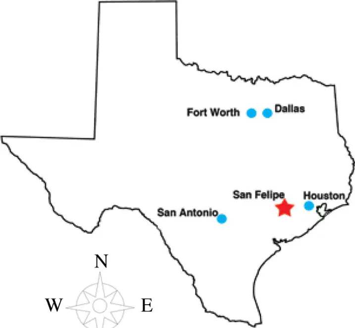
What information does this map provide to the reader?
the location of several important cities in Texas
the cardinal and intermediate directions
the approximate location of San Felipe
all of the above
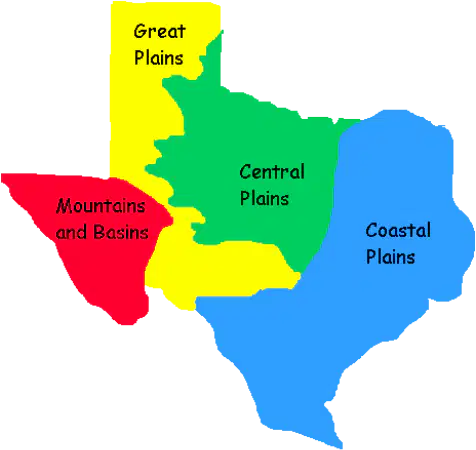
Which region of Texas receives the most rain due to its proximity to the Gulf of Mexico?
Great Plains
Central Plains
Mountains & Basins
Coastal Plains
In which region would you find Houston, Corpus Christi, and Brownsville?
Great Plains
Central Plains
Mountains & Basins
Coastal Plains
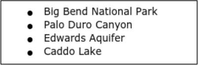
Which title is most appropriate for this list?
Industrial Developments in Texas
Causes of Economic Downturn in Texas
Features of the Mountains and Basins Region of Texas
Geographic Landmarks of Texas

It can be concluded that George Perry is describing the —
wettest area in Texas
driest area in Texas
largest city in Texas
coldest area in Texas
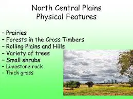
Which region of Texas has prairie grasses as its primary vegetation?
Great Plains
Central Plains
Mountains & Basins
Coastal Plains
Which region has the highest elevation?
Central Plains
Great Plains
Coastal Plains
Mountains and Basins
The Houston area is located in the —
North Central Plains
Coastal Plains
Great Plains
Mountains
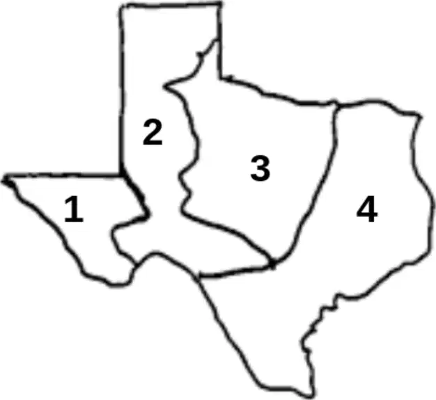
What area on the map is called the Great Plains?
Area 1
Area 2
Area 3
Area 4
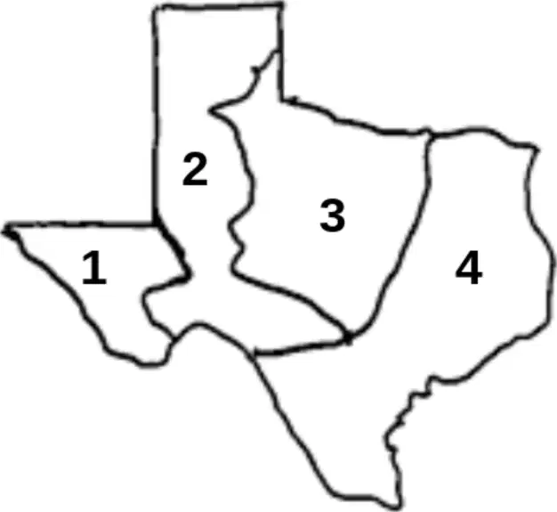
What area on the map is called the Central Plains?
Area 1
Area 2
Area 3
Area 4
What differences exist between region 1 and region 4?
Region 1 has rivers and region 4 does not.
Region 1 has aquifers and region 4 does not.
Region 1 has mountains and region 4 does not.
There is no difference between them.

Which region would you be in if you were visiting the Fort Worth Rodeo?
Gulf Coastal Plains
Central Plains
Mountains & Basins
Great Plains
Which region would you be in if you saw a mockingbird while touring the N.A.S.A. Space Center?
Central Plains
Gulf Coastal Plains
Great Plains
Mountains & Basins
Which region would you be in if you were visiting Big Bend National Park?
Gulf Coastal Plains
Great Plains
Mountains & Basins
Central Plains
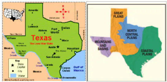
Which region would you be in if you were visiting our state capital, Austin?
Gulf Coastal Plains
Central Plains
Mountains & Basins
Great Plains
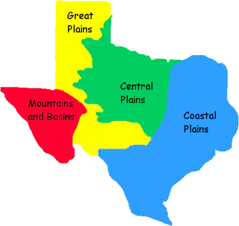
Which region covers MOST of the Texas Panhandle?
Central Plains
Gulf Coastal Plains
Great Plains
Mountains & Basins
Which region do you currently live in? (Tomball is near Houston)
Central Plains
Gulf Coastal Plains
Great Plains
Mountains & Basins
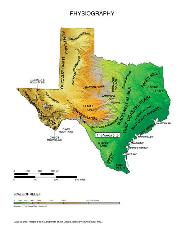
Which landform is most common in Texas?
Mountains
Plains
Basins
Deserts
Which region has very little vegetation (plants)?
Gulf Coastal Plains
Central Plains
Mountains & Basins
Great Plains
American Indian Cultures developed differently as they —
fought each other during tribal councils
adapted to their physical surroundings
moved out of Texas
were surrounded by various temples
A tribe that is sedentary (permanent homes) would most likely
fish
farm
hunt
travel
A tribe that is nomadic would most likely
live in a teepee
plant corn and beans
live in an adobe
irrigate (water) their crops
Which of these is often a characteristic of nomadic tribes?
permanent settlements
plank houses
expert fishermen
expert hunters
Which of these is often a characteristic of sedentary tribes?
expert farmers
tipis made from buffalo hides
travels often
expert hunters
Teepees were often used by Native Americans because
they were very durable
they were easy to move
they were fashionable
they were made from buffalo
The region that a tribe lived in affected their lifestyle because of
the available resources
the age of the tribe
the scenery
the size of the region
Tribes would most likely settle
in the desert
near a body of water
near the Comanche
in another state
How was a buffalo useful to Native Americans?
it provided food
it provided weapons/tools
it provided shelter
all of the above
Which American Indian tribe is located in the Gulf Coastal Plains and often fished for their food source?
Lipan
Karankawa
Jumano
Apache
One way the Gulf Coastal tribes adapted to their environment was to —
create permanent villages
use dugout canoes for fishing
travel with the buffalo herds
planted crops along the ocean
Use the choices below to answer: create permanent villages; use dugout canoes for fishing; travel with the buffalo herds; planted crops along the ocean. Which statement best describes the Karankawas?
create permanent villages
use dugout canoes for fishing
travel with the buffalo herds
planted crops along the ocean
This tribe lived in the Gulf Coastal Plains and ate mostly fish, clams, mussels and alligator (seafood).
Caddos
Karankawas
Jumanos
Apaches
This tribe lived in pueblos in the Mountains & Basins region and traded their crops for meat and other supplies with other tribes.
Caddos
Karankawas
Jumanos
Apaches
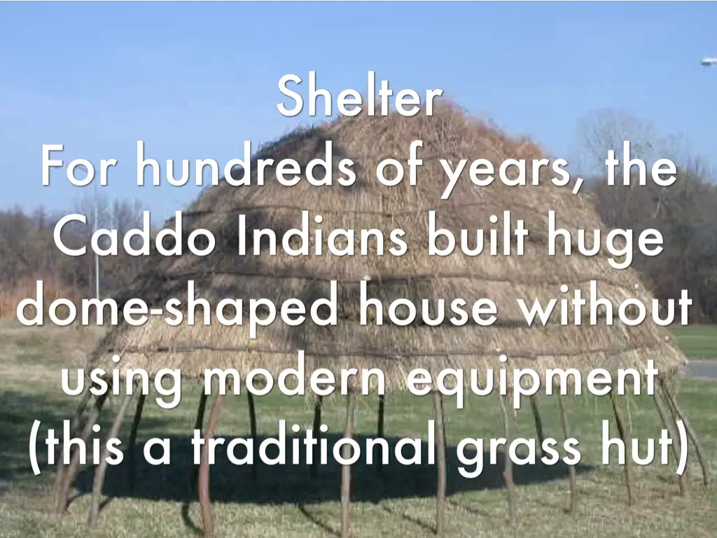
Which of these tribes lived in bee-hive/dome shaped grass huts of East Texas?
Caddos
Coahuiltecans
Jumanos
Comanches
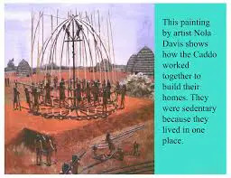
Which of these tribes is not nomadic?
Caddos
Coahuiltecans
Karankawas
Comanches
What is the name of the cone-shaped shelter used by nomadic tribes?
Wigwam
adobe
teepee
long house
Which of these tribes were fierce warriors and feared by other tribes?
Caddos
Coahuiltecans
Karankawas
Comanches
Why did some American Indians depend on buffalo for food while others relied on fish?
Buffalo were plentiful in all areas of Texas.
Not all rivers had fish in them.
Tribes were not willing to trade goods.
The geography of an area determined what they ate.
Why was the buffalo important to the American Indian people?
The Spanish explorers were afraid of them.
Buffalo stampedes cleared the land for farming.
Herds provided protection from neighboring tribes.
Food, shelter, and tools were provided by the buffalo.
Farming was important to the development of American Indian cultures because it allowed people to —
fight better
build long houses
have a dependable food source
develop flint tipped spears
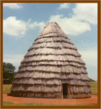
Unlike movable teepees, the American Indians using the type of shelter shown in the photograph were most likely —
Nomadic
sedentary
horse traders
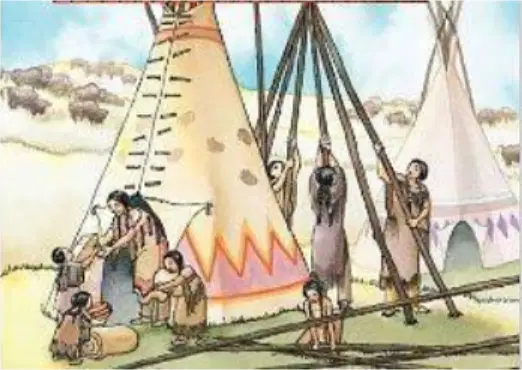
The American Indian found it necessary to build this type of shelter shown in the illustration because they were most likely —
Nomadic
Sedentary
Vegetarian
religious
What is the state motto?
love
peace
friendship
freedom
What are we promising to do when we state the Texas pledge?
A) To memorize the state bird and state tree.
B) To be loyal to and honor the Texas flag and the State of Texas.
C) To promise to only visit Texas every summer.
D) To always buy things that are made in Texas.
a
b
c
d
On the Texas state flag, each of the three colors represent something different. What does the red stand for and give an example of what it means?
A) Courage and Bravery. (Example: The brave people who fought for Texas's freedom.)
B) Purity and Peace. (Example: The peaceful intentions of the state toward other nations.)
C) Loyalty and Respect. (Example: How Texans respect the laws of the United States.)
D) Farming and Oil. (Example: The important resources that help Texas make money.)
a
b
c
d
Which region has the MOST rainfall?
Coastal plains
Mtn. & Basins
Central plains
Great Plains

