
 Worksheets
Revisão Prova Paulista 3 Bimestre
Total questions: 8
Worksheet time: 4mins

Observe the map. Indicate a characteristic of the predominant climate in most of Europe:
The semi-arid climate occurs in small regions and makes agricultural development difficult.
The Mediterranean climate predominates in southern Europe, with hot, dry summers and mild winters.
The polar climate occurs in very cold regions of northern Europe, making vegetation and population presence difficult.
The temperate climate presents mild temperatures and good conditions for agriculture and human occupation.

Observe the image. Which statement is correct about the mountain range shown?
The Himalaya mountain range, located in Asia, is home to Mount Everest, the highest point on the planet.
The highest point in Asia is located in a desert and low region, like the Gobi Desert.
The Asian continent has mountain ranges in its central part, without exceeding 7 thousand meters in altitude.
Most of the Asian relief is formed by plains and depressions, with few high mountainous areas.

Based on the use of land and the location of industrialized areas in Europe, where are the most economically developed regions concentrated?
Arid areas, with low population and difficult access to natural resources.
Mountainous regions of the south, where the terrain makes urban and industrial expansion difficult.
Coastal regions of the Scandinavian Peninsula, with limited agricultural activities.
Central plains, with easy access to navigable rivers, consolidated cities, and advanced economic infrastructure.
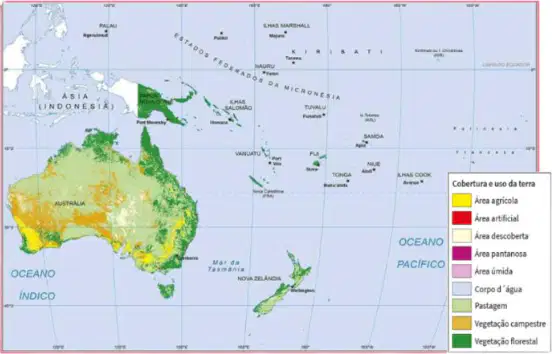
Observe the map. What is the type of land use most present in Oceania?
Forest cover is the most present type of land use in Oceania.
Pacific islands mainly have areas for agriculture.
Most of Oceania is occupied by urban and artificial areas.
Vast pastures highlight the importance of livestock for Oceania's economy.
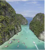
Considering the information in the text and the relationship between tourism and land use in Asia, what is one impact caused by human activities?
Complete preservation of natural coastal areas.
Water pollution due to irregular waste disposal.
Controlled and sustainable expansion of tourist areas.
Total environmental recovery in degraded urban areas.
What is the main reason for land use in the Middle East according to the text?
The land is mainly used to extract oil.
Oil is rarely explored because of protected areas.
The land is covered by forests, making oil extraction difficult.
The land is mainly used for agriculture, despite the lack of water.
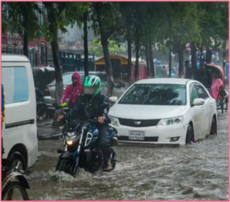
What impact do monsoons have on urban areas in South Asia?
Monsoons guarantee climate stability throughout the year.
Monsoons cause frequent floods, making urban life difficult.
Monsoons reduce the amount of rain, benefiting agriculture.
Monsoons eliminate the need for investments in city infrastructure.
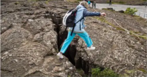
Observe the image. Which natural process is responsible for the formation of the geological fault shown in the image?
Erosion caused by rivers, in dry climate areas.
Freezing of underground water, typical of polar regions.
Meeting of tectonic plates, forming mountain ranges.
Separation of tectonic plates, allowing the formation of fissures and volcanic activity.

