
 Worksheets
Map Skills Unit Test # 2
Total questions: 23
Worksheet time: 12mins
Name
Class
Date
1.
1. If you want to find the DIRECTION from Franklin Square in New York to Disney World in Florida, you would use a...
a)
longitude
b)
scale
c)
compass rose
d)
latitude
2.
2. Peninsulas, mountains, and valleys are examples of...
a)
continents
b)
water forms
c)
physical features
d)
products
3.
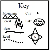
3. Another word for a map key is...
a)
legend
b)
symbol
c)
scale
d)
cardinal directions
4.
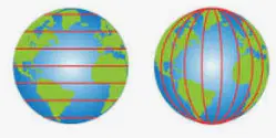
4. What helps you identify a location on a map?
a)
mathematics
b)
border
c)
longitude and latitude
d)
land form
5.
5. Name the continent on which you live.
a)
North America
b)
Asia
c)
South America
d)
Europe
6.
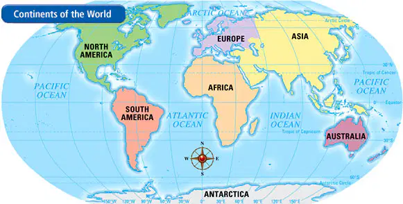
6. What ocean borders the east coast of North America?
a)
Pacific Ocean
b)
Arctic Ocean
c)
Indian Ocean
d)
Atlantic Ocean
7.
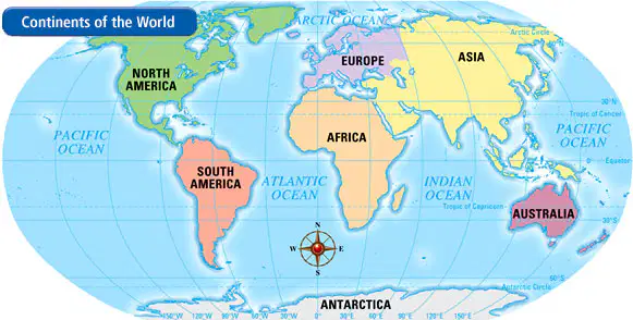
7. What continent is just south of Europe?
a)
South America
b)
Asia
c)
Australia
d)
Africa
8.
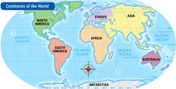
8. What continent is northeast of Africa?
a)
North America
b)
Antarctica
c)
Asia
d)
Europe
9.
9. What is a hemisphere?
a)
half of the school
b)
half of the earth
c)
a globe
d)
a map
10.
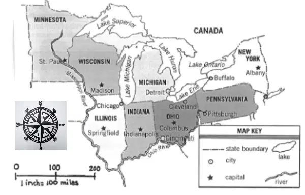
10. Which direction would you travel to go from Illinois to Wisconsin?
a)
North
b)
South
c)
East
d)
West
11.
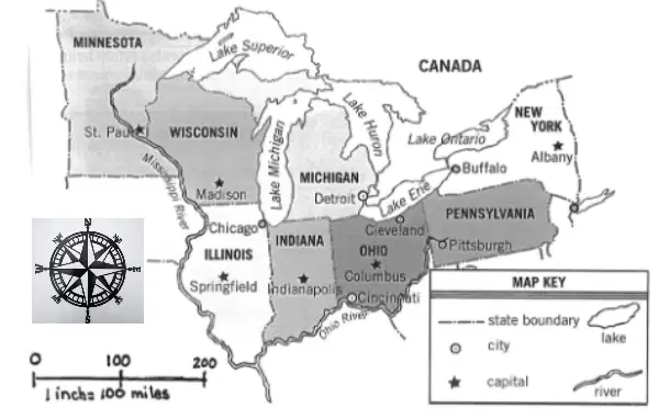
11. What natural boundary separates Wisconsin from Michigan?
a)
Lake Superior
b)
Lake Michigan
c)
Lake Huron
d)
Lake Erie
12.
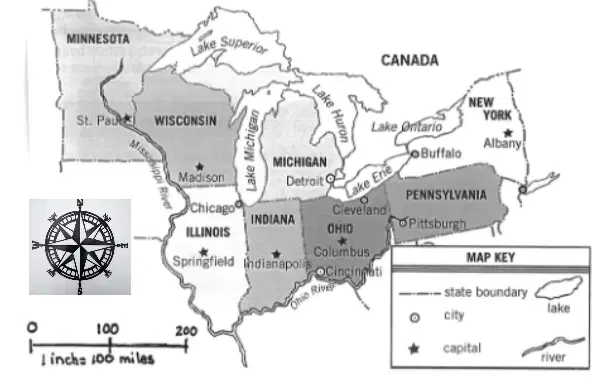
12. What is the capital of New York State?
a)
Buffalo
b)
Pittsburgh
c)
Albany
d)
Columbus
13.
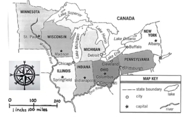
13. On what river is Cincinnati located?
a)
Mississippi River
b)
Snake River
c)
Amazon River
d)
Ohio River
14.
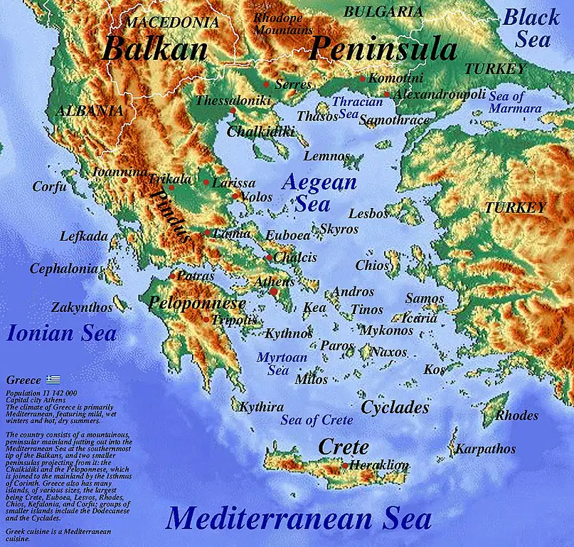
14. What type of map is used to identify landforms and bodies of water?
a)
physical map
b)
political map
c)
road map
d)
product map
15.
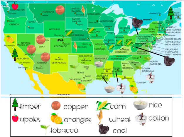
15. What type of map is used to identify items that are grown, mined or raised?
a)
political map
b)
product map
c)
physical map
d)
road map
16.
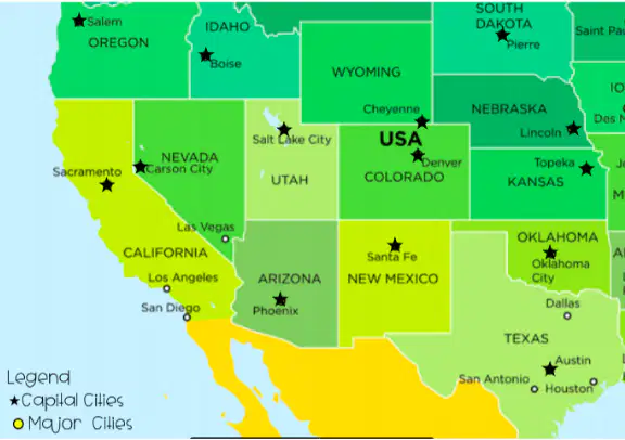
16. Which type of map is used to identify countries, states and cities.
a)
climate map
b)
product map
c)
road map
d)
political map
17.
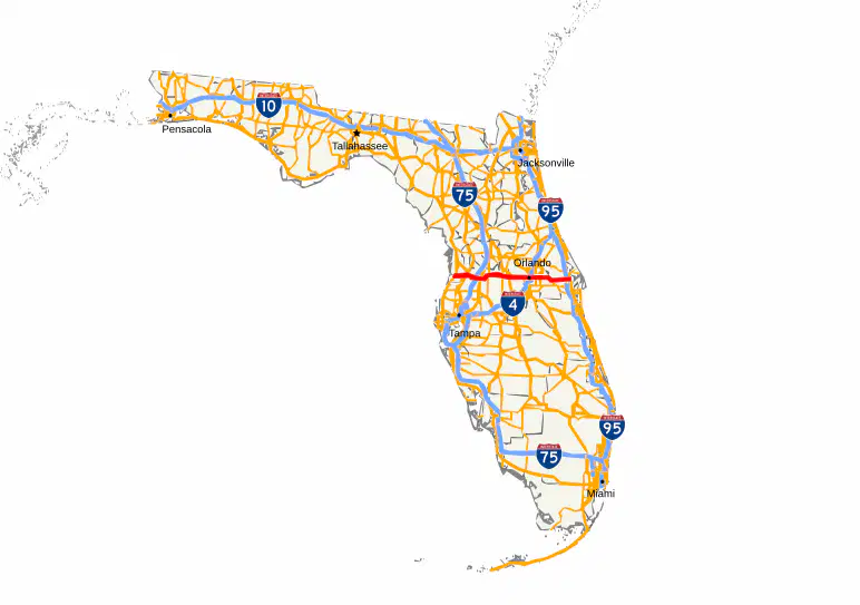
17. Roger lives in New York. His family needs to travel to Florida by car. Which map would get him there?
a)
physical map
b)
product map
c)
political map
d)
road map
18.
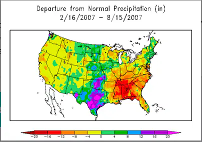
18. Which type of map would you use to find the average temperature of an area?
a)
physical map
b)
road map
c)
climate map
d)
political map
19.
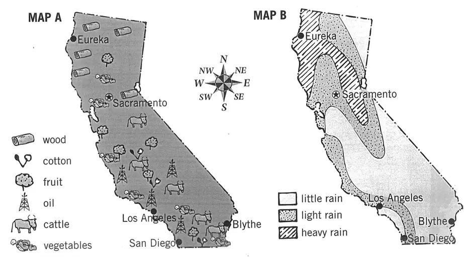
19. What product is found in Northern California?
a)
cotton
b)
fruit
c)
wood
d)
cattle
20.
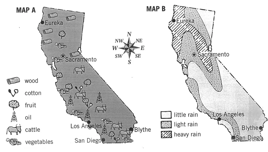
20. What city has HEAVY rain?
a)
Los Angeles
b)
Blythe
c)
San Diego
d)
Eureka
21.
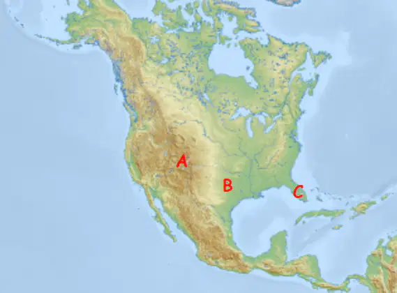
21. If you were a skier, snowboarder or mountain biker, which place would you most likely visit?
a)
A
b)
B
c)
C
22.
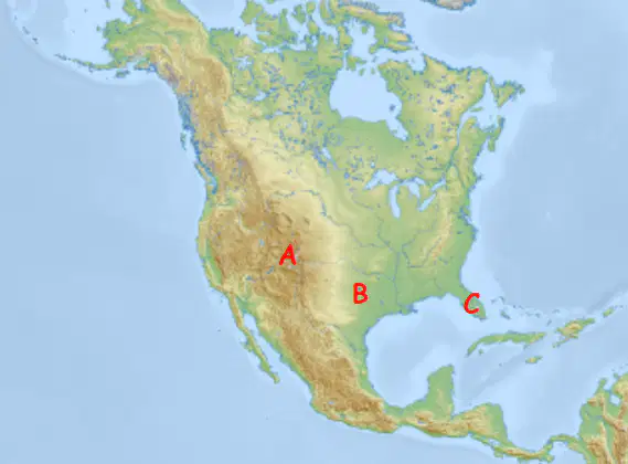
22. If you were a farmer, where would you be most likely to settle?
a)
A
b)
B
c)
C
23.
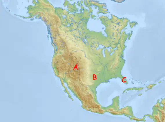
23. If you owned a sailboat, where would you be likely to live?
a)
A
b)
B
c)
C
100 %

