
NEW
Font size
 Worksheets
South American Maps
Total questions: 20
Worksheet time: 10mins
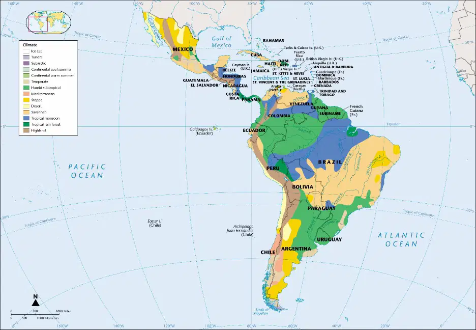
Based on the map provided, which climate type is most prevalent in the Amazon region of South America?
Tropical rainforest
Desert
Tundra
Mediterranean

Which country in South America has a significant area covered by desert climate, as shown in the map?
Brazil
Chile
Argentina
Colombia
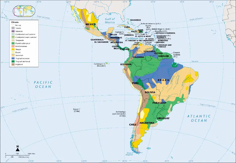
What type of climate is found in the northern part of Mexico according to the map?
Tropical monsoon
Desert
Humid subtropical
Tundra
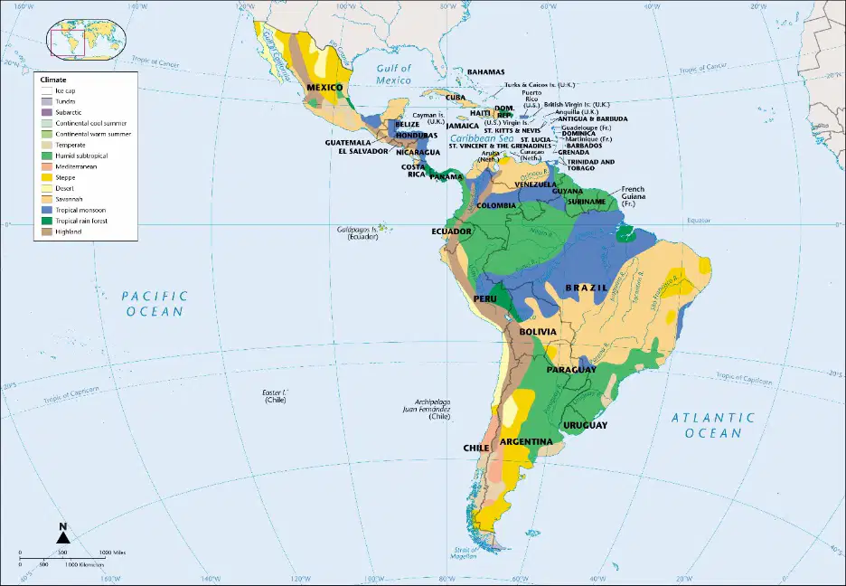
Which ocean borders the western side of Latin America as shown in the map?
Atlantic Ocean
Indian Ocean
Pacific Ocean
Arctic Ocean
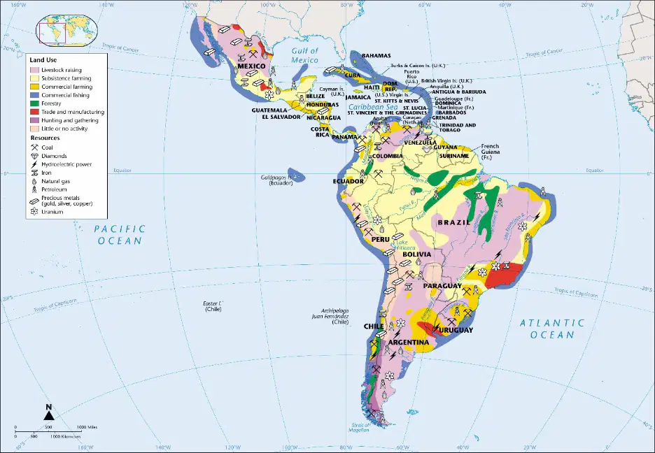
Which country in Latin America is known for its significant uranium resources according to the map?
Brazil
Argentina
Mexico
Chile
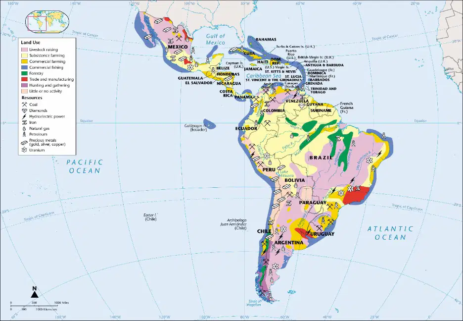
What type of land use is most commonly found in the Amazon rainforest region of South America?
Livestock raising
Subsistence farming
Forestry
Commercial farming
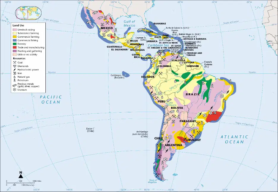
Which resource is prominently found in Venezuela according to the map?
Coal
Petroleum
Uranium
Precious metals

What country is does NOT have an African Ethnolinguistic Groups?
Uruguay
Brazil
Guyana
Suriname
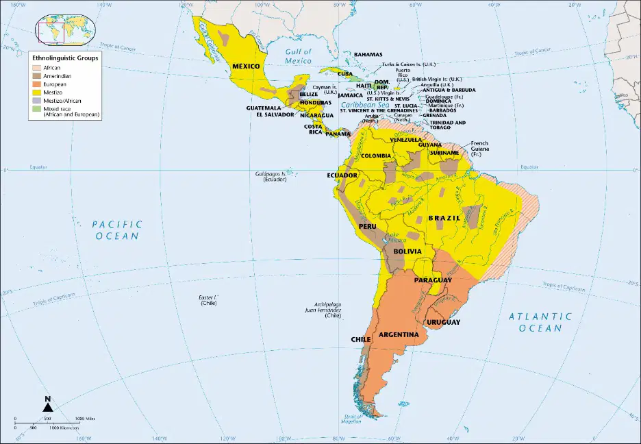
Which ethnolinguistic group is represented by the yellow color on the map?
Mestizo
African
Amerindian
European
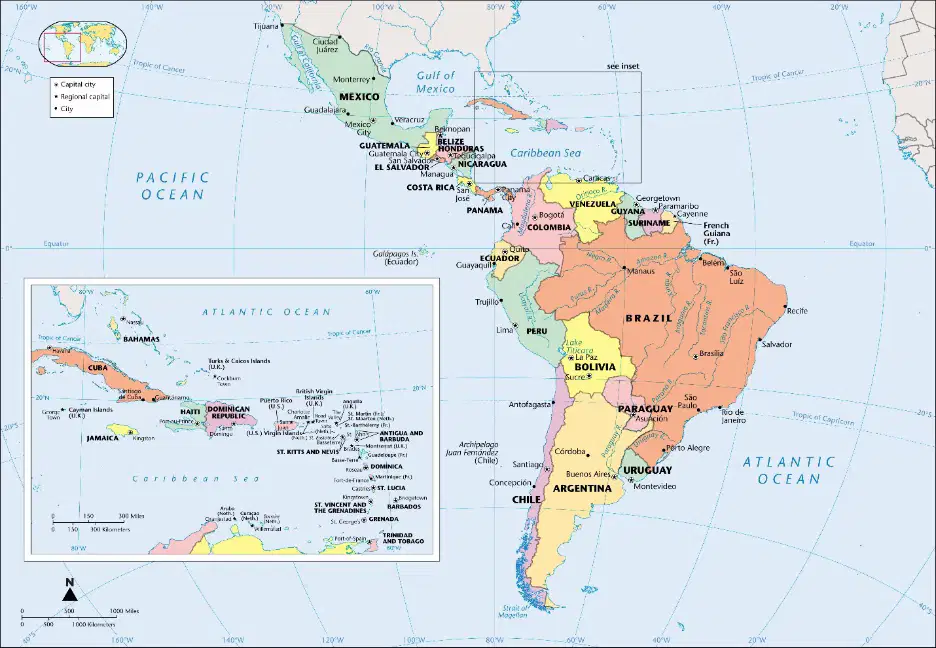
Which ocean is located to the west of Latin America?
Atlantic Ocean
Pacific Ocean
Indian Ocean
Arctic Ocean
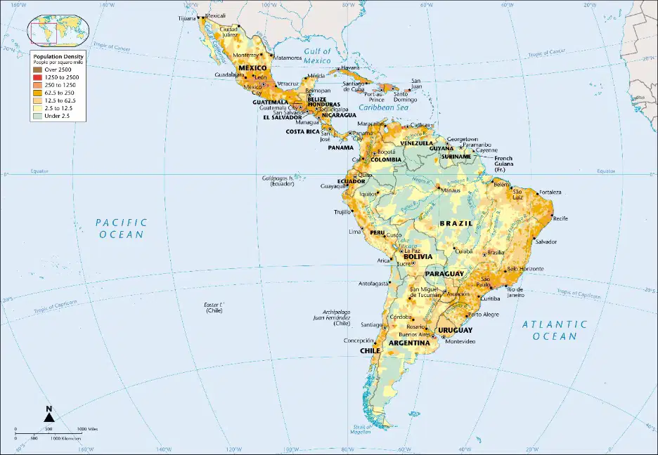
Which region on the map has the highest population density, as indicated by the color coding?
Areas marked in yellow
Areas marked in orange
Areas marked in red
Areas marked in light blue
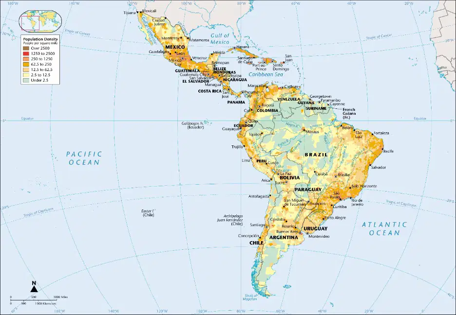
Which ocean is located to the west of Latin America, as shown on the map?
Atlantic Ocean
Indian Ocean
Pacific Ocean
Arctic Ocean
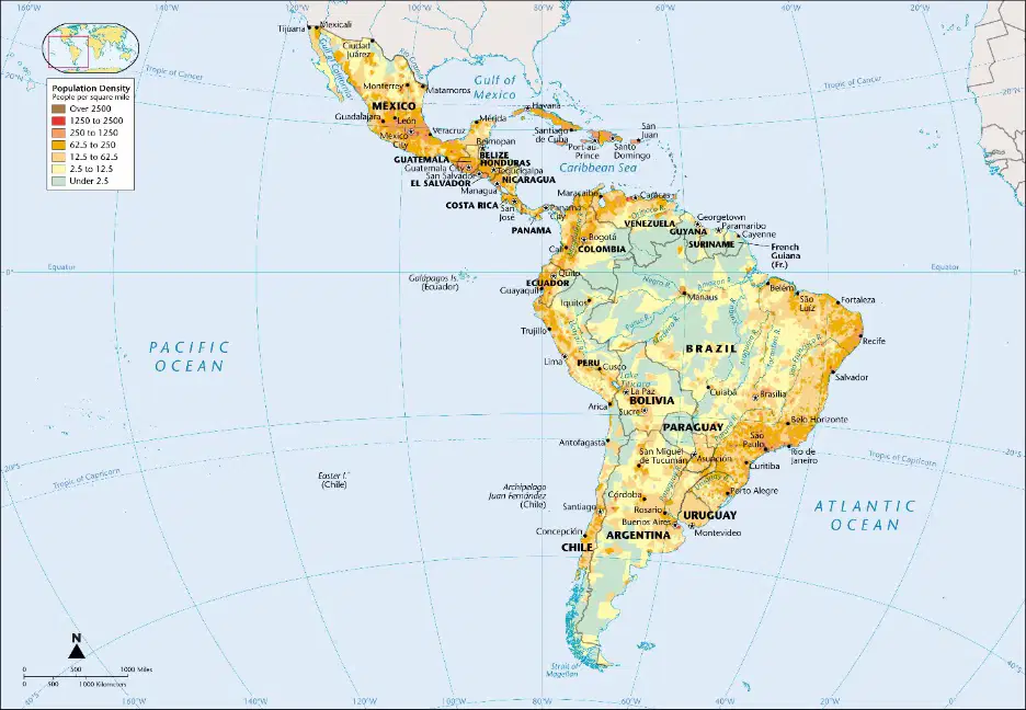
What is the significance of the small inset map in the top left corner of the image?
It shows the climate zones of the region
It provides a global context for the location of Latin America and the Caribbean
It highlights the political boundaries of the region
It indicates the natural resources of the region
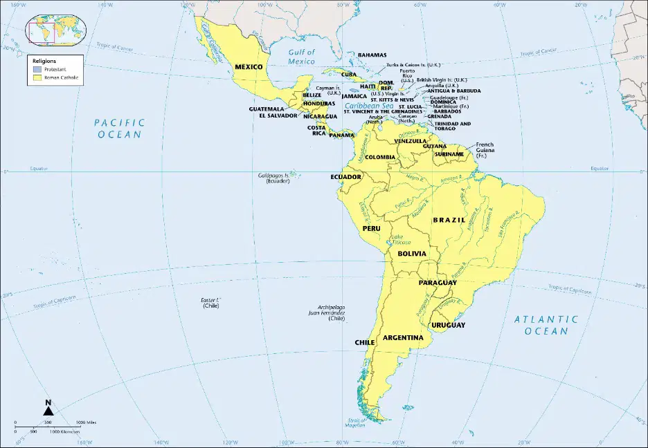
What is the predominant religion in most of South America as shown in the map?
Protestant
Roman Catholic
Hinduism
Islam
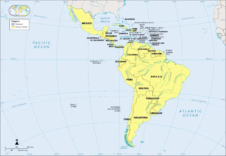
Which ocean is located to the west of South America as depicted in the map?
Atlantic Ocean
Indian Ocean
Pacific Ocean
Arctic Ocean
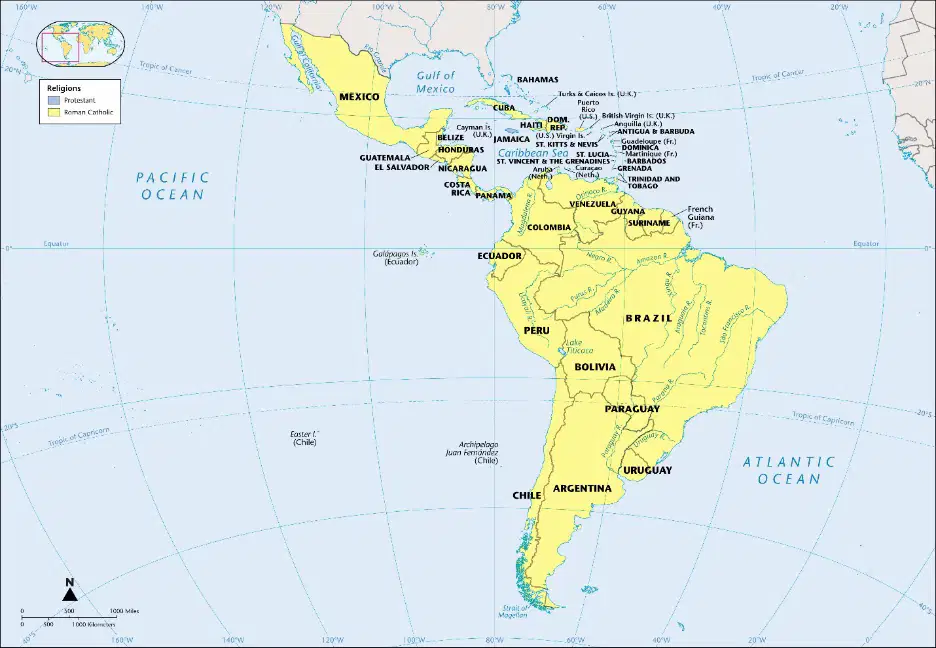
Which country in South America is the largest in terms of area as shown in the map?
Argentina
Brazil
Peru
Colombia

What type of vegetation is most commonly found in the Amazon region of South America?
Desert vegetation
Rainforest vegetation
Grassland vegetation
Tundra vegetation
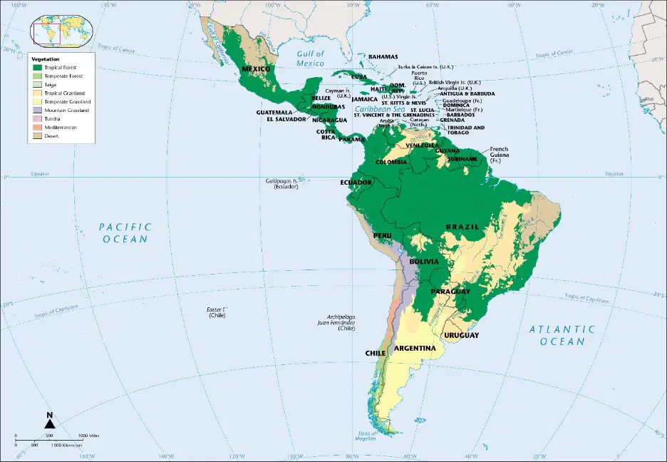
What type of vegetation is represented by the light green color on the map?
Rainforest
Grassland
Desert
Tundra

This Argentinian region has an elevation of 2000 feet (610m)
Amazon Basin
Andes Mountains
Patagonia
Pampas

What is the elevation of the Paraguay river in Paraguay?
500 feet
1000 feet
5000 feet
0 feet

