wayground logo

Free Printable Worksheets

Font size

S
M
L
XL
Worksheets

Physical Geography of Latin America

Total questions: 20

Worksheet time: 13mins
Name
Class
Date
1.
All of the following are regions of Latin America EXCEPT
a)
the United States and Canada
b)
Mexico and Central America
c)
the Caribbean
d)
South America
2.
7. The long mountain chain along the west coast of South America is the
a)
Rockies
b)
Sierra Nevada
c)
Andes
d)
Sierra Madre
3.
8. The Lesser Antilles are formed from
a)
tops of underwater mountains
b)
coral
c)
a long isthmus
d)
high, flat plateaus
4.
9. The Amazon River Basin is home to
a)
the rolling highlands called pampas
b)
South America’s gauchos
c)
the largest tropical rainforest in the world
d)
the world’s biggest volcano
5.
10. One statement about climate in Latin America is that it is
a)
always hot and rainy
b)
usually cold and frosty
c)
very much the same everywhere
d)
different from place to place
6.
11. Factors that affect climate in Latin America include
a)
earthquakes, hurricanes, and volcanoes
b)
elevation, the Equator, and wind patterns
c)
vegetation, elevation, and earthquakes
d)
El Niño, hurricanes, and volcanoes
7.
12. Many Latin American countries have tried to reduce reliance on one crop by
a)
increasing exports
b)
reducing imports
c)
depending more on oil
d)
diversifying their economies
8.
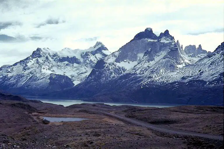
1. What geographic feature is shown in the picture, and what is one specific example of this feature in Latin America? 2. How does this feature affect people’s daily lives?
4 lines
9.
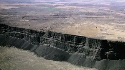
1. What geographic feature is shown in the picture, and what is one specific example of this feature in Latin America? 2. How does this feature affect people’s daily lives?
4 lines
10.
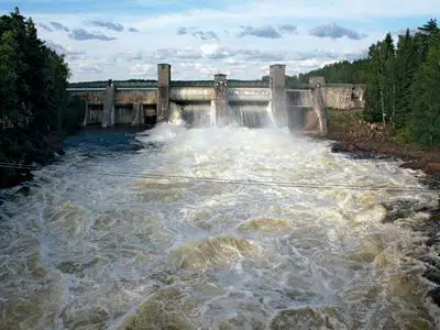
1. What geographic feature is shown in the picture, and what is one specific example of this feature in Latin America? 2. How does this feature affect people’s daily lives?
4 lines
11.

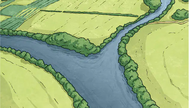
Match the terms to their pictures

a)

1.

isthmus

b)

2.

plateau

c)

3.

hydroelectricity

d)

4.

diversify

e)

5.

tributary

12.

The (a)   in Argentina is similar to the Great Plains in the U.S. The (b)   is the famous cowboy of this region.

Choose from the below words

Pampas

gaucho

Patagonia

ranchero

llanos

13.

How does the higher elevation affect climate?

a)

cooler temperatures

b)

warmer temperatures

c)

temperature stays the same

d)

no temperature change

14.

___ is electricity generated from water.

a)

hydroelectric power

b)

wind power

c)

nuclear power

d)

thermal electricity

15.
What does the Panama Canal help people do?
a)
Travel faster from the Atlantic to the Pacific Ocean
b)
Travel from the Indian Ocean to the Atlantic
c)
Travel faster from the Arctic Ocean to the Indian Ocean
16.

Which country is the world's largest exporter of copper?

a)

Mexico

b)

Jamaica

c)

Colombia

d)

Chile

17.

What are the MAIN reasons the rivers of Latin America important to the people who live there?

CHOOSE THREE

a)

The rivers provide hydroelectric power for the population

b)

The rivers are a good source of trade and transportation routes

c)

The rivers provide naturals borders between nations

d)

The rivers are important fisheries, providing food for the people

18.

What is the desert located in northern Chile that is bordered by the Pacific Ocean to the west and the Andes Mountains to the east?

a)

Atacama Desert

b)

Death Valley Desert

c)

Gobi Desert

d)

Sahara Desert

19.
a)
Amazon River
b)
Rio Grande River
c)
Rio de la Plata
d)
Orinoco River
20.

Which of these boxes best represents Latin America on the world map?