
 Worksheets
Middle East review
Total questions: 20
Worksheet time: 10mins

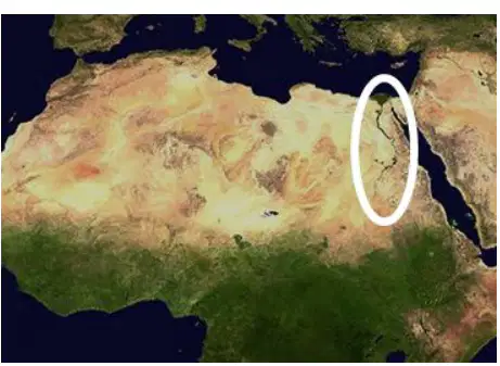
The landform circled on the map is the __________.
Sahara
Sahel
Nile River Valley
Atlas Mountains

On the map, which arrow is pointing to the Mediterranean Sea?
a
b
c
d
The mountains that stretch across northwest Africa are called the __________ Mountains.
Atlas
Sahara
Sahel
Nile River Valley
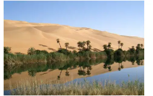
The photo above shows a small, fertile area in a desert with water supplied by an underground spring. These areas are called __________.
oasis
reservoir
delta
savannah
Extreme temperatures that are typical of the Sahara desert can best be described as __________.
Much colder than average
Slightly cooler than average
Slightly warmer than average
Much hotter than average
What is the world’s longest river?
Nile
Niger
Mississippi
Yukon
What is the world’s largest desert?
What is home to 99% of Egypt's population?
The Nile River Valley
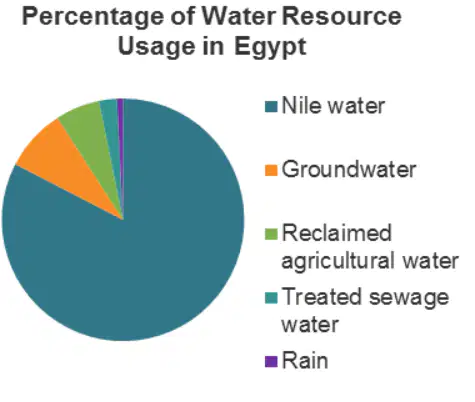
According to the pie chart, where does most of the water consumed by Egyptians come from?
Nile River (Nile water)
Ground water
Rain
Treated Sewer Water
Rare storms in North Africa cause...
significant weather changes, including damaging rainfall and erosion

