
Font size
 Worksheets
Week 2 exit ticket-grade 8
Total questions: 10
Worksheet time: 5mins
What does the acronym SONAR stand for?
Sound Navigation And Ranging
Submarine Observation And Radar
Signal Orientation And Reflection
Sea Navigation And Radio
What does GPS stand for?
Global Positioning System
General Positioning Service
Geographic Placement System
Guided Pathing System
Why do smartphones and cars have GPS systems?
To determine precise location and provide navigation directions
To store photos and videos
To increase battery capacity
To play music without internet

The surface of Earth is made up of rigid plates that move relative to each other. What are these plates called?
Seismic plates
Hydrospheric plates
Lithospheric plates (tectonic plates)
Atmospheric plates
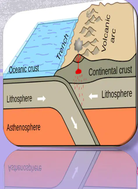
Below Earth’s crust is the mantle. What term is used for the very hot but solid part of the mantle described in the slide?
Lithosphere
Asthenosphere
Hydrosphere
Thermosphere
In Greek, the term asthenes means which of the following?
weak
strong
dense
hot
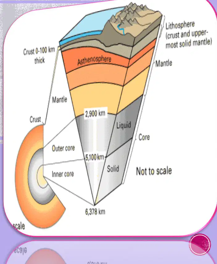
Where is the asthenosphere located within Earth?
below the lithosphere
above the outer core
inside the crust only
outside the mantle
Which are the two main sources of heat in Earth’s deep interior?
heat retained from Earth’s formation and accretion
heat from the decay of radioactive elements
friction from tectonic plates rubbing at the surface
sunlight absorbed by the crust

What is the inner core primarily like in terms of material and state?
a cold, liquid ball of nickel
a hot, dense ball of mostly iron that is not liquid or molten
a gaseous sphere of iron and sulfur
a brittle shell of solid rock
How are seismic waves used to determine the Earth’s interior?
By analyzing their travel times, speeds, and paths to infer layer properties and composition
By directly drilling into all layers to collect samples
By observing surface volcano colors to map interior materials
By using satellites to photograph the inside of Earth

