
 Worksheets
Coasts, Rivers and Flooding
Total questions: 60
Worksheet time: 43mins

Which of the following is not a factor influencing climate?
A. Altitude
B. Latitude
C. Longitude
D. Ocean Current

Why large bodies of water affect climate?
A. Water heats up and cools more slowly than land.
B. Water heats up and cools faster than land.
C. Water and land cool at the same time
D. Water and land heat at the same rate

What happens to the temperature of air when altitude increases?
A. Decreases
B. Increases
C. Remains the same
D. Varies
Because the Earth is tilted on its axis,
ocean currents move in predictable patterns.
the seasons occur at the same time in all parts of the world.
different places on the Earth receive different amounts of sunlight.
it is never dark at the North and South Poles.
Rainfall is caused by
water vapour rising
Water vapor cooling down and condensing
Condensed water vapour falling back to the earth
evaporation
There are _______ types of rainfall.
2
3
4
5
Which type of rain occurs when two air masses meet?
Convectional
Relief
Frontal
Relief rainfall occurs when air moves towards a mountain and is forced to do what?
Rise over it
Go through it
Go under it

Which type of rainfall is seen in the image?
precipitation
relief
frontal
convectional
What is the meaning of coast?
Where the sea meets the ocean
Where the land meets the land
Where the land meets the sea
Where the sea meets the air
Which of the following are the processes of erosion?
Abrasion
Longshore drift
attrition
Hydraulic action
Hard engineering
Man-made structures to protect coast
Works with nature
Groynes, sea wall, gabions, rock armour
Beach nourishment, managed retreat, dune regeneration
Soft engineering
Man-made structures to protect coast
Works with nature
Groynes, sea wall, gabions, rock armour
Beach nourishment, managed retreat, dune regeneration
Diagram of longshore drift


Left arrow

Right arrow
Match the following
hills of sand made by wind, usually near beaches
sand dunes
high, steep rock faces formed by the sea eroding the land
cliffs
long, narrow, low landform extending into a body of water
spit
once a cave, a rock formation that arches over water
arch
rocky coastal landform that juts out into the sea
headland
Which of these coastal features are created by erosion and which by deposition?
cliffs
river delta
headland
arch
stack
stump
cave
beach
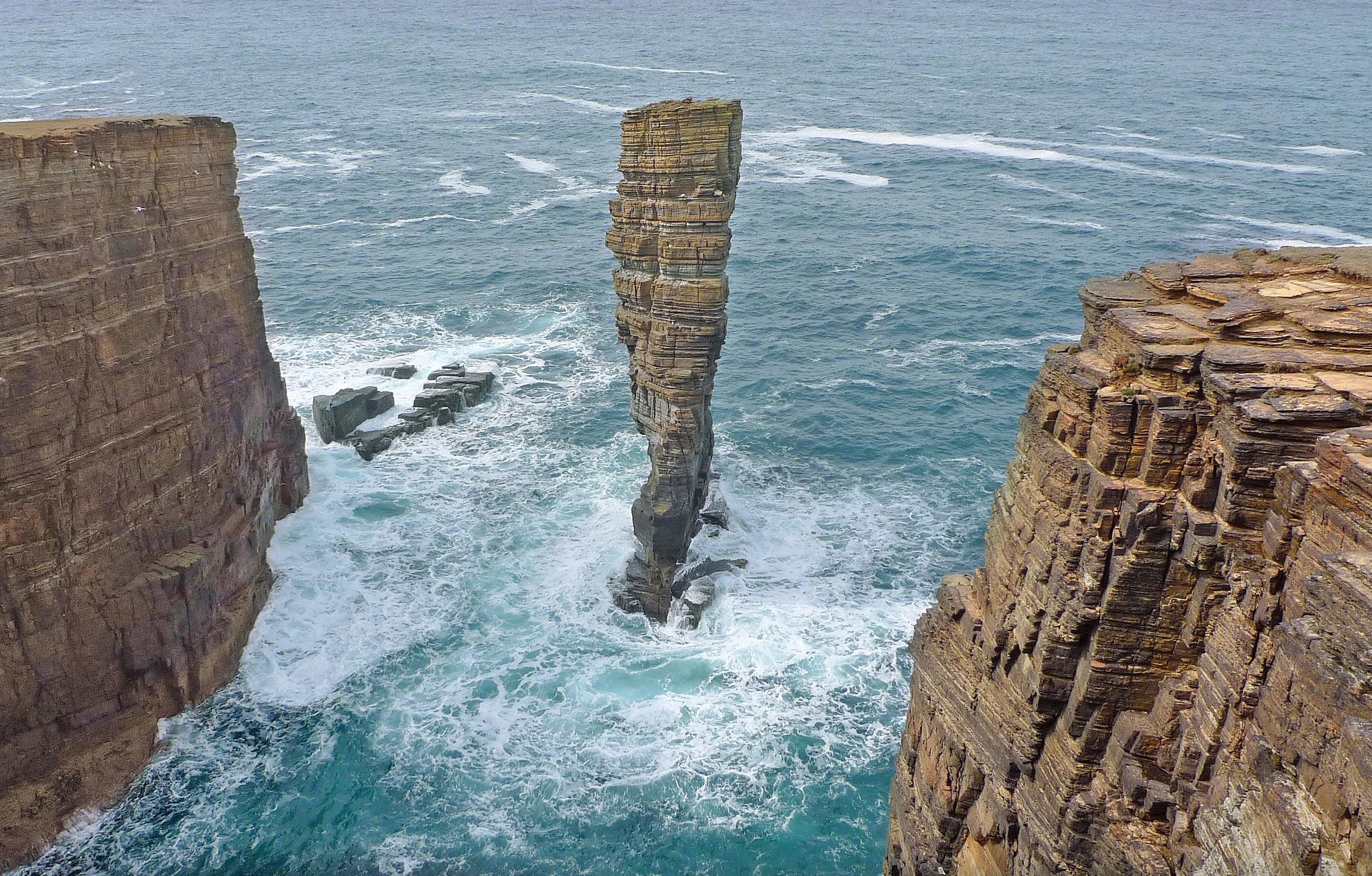
Identify the landform type.
Sea Stack
Sea Stump
Arch
Bay
True of False: Deposition occurs when the flow of water loses it's energy.
True
False

Is this a spit, bar or tombolo?
Spit
Bar
Tombolo

Is this a spit, bar or tombolo?
Spit
Bar
Tombolo

Is this a spit, bar or tombolo?
Spit
Bar
Tombolo

Identify the Coastal Management Strategy
Offshore Breakwater
Sea Wall
Groyne
Rock Armour

Identify the coastal management strategy
Revetment
Groynes
Beach Nourishment
Dune stablisation

Identify the coastal management strategy
Offshore Reefs
Dune Stabilisation
Rock Armour
Sea Wall

Planting vegetation is central to this form of coastal management strategy. What is it?
Revetment
Cliff Drainage
Rip Rap
Dune stablisation

How do groynes work to protect the coastline?
They trap sediment by slowing down longshore drift, thereby building up a wide beach
They absorb wave energy so that the cliffs behind are protected
They act as a hard rock barrier at foot of cliff to provide a buffer again the sea
They allow rapid longshore drift along the coastline

What landform can you see in the picture?
U shaped valley
V Shaped Valley
Floodplain
Waterfall

Which landform can be seen in the photo?
Waterfall
Estuary
Inter-locking Spur
Meander

What landform can you see in this picture?
Waterfall
V Shaped Valley
Meander
Ox-bow lake
What is the deep water called beneath a waterfall?
Plunge bath
Mermaids retreat
Plunge pool
Pool

What landform can you see in the picture?
Meanders
Rapids
Estuary
V shaped valleys

What landform can you see in the middle of the picture?
Estuary
Meander
Levee
Ox-bow Lake

What is the land next to the river called and how would you describe it?
Floodplain, steep land next to the river.
Floodplain, flat land next to the river.
Floodplain, flat land away from the river.
Floodplain, flat land on top of the river.
What is the name given to material deposited in a flood plain?
Aluminium
Boulders
Alluvium
Gorge
When a delta forms, the river breaks up into a number of smaller rivers called ......................
Distributaries
Confluences
Tributaries
Waterfalls

Waterfalls and rapids are found in which course of the river?
Upper course
Lower course
Middle course
All parts/courses


At which point does the greatest stream erosion occur?
A
B
C
D
What can form if a meander "pinches off" from the main channel?
Oxbow Lake
Tributary
Point bar
Cut bank
Traction refers to the way in which material in the river's load are bounced along the riverbed
True
False
Which Process involves small pebbles and stones being bounced along the river bed?
Solution
Traction
Saltation
none of the above
What is the primary purpose of the Yangtze River for China?
It is a major transportation route.
It is used for fishing.
It is a source of drinking water.
It is a tourist attraction.
When was the Three Gorges Dam project finally begun?
1919
1992
2000
1985
What is the main reason for building the Three Gorges Dam?
To promote tourism
To control flooding and generate electricity
To improve agriculture
To create a new city
Which of the following is a positive effect of the Aswan Dam?
More jobs
Flood control
Hydroelectricity
All of the above
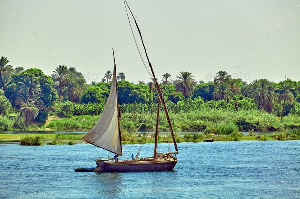
What stopped the annual flooding of the Nile in 1970?
A serious drought
The construction of the Aswan High Dam
A sudden change in climate
An earthquake changed the course of the river
What is the reservior behind the Aswan Dam called?
Lake Houston
Lake Charles
Lake Aswan
Lake Nasser
Which is a danger of the Aswan High Dam?
Overgrazing of farmland
Decreased transportation in the country
Artificial fertilizers are seeping into the drinking water
Extreme flooding is destroying monuments
What two main rivers flow through Bangladesh?
The Ganges and the Brahmaputra
The Nile and the Amazon
The Ganges and the Yellow
The Brahmaputra and the Yangtze
The wet season in Bangladesh is called...
The Monsoon
The Pontoon
The Vancroon
The Soonmon
The source of most rivers in Bangladesh is the...
Himalaya Mountains
Indian Ocean
Rocky Mountains
Pacific Ocean
What do you call the area where water is stored behind a dam?
reservoir
generator
refuge
turbine

A wall across a river that controls the flow of river water
dam
flood
floodway
levee
Which of these is a famous dam in China?
Three Gorges Dam
Four Gorges Dam
Five Gorges Dam

