

Wayground
Fast & Curious: Indian Geography & the Indus Valley Civilization - Printable สังคมศึกษา Worksheets ระดับ 7 - Wayground

Fast & Curious: Indian Geography & the Indus Valley Civilization

Courtenay Whalen

สร้างโดย Courtenay Whalen

20 คำถาม

7th ระดับชั้น

สังคมศึกษา

อัปเดตแล้ว พ.ค. 2568

เร็วและอยากรู้อยากเห็น: ภูมิศาสตร์อินเดียและอารยธรรมลุ่มแม่น้ำสินธุ เป็นแบบฝึกหัดวิชาสังคมศึกษาสำหรับนักเรียนชั้น ม.1 ที่เชื่อมโยงภูมิศาสตร์กายภาพของอินเดียกับการพัฒนาอารยธรรมยุคแรก แบบฝึกหัดประกอบด้วย 20 ข้อ—คำถามแบบเลือกตอบ 19 ข้อ และคำถามแบบเลือกคำตอบ 1 ข้อ—นักเรียนจะได้ระบุว่าอินเดียเป็นอนุทวีป แยกแยะลักษณะภูมิประเทศ เช่น ที่ราบสูงและเทือกเขา ติดตามแม่น้ำและแหล่งน้ำ และอธิบายผลกระทบของมรสุมและเทือกเขาหิมาลัย นอกจากนี้ นักเรียนยังใช้ความรู้เกี่ยวกับอารยธรรมลุ่มแม่น้ำสินธุเพื่อระบุถิ่นฐานยุคแรก เมืองที่วางแผนไว้ การค้ากับเมโสโปเตเมีย ความสำเร็จทางวิศวกรรมด้านระบบประปา และหลักฐานจากโบราณวัตถุ คำถามช่วยเสริมสร้างทักษะการจดจำและการเปรียบเทียบโดยให้นักเรียนเลือกคุณลักษณะทางภูมิศาสตร์ สถานที่ และลักษณะเฉพาะอย่างเจาะจง แทนที่จะตอบคำถามกว้างๆ แบบฝึกหัดที่พิมพ์ได้ฟรีนี้มีเฉลยคำตอบครบถ้วนสำหรับการทบทวน การฝึกฝนด้วยตนเอง หรือการประเมินผลอย่างมีประสิทธิภาพ

การตั้งค่าแผ่นงาน

ขนาดตัวอักษร

S
M
L
XL
Waygroundแผ่นงาน

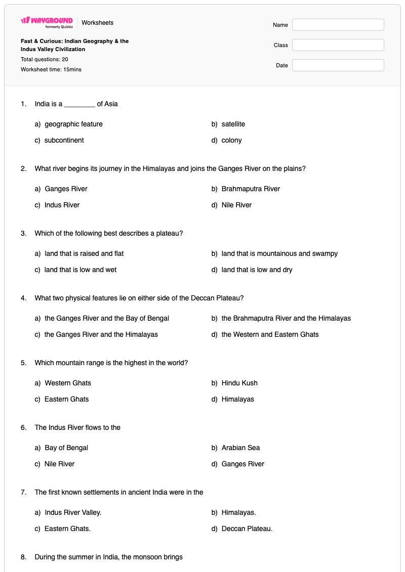
Fast & Curious: Indian Geography & the Indus Valley Civilization

คำถามทั้งหมด: 20

ชื่อ
ระดับ
วันที่
1.

India is a ________ of Asia

a)

geographic feature

b)

satellite

c)

subcontinent

d)

colony

2.

What river begins its journey in the Himalayas and joins the Ganges River on the plains?

a)

Ganges River

b)

Brahmaputra River

c)

Indus River

d)

Nile River

3.

Which of the following best describes a plateau?

a)

land that is raised and flat

b)

land that is mountainous and swampy

c)

land that is low and wet

d)

land that is low and dry

4.

What two physical features lie on either side of the Deccan Plateau?

a)

the Ganges River and the Bay of Bengal

b)

the Brahmaputra River and the Himalayas

c)

the Ganges River and the Himalayas

d)

the Western and Eastern Ghats

5.

Which mountain range is the highest in the world?

a)

Western Ghats

b)

Hindu Kush

c)

Eastern Ghats

d)

Himalayas

6.

The Indus River flows to the

a)

Bay of Bengal

b)

Arabian Sea

c)

Nile River

d)

Ganges River

7.

The first known settlements in ancient India were in the

a)

Indus River Valley.

b)

Himalayas.

c)

Eastern Ghats.

d)

Deccan Plateau.

8.

During the summer in India, the monsoon brings

a)

unbearable heat.

b)

pleasant mornings.

c)

heavy rain.

d)

dust storms.

9.

Much of the water in the Indus, Ganges, and Brahmaputra rivers comes from

a)

natural springs in the desert.

b)

melting ice in the mountains.

c)

rain-fed streams in the plateau.

d)

large lakes in the northern plain.

10.

How has the location of the Himalaya Mountains benefited India?

a)

roads for trade routes

b)

consistent water supply

c)

prevention of earthquakes

d)

protection from enemies

11.

Harappa and Mojhenjo-Daro are both examples of

a)

cities

b)

social structure

c)

written language

d)

belief systems

12.

Artifacts of the Indus Valley Civilization have shown no evidence of

a)

government.

b)

an army.

c)

trade.

d)

a belief in the afterlife.

13.

In what area of engineering did the Indus Valley Civilization excel?

a)

agricultural - dams & levees

b)

building - towers & arches

c)

plumbing - waste & water removal

d)

infrastructure - roads & bridges

14.

There is evidence that Indus Valley people traded with ________.

a)

Mesopotamia

b)

Sri Lanka

c)

Myanmar

d)

China

15.

Cities of the Indus Valley Civilization were

a)

unplanned messes

b)

places where only the very wealthy lived

c)

laid out in a grid with straight lines & right angles

d)

eventually conquered by the Mongol Empire

16.

What evidence is there in Mohenjo-daro that the city had a separate middle and lower class?

a)

Written records of every citizen & their status

b)

Differences in size & quality of housing

c)

Burial practices differed depending on a person's wealth

d)

Some children were taught to read and write; others were not

17.

The Indus Valley Civilization was devoted to (two answers here)

a)

craftsmanship

b)

war

c)

trade

d)

territorial expansion

18.

What is a reason we know very little about the Indus Valley Civilization?

a)

Most of their civilization was destroyed by foreign invaders.

b)

They left very few records of their society.

c)

Cities are fortified with 40 foot walls.

d)

We cannot translate their written language.

19.
What evidence suggests that Indus Valley cities were run by a strong central government?
a)

They built massive building projects to honor their kings.

b)

Grain was stored in a central location in well- organized cities.

c)

Archaeologists have found trade items from many different cultures across Asia & Africa.

d)

Rivers shifted due to global climate change.

20.

Which of the following was a likely cause of the decline of the Indus Valley Civilization?

a)

Unemployment & unrest among the lower classes

b)

Climate change and changes in river flow patterns

c)

Civil war made the government unstable

d)

Monsoon season stopped occurring, causing drought

Waygroundแป้นคำตอบ

Fast & Curious: Indian Geography & the Indus Valley Civilization

คำถามทั้งหมด: 20

1.
c)

subcontinent

2.
b)

Brahmaputra River

3.
a)

land that is raised and flat

4.
d)

the Western and Eastern Ghats

5.
d)

Himalayas

6.
b)

Arabian Sea

7.
a)

Indus River Valley.

8.
c)

heavy rain.

9.
b)

melting ice in the mountains.

10.
d)

protection from enemies

11.
a)

cities

12.
b)

an army.

13.
c)

plumbing - waste & water removal

14.
a)

Mesopotamia

15.
c)

laid out in a grid with straight lines & right angles

16.
b)

Differences in size & quality of housing

17.
a)

craftsmanship

, c)

trade

18.
d)

We cannot translate their written language.

19.
b)

Grain was stored in a central location in well- organized cities.

20.
b)

Climate change and changes in river flow patterns

คำถามที่พบบ่อย

แบบฝึกหัดภูมิศาสตร์อินเดียและอารยธรรมลุ่มแม่น้ำสินธุนี้ครอบคลุมเนื้อหาอะไรบ้าง?

แบบฝึกหัดสำหรับนักเรียนชั้น ม.1 นี้ ประกอบด้วยข้อสอบแบบเลือกตอบ 20 ข้อ—แบบเลือกตอบหลายตัวเลือก 19 ข้อ และแบบเลือกตอบหลายข้อ 1 ข้อ—เพื่อประเมินลักษณะภูมิประเทศ แม่น้ำ สภาพภูมิอากาศ และภูมิภาคทางภูมิศาสตร์ของอินเดีย ควบคู่ไปกับลักษณะสำคัญของอารยธรรมลุ่มแม่น้ำสินธุ นักเรียนจะต้องระบุความสัมพันธ์ต่างๆ เช่น เทือกเขาเวสเทิร์นกัตส์และอีสเทิร์นกัตส์ที่อยู่ติดกับที่ราบสูงเดคคาน แม่น้ำสินธุที่ไหลลงสู่ทะเลอาหรับ และเมืองต่างๆ ในลุ่มแม่น้ำสินธุที่จัดวางผังเป็นตาราง พร้อมระบบระบายน้ำและกำจัดของเสียที่พัฒนาแล้ว

ฉันจะใช้แบบฝึกหัดนี้ในการสอนภูมิศาสตร์ของอินเดียและอารยธรรมลุ่มแม่น้ำสินธุได้อย่างไร?

เริ่มทำแบบฝึกหัดโดยแบ่งเป็นสองขั้นตอน: ขั้นแรก ให้นักเรียนทบทวนแผนที่ของอินเดียเพื่อระบุตำแหน่งของเทือกเขาหิมาลัย ที่ราบสูงเดคคาน เทือกเขาเวสเทิร์นและอีสเทิร์นกาตส์ และแม่น้ำสายสำคัญ จากนั้นให้พิจารณาว่าภูมิศาสตร์สนับสนุนการตั้งถิ่นฐานและอารยธรรมอย่างไร ในขณะที่นักเรียนตอบคำถามแบบเลือกตอบ ให้พวกเขาอธิบายเหตุผลประกอบการเลือกโดยใช้แผนที่หรือหลักฐาน เช่น น้ำแข็งบนภูเขาที่ละลายและฝนจากมรสุมส่งผลกระทบต่อแม่น้ำอย่างไร หรือถนนและระบบประปาที่วางแผนไว้เผยให้เห็นอะไรเกี่ยวกับเมืองในลุ่มแม่น้ำสินธุ

ฉันควรสังเกตข้อผิดพลาดอะไรบ้างเมื่อนักเรียนทำแบบฝึกหัดนี้เสร็จ?

นักเรียนอาจสับสนระหว่างแม่น้ำพรหมบุตรกับแม่น้ำคงคา วางแม่น้ำสินธุไว้ในอ่าวเบงกอลแทนที่จะเป็นทะเลอาหรับ หรือเข้าใจผิดว่าเทือกเขาฆัตส์เป็นลักษณะภูมิประเทศที่อยู่ติดกับที่ราบสูงเดคคาน นอกจากนี้ พวกเขาอาจมองข้ามข้อความเชิงลบในคำถามที่ว่าโบราณวัตถุใดไม่แสดงหลักฐานของสิ่งใด หรือสับสนระหว่างวิศวกรรมของอารยธรรมลุ่มแม่น้ำสินธุในด้านระบบประปาและการกำจัดของเสียกับถนน สะพาน หรืออาคาร

ฉันจะมอบหมายและให้คะแนนแบบฝึกหัดภูมิศาสตร์อินเดียนี้อย่างไร?

บน Wayground คุณสามารถกำหนดแบบทดสอบได้ทั้งในรูปแบบไฟล์ PDF ที่พิมพ์ได้ หรือแบบทดสอบดิจิทัล และใช้เฉลยคำตอบฉบับสมบูรณ์เพื่อตรวจสอบคำตอบแบบเลือกตอบ 19 ข้อ และคำตอบแบบเลือกหลายข้ออีก 1 ข้อ การส่งงานในรูปแบบไฟล์ PDF สามารถตรวจได้โดยการสแกนงานของนักเรียนด้วยแอป Wayground for Teachers ในขณะที่ตัวเลือกไฟล์ PDF ยังช่วยสนับสนุนห้องเรียนที่ต้องการลดเวลาการใช้หน้าจออีกด้วย

ฉันจะปรับแบบฝึกหัดภูมิศาสตร์อินเดียและอารยธรรมลุ่มแม่น้ำสินธุนี้ให้เหมาะสมกับนักเรียนของฉันได้อย่างไร?

ในการตั้งค่าขั้นสูงของแบบฝึกหัด ให้ปรับระยะห่างระหว่างตัวอักษรหรือขนาดตัวอักษรเพื่อให้คำศัพท์ทางภูมิศาสตร์ ชื่อแม่น้ำ และตัวเลือกแบบปรนัยอ่านง่ายขึ้น นอกจากนี้ คุณยังสามารถเปิดใช้งานแบบอักษรที่เหมาะสำหรับผู้ที่มีภาวะดิสเล็กเซีย หรือแปลแบบฝึกหัดเป็นภาษาอื่นโดยคงคำศัพท์ที่เกี่ยวข้องกับแผนที่และคำถามเกี่ยวกับอารยธรรมไว้ในรูปแบบเดิมได้

ฉันจะหาแบบฝึกหัดแบบนี้เพิ่มเติมได้ที่ไหนบน Wayground?

Wayground นำเสนอชุดแบบฝึกหัดและโจทย์ฝึกหัดฟรีที่ครอบคลุมหลากหลายวิชา พร้อมไฟล์ PDF และเฉลยคำตอบ เพื่อช่วยให้นักเรียนเชี่ยวชาญทักษะและแนวคิดที่สำคัญ ดูแหล่งข้อมูลเพิ่มเติมได้ที่ https://wayground.com/en-us/worksheets