Search Header Logo
Map Skills

Map Skills

Assessment

Presentation

•

Social Studies

•

1st - 5th Grade

•

Practice Problem

•

Hard

Created by

Renee Domangue

Used 197+ times

FREE Resource

0 Slides • 49 Questions

1

Multiple Choice

A small map or picture of a globe that shows where an area on the main map is found in a state, on a continent, or in the world. 


1

Map Scale

2

Map Legend

3

Inset Map

4

Locator Tool

2

Multiple Choice

Question image
2. What is highlighted with the blue line?
1
The Equator
2
The Prime Meridian

3

Multiple Choice

Question image
3. What is highlighted with the blue line?
1
Latitude 30°S
2
Longitude 30°S

4

Multiple Choice

4. What does the equator separate?
1
The Northern and Southern Hemispheres
2
The Eastern and Western Hemispheres

5

Multiple Choice

5. What is the division of the Earth into two sets of two spheres?
1
The Hemispheres
2
The Prime Meridan

6

Multiple Choice

Question image
6. What is shown with the highlighted blue line?
1
Line of Latitude
2
Line of Longitude

7

Multiple Choice

8. What does the Prime Meridian separate?
1
The Northern and Southern Hemispheres
2
The Eastern and Western Hemispheres

8

Multiple Choice

Question image
7. What is shown with the blue line?
1
Line of Latitude
2
Line of Longitude

9

Multiple Choice

10. What is another name for the equator?
1
0° Latitude
2
0° Longitude

10

Multiple Choice

9. What is another name for the prime meridian?
1
0° Latitude
2
0° Longitude

11

Multiple Choice

provides directions for traveling from one point to another; shows major attractions

1

road map

2

thematic map

3

political map

4

physical map

12

Multiple Choice

measures the distance between two places on the map related to the real world.

1

compass

2

map scale

3

legend

4

key

13

Multiple Choice

shows one or two themes of a location (population, livestock)

1

road map

2

political map

3

physical map

4

thematic map

14

Multiple Choice

shows human-made features of a location (countries, cities & states, significant bodies of water)

1

road map

2

political map

3

physical map

4

thematic map

15

Multiple Choice

shows the location, shape, or elevation of features on Earth's surface

1

road map

2

political map

3

physical map

4

thematic map

16

Multiple Choice

gives information about what colors and symbols on the map mean

1

map key

2

inset map

3

map title

4

map element

17

Multiple Choice

a flat drawing of all parts of Earth's surface

1

map key

2

map

3

map title

4

map element

18

Multiple Choice

parts of a map

1

map key

2

map

3

map title

4

map elements

19

Multiple Choice

also referred to as a Map Key

1

Map Story

2

Map Legend

3

Map Title

20

Multiple Choice

Question image

What element on the map shows directions?

1

scale

2

compass rose

3

title

4

country

21

Multiple Choice

Question image

What is this map element called?

1

title

2

compass rose

3

legend

4

scale

22

Multiple Choice

Question image

The following information is often found on a map in what area?

1

scale

2

key or legend

3

compass rose

4

cardinal directions

23

Multiple Choice

Question image
This is a picture of a
1
map title
2
map key
3
map legend
4
map scale

24

Multiple Choice

Question image
 This type of map shows governmental boundaries of countries, states, and/or counties.  It sometimes includes cities, roads, and significant bodies of water.
1
Physical
2
Political
3
Product
4
Map

25

Multiple Choice

Question image
This type of map shows the boundaries of states and countries.
1
Political Map
2
Physical Map
3
Grid Map
4
Distribution Map

26

Multiple Choice

Question image
What type of map is pictured?
1
Political
2
Physical
3
Thematic

27

Multiple Choice

Question image

On the map the circles, triangles, and squares are all examples of:

1

Legends

2

Keys

3

Roses

4

Symbols

28

Multiple Choice

Question image

The earth can be divided into four halves known as _____.

1

fractions

2

semaphores

3

moieties

4

hemispheres

29

Multiple Choice

Question image

What is the name of the imaginary line that runs from east to west, and separates the Northern and Southern Hemispheres?

1

Equator

2

Prime Meridian

3

Longitude

4

Latitude

30

Multiple Choice

Measures distance from the equator. These lines run east and west and measure north and south.
1
Cardinal Directions
2
Latitude Lines
3
Longitude Lines
4
Intermediate Directions

31

Multiple Choice

What is another name for a map maker?
1
Geographer
2
Biologist
3
Cartographer
4
Graphologist

32

Multiple Choice

A ___ is a model of the Earth.

1

equatoe

2

scale

3

globe

4

symbol

33

Multiple Choice

A spherical map of the Earth is called ______________.

1

map

2

Northern

3

longitude

4

globe

34

Multiple Choice

Map keys show symbols, colors, pictures and lines.

1

True

2

False

35

Multiple Choice

What is a human-made line called on a map?

1

border

2

continent

3

mountain ridge

4

reservoir

36

Multiple Choice

Question image

Which type of map is shown here?

1

thematic

2

political map

3

mental

4

physical map

5

road map

37

Multiple Choice

Question image

Which type of map is shown here?

1

thematic

2

political map

3

mental

4

physical map

5

road map

38

Multiple Choice

Question image

Which type of map is shown here?

1

thematic

2

political map

3

mental

4

physical map

5

road map

39

Multiple Choice

Question image

Which type of map is shown here?

1

thematic

2

political map

3

mental

4

physical map

5

road map

40

Multiple Choice

Prime Meridian

1

Longitude

2

Latitude

41

Multiple Choice

This imaginary line crosses our planet in the middle from east to west.

1

Equator

2

Prime Meridian

42

Multiple Choice

This line separates the Northern and Southern Hemispheres

1

Prime Meridian

2

Equator

43

Multiple Choice

Question image

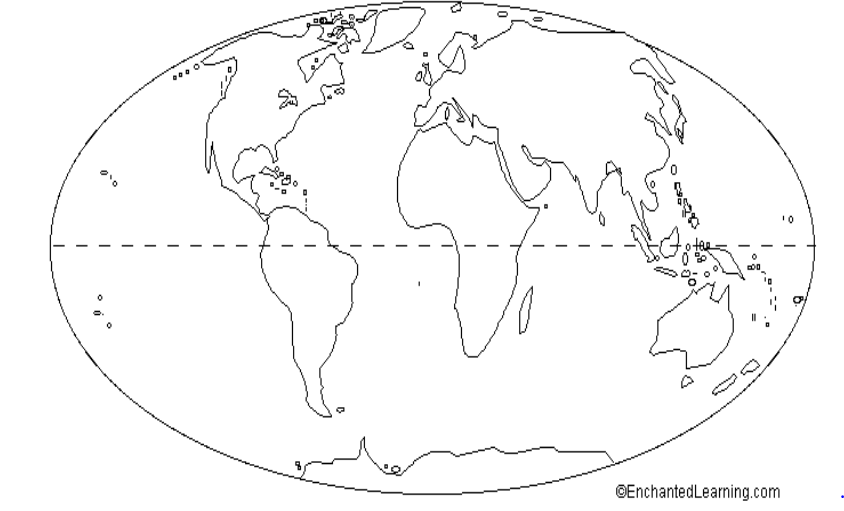
this imaginary line crosses our planet, horizontally through the middle.

1

Equator

2

Compass

3

Prime Meridian

4

44

Multiple Choice

divides map into evenly spaced vertical and horizontal lines; a way used to locate a place on the map.

1

Grid System

2

Compass Rose

3

Inset Map

45

Multiple Choice

Equator

1

Longitude

2

Latitude

46

Multiple Choice

Question image

Name this tool

1

Map Scale

2

Cardinal Directions

3

Compass Rose

4

Locator

47

Multiple Choice

a type of symbol on maps and globes that show cardinal (north, south, east, west) and intermediate directions (northeast,northwest, southeast, southwest)


1

map title

2

key

3

compass rose

48

Multiple Choice

main compass points of north, south, east, west

1

intermediate directions

2

cardinal directions

49

Multiple Choice

compass points of that are halfway between each cardinal direction; northeast,northwest, southeast, southwest


1

intermediate directions

2

cardinal directions

A small map or picture of a globe that shows where an area on the main map is found in a state, on a continent, or in the world. 


1

Map Scale

2

Map Legend

3

Inset Map

4

Locator Tool

Show answer

Auto Play

Slide 1 / 49

MULTIPLE CHOICE