

Us Rivers and Mountains Lesson

Presentation
•
English
•
3rd Grade
•
Practice Problem
•
Hard
Standards-aligned

Felica Morgan
FREE Resource
57 Slides • 0 Questions
1

Rivers and Mountains
of North America
2


Exploring U.S. Rivers and Mountain Ranges
3


A river is a large stream of water flowing through the land into a lake, ocean, or other
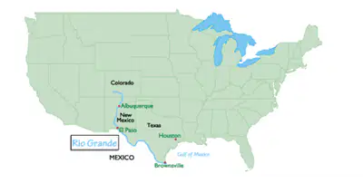
body of water. There are many rivers throughout the United States. Five of these are
considered major rivers: Colorado, Rio Grande, Mississippi, Ohio, and Hudson.
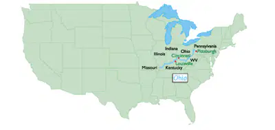
4

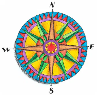
Compass Rose
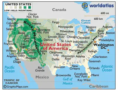
We’ll start our tour
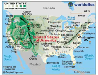
and move across
from west to east.
• Colorado
• Rio Grande
• Mississippi
• Ohio
• Hudson
5

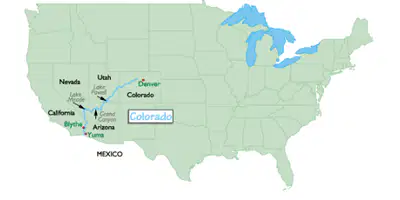
Colorado River
The Colorado River begins on a 14,000 foot high mountain and flows to
the Gulf of California. This river is 1450 miles in length. The Colorado
River flows through seven U.S. states (including, Colorado, Utah,
Arizona, Nevada and California) and is made up of over 50 smaller rivers.
The Colorado River is home to one of the seven natural wonders of the
world, the Grand Canyon. The biggest sport along the Colorado River is
whitewater rafting.
6


Rio Grande
The Rio Grande River begins in Colorado and flows to the Gulf of
Mexico. This river forms the border between the U.S. state of Texas
and Mexico. The Rio Grande is 1,885 miles long. Rio Grande means
“big river” in Spanish. This river is the 5th longest river in North
America.
7

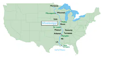
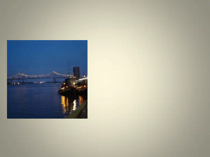
Mississippi River
The Mississippi River lies in the following ten US states: Louisiana, Mississippi,
Arkansas, Tennessee, Kentucky, Missouri, Illinois, Iowa, Wisconsin and Minnesota.
The length of the Mississippi River is approximately 2,320 miles long, and is the 2nd
longest river in the U.S. Water from 31 states and Canada flows into this river. The
Mississippi River is known for flooding. Many flood control systems have been built
along the river.
8

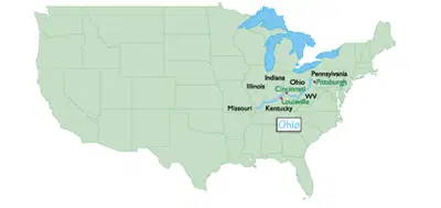
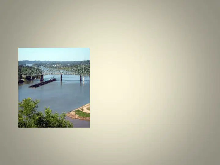
Ohio River
The Ohio River is 981 miles long. This river flows through or borders six states: Illinois,
Indiana, Kentucky, Ohio, Pennsylvania, and West Virginia. The Ohio River begins in
Pennsylvania and flows into the Mississippi River. This river is the source of drinking
water for 3 million people. More than 200 million tons of cargo, such as coal, is shipped
along the Ohio River each year. The Ohio River is also known for flooding.
9

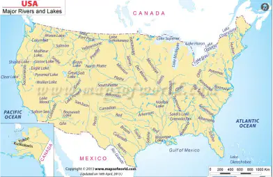
Hudson River
The length of the Hudson is 315 miles. It runs from the Adirondack Mountains
(part of the Appalachian Mountain chain) to Manhattan in New York. It flows
north and south through the state of New York. The Hudson is smaller in size
compared to the other major rivers in America, such as the Mississippi River
and the Ohio River.
10

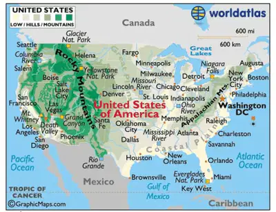
Mountain Ranges
There are two major
mountain ranges in the
United States. These are
the Rocky Mountains and
the Appalachian
Mountains. Let’s look at
each of these mountain
ranges!
11

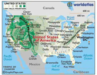
The Rocky Mountains
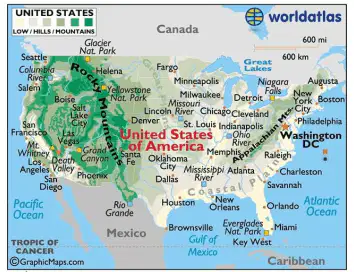
The Rocky Mountains are located along western North America. These mountains
are high and rugged. The Rocky Mountains stretch over 3,000 miles. They start in
Canada and end in New Mexico. Many of the mountains in this range are over
10,000 feet high! Water and melted snow that run off the mountains feed lakes
and rivers that provide water for one-fourth of the United States.
12

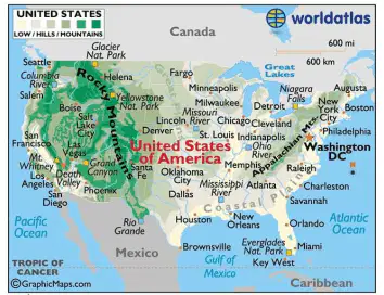
The Appalachian Mountains
The Appalachian Mountains are located on the eastern side of the United
States. They stretch from Canada to Georgia. These mountains are over 500
million years old and are not as high as the Rocky Mountains because of erosion
and weathering. The Appalachian Mountains are filled with trees and plants
rather than rocky cliffs.
13

Let’s See What You Learned!
Can you name the 5 rivers we explored from
west to east?
Colorado
Rio Grande
Mississippi
Ohio
Hudson
14

Let’s See What You Learned!
Can you name the mountain ranges we
explored?
Rocky Mountains
Appalachian Mountains
15

Map Source
All maps are from www.worldatlas.com
16
Map Skills
3rd Grade Geography
17


Exploring U.S. Rivers and Mountain Ranges
18

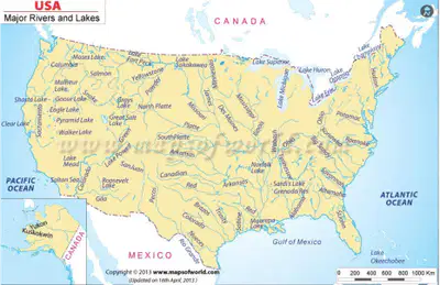
A river is a large stream of water flowing through the land into a lake, ocean, or other
body of water. There are many rivers throughout the United States. Five of these are
considered major rivers: Colorado, Rio Grande, Mississippi, Ohio, and Hudson.
19

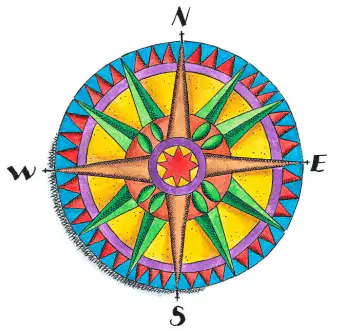
Compass Rose
We’ll start our tour
and move across
from west to east.
• Colorado
• Rio Grande
• Mississippi
• Ohio
• Hudson
20

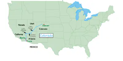
Colorado River
The Colorado River begins on a 14,000 foot high mountain and flows to
the Gulf of California. This river is 1450 miles in length. The Colorado
River flows through seven U.S. states (including, Colorado, Utah,
Arizona, Nevada and California) and is made up of over 50 smaller rivers.
The Colorado River is home to one of the seven natural wonders of the
world, the Grand Canyon. The biggest sport along the Colorado River is
whitewater rafting.
21

Rio Grande
The Rio Grande River begins in Colorado and flows to the Gulf of
Mexico. This river forms the border between the U.S. state of Texas
and Mexico. The Rio Grande is 1,885 miles long. Rio Grande means
“big river” in Spanish. This river is the 5th longest river in North
America.
22


Mississippi River
The Mississippi River lies in the following ten US states: Louisiana, Mississippi,
Arkansas, Tennessee, Kentucky, Missouri, Illinois, Iowa, Wisconsin and Minnesota.
The length of the Mississippi River is approximately 2,320 miles long, and is the 2nd
longest river in the U.S. Water from 31 states and Canada flows into this river. The
Mississippi River is known for flooding. Many flood control systems have been built
along the river.
23

Ohio River
The Ohio River is 981 miles long. This river flows through or borders six states: Illinois,
Indiana, Kentucky, Ohio, Pennsylvania, and West Virginia. The Ohio River begins in
Pennsylvania and flows into the Mississippi River. This river is the source of drinking
water for 3 million people. More than 200 million tons of cargo, such as coal, is shipped
along the Ohio River each year. The Ohio River is also known for flooding.
24


Hudson River
The length of the Hudson is 315 miles. It runs from the Adirondack Mountains
(part of the Appalachian Mountain chain) to Manhattan in New York. It flows
north and south through the state of New York. The Hudson is smaller in size
compared to the other major rivers in America, such as the Mississippi River
and the Ohio River.
25

Mountain Ranges
There are two major
mountain ranges in the
United States. These are
the Rocky Mountains and
the Appalachian
Mountains. Let’s look at
each of these mountain
ranges!
26

The Rocky Mountains
The Rocky Mountains are located along western North America. These mountains
are high and rugged. The Rocky Mountains stretch over 3,000 miles. They start in
Canada and end in New Mexico. Many of the mountains in this range are over
10,000 feet high! Water and melted snow that run off the mountains feed lakes
and rivers that provide water for one-fourth of the United States.
27

The Appalachian Mountains
The Appalachian Mountains are located on the eastern side of the United
States. They stretch from Canada to Georgia. These mountains are over 500
million years old and are not as high as the Rocky Mountains because of erosion
and weathering. The Appalachian Mountains are filled with trees and plants
rather than rocky cliffs.
28

Let’s See What You Learned!
Can you name the 5 rivers we explored from
west to east?
Colorado
Rio Grande
Mississippi
Ohio
Hudson
29

Let’s See What You Learned!
Can you name the mountain ranges we
explored?
Rocky Mountains
Appalachian Mountains
30

Map Source
All maps are from www.worldatlas.com
31
Standards Addressed
SS3G1 The student will locate major
topographical features.
a. Identify major rivers of the United
States of America: Mississippi, Ohio,
Rio Grande, Colorado, Hudson and St.
Lawrence.
b. Identify major mountain ranges of the
United States of America: Appalachian,
Rocky.
32
Parts of a Map
There are many maps that we
use, but they all have one or
more of these basic parts:
1. Map scale
2. Legend/Map Key
3. Compass
4. Title
33
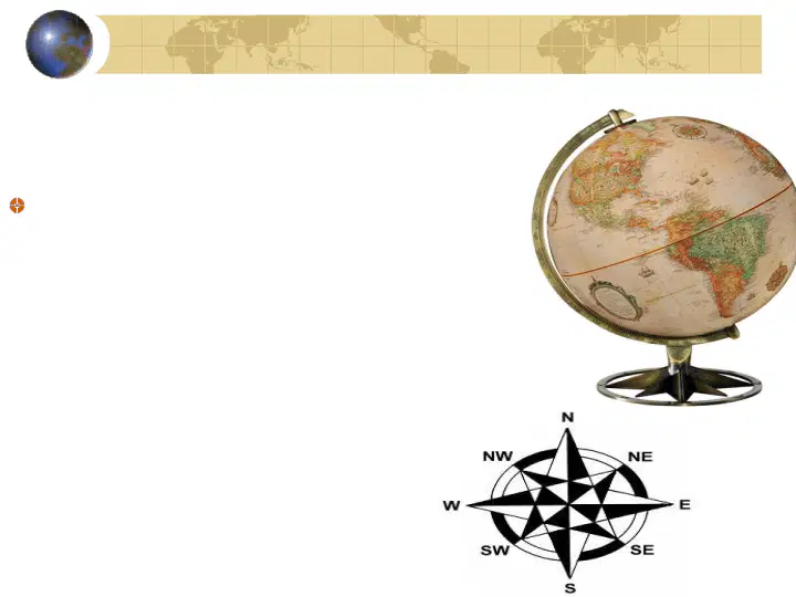
Compass Rose
The compass rose
is included on a map to help
the user with the cardinal directions
(North, East, South, and West)
in relation to the map.
34
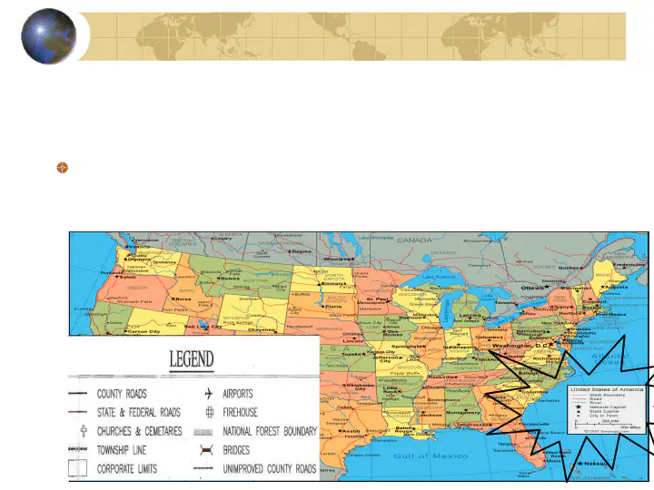
Map Key/Legend
A map key or legend as it is often called tells what
the symbols on a map represent.
35

Map Titles
Map titles tell you what you are looking at.
Example:
36
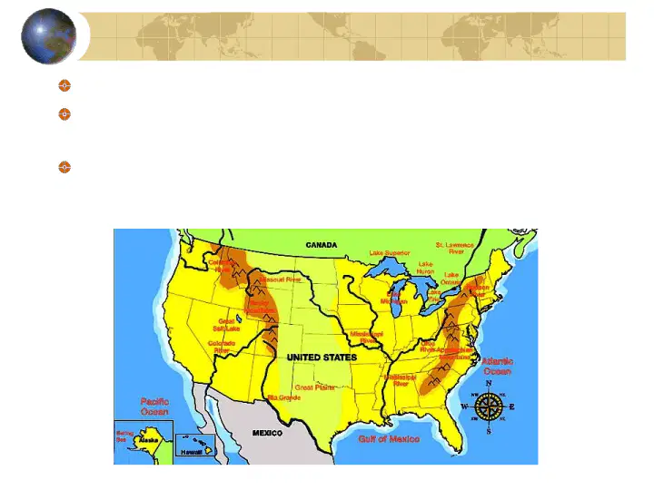
Major Rivers of the United States
There are 5 major rivers of the United States:
Mississippi River, Colorado River, Rio Grande,
Ohio River and the Hudson River.
Rivers help people in the U.S. meet their needs.
They use river water for crops, drinking water,
moving goods, and for having fun!
37
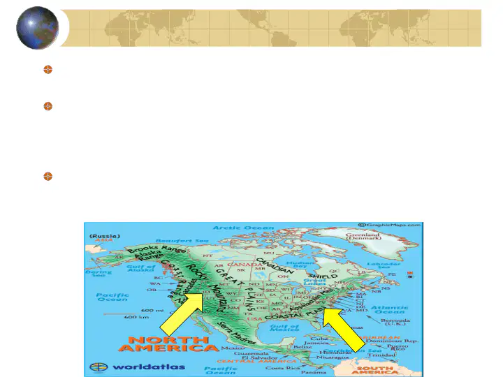
Mountains of the United States
The Rocky and Appalachian Mountains are found in
the United States.
The Rocky Mountains is the largest mountain range
in the country located in the western part of the U.S.
The rockies pass through northern New Mexico and
into Colorado, Wyoming, Idaho and Montana.
The Appalachian Mountains located west of the
Atlantic Coastal Plain run from Maine (north) to
Georgia (south). They aren’t as high as the Rockies.
38
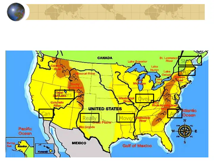
Use the sentence learned in to remember the
location of the mountains and rivers. Practice daily.
R
ivers
Can
R
eally
M
ove
Over
Any
High
Stone?
39
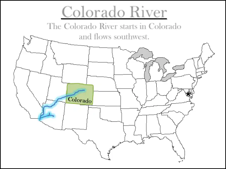
Colorado River
The Colorado River starts in Colorado
and flows southwest.
40
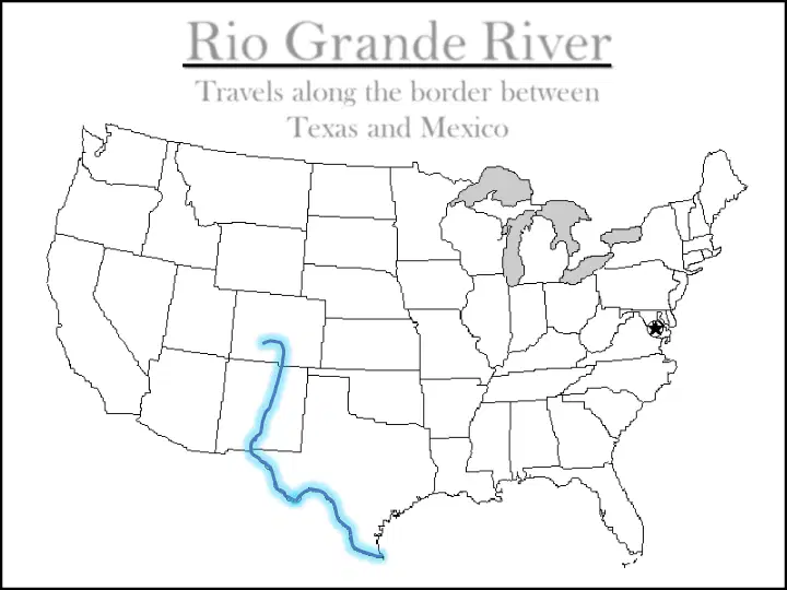
Rio Grande River
Travels along the border between
Texas and Mexico
41
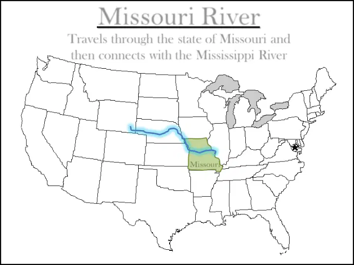
Missouri River
Travels through the state of Missouri and
then connects with the Mississippi River
Missouri
42
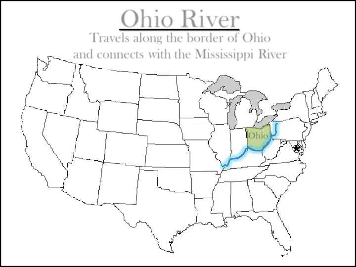
Ohio River
Travels along the border of Ohio
and connects with the Mississippi River
Ohio
43
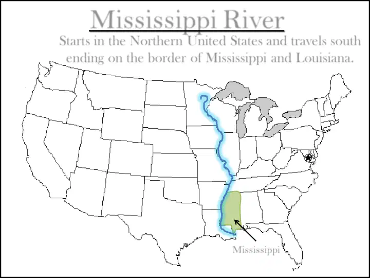
Mississippi River
Starts in the Northern United States and travels south
ending on the border of Mississippi and Louisiana.
Mississippi
44
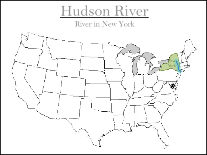
Hudson River
River in New York
New
York
45

Five Major U.S. Rivers
And
Two Mountain Chains
By: Melissa White and Lyndsey Robbins
46

GPS Standard
SS3G1 The student will locate major topographical
features.
a. Identify major rivers of the United States of America:
Mississippi, Ohio, Rio Grande, Colorado, Hudson.
b. Identify major mountain ranges of the United States
of America: Appalachian, Rocky.
NCSS Standard
NCSS3 How to Analyze the Spatial Organization of
People, Places, and Environments on Earth’s Surface
Element 11: The World in Spatial Terms
47
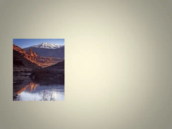
Colorado River
•1,450 miles long
•Western Side of the Rockies
•Ends in the Gulf of California (in Mexico)
48
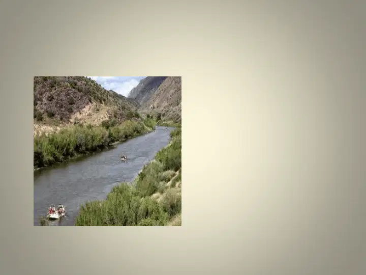
Rio Grande River
• Eastern Side of Rockies
•Texas’s southern border with Mexico
• 1,896 miles long
49
Ohio River
• Part of Ohio’s service industry
•States south of the Ohio were slave states
•Connected to Lake Erie
•Forms the states southern border and part of
the eastern border
•Ohio lowest point (sea level)
50

Hudson River
• Connected to Lake Erie
•New York’s longest river
•306 miles
•Primary source is Lake Tear of the Clouds
51
Mississippi River
•Cities got started as commercial ports
and farmers markets.
•Main designation is Lake Itasca
•Flows every direction but west
•Flows into the Gulf of Mexico
• known for its tourist attractions
(riverboats, casinos)
•Cuts the nation into two parts
•Forms borders on ten states
• At 2,530 miles it is one of the longest
rivers in the World
52

Appalachian Mountains
•Contains the Appalachian trail which is
the longest hiking trail in the United
States.
•Blue Ridge Mountains and Lookout
Mountain are part of Appalachian
Mountains
•Extends into Canada
•Erosion has worn them down
53
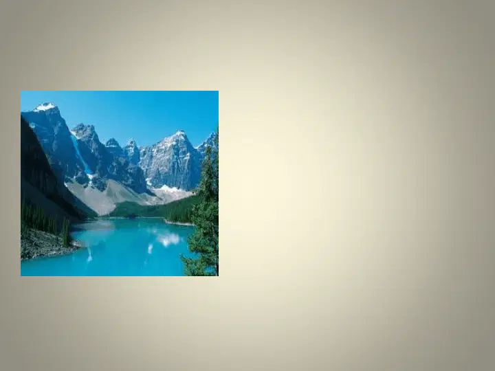
Rocky Mountains
•Mostly rock at the tops
•Includes Pikes Peak (14,115 ft above sea
level)
•Covers the middle third of the state
•Covers over 3,000 miles from Northern
Canada to New Mexico
•Popular for hiking, skiing, hunting, and
fishing.
54

55
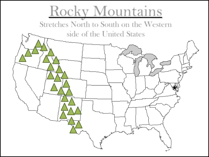
Rocky Mountains
Stretches North to South on the Western
side of the United States
56
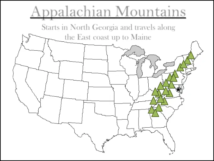
Appalachian Mountains
Starts in North Georgia and travels along
the East coast up to Maine
57
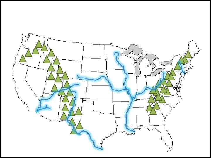
Rivers and Mountains
of North America
Show answer
Auto Play
Slide 1 / 57
SLIDE
Similar Resources on Wayground

52 questions
{HM2}-Tin3. Bài 8, làm quen với thư mục
Presentation
•
3rd Grade
49 questions
Unit 8 - Healthy living
Presentation
•
3rd Grade
48 questions
POPULAR MEMBER SERVICES DIAGNOSTICS, HOSPITILIZATION AND SURGERY
Presentation
•
KG
51 questions
T1.C3 - Singular and Plural Nouns (Meeting 1)
Presentation
•
3rd Grade
52 questions
Grade 11 L16 IELTS
Presentation
•
3rd Grade
51 questions
VST 2 Review
Presentation
•
3rd Grade
54 questions
Lesson 3.2.2
Presentation
•
3rd Grade
50 questions
Reading 11/14/21
Presentation
•
3rd Grade
Popular Resources on Wayground
6 questions
Secondary Safety Quiz
Presentation
•
9th - 12th Grade
10 questions
MyPath Diagnostic Overview
Presentation
•
6th - 8th Grade
20 questions
Lab Safety Quiz

Quiz
•
6th Grade
21 questions
Continents and Oceans
Quiz
•
6th Grade
20 questions
Adding and Subtracting Decimals
Quiz
•
5th Grade
20 questions
Parts of Speech
Quiz
•
5th Grade
16 questions
Subject & Predicate
Quiz
•
5th Grade
21 questions
Lab Safety
Quiz
•
10th Grade
Discover more resources for English
18 questions
Nouns
Quiz
•
3rd Grade
20 questions
Four Types of Sentences
Quiz
•
3rd - 5th Grade
10 questions
Verb Tenses Third Grade
Quiz
•
3rd Grade
15 questions
Common and Proper Nouns
Quiz
•
3rd Grade
12 questions
What are nouns?
Quiz
•
3rd Grade
20 questions
Inferences
Quiz
•
3rd Grade
20 questions
Capitalization
Quiz
•
3rd - 4th Grade
13 questions
Subjects & Predicate
Quiz
•
3rd Grade