

Grade 6 r

Presentation
•
Social Studies
•
KG
•
Hard

RAYAN Mohammad
FREE Resource
22 Slides • 2 Questions
1
Maps
Every map is different, but most maps have at least three main components in common.
Map title
Map key
compass rose

2
The title of a map is found at the top of the map.
It tells you what the map is showing. The title will be in a large font and describe in detail what the map is for.
The Title

3
All the map symbols are named in the map key.
The key is usually off to the side of the map and tells you the meaning for each symbol .
Map Key

4
A Compass Rose is a symbol on a map that shows directions.
The directions are
N = North
S = South
E = East
W = West
Compass Rose

5
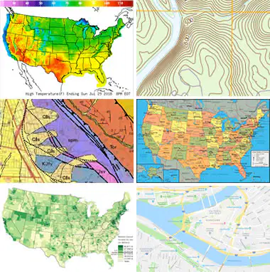
There are many different types of maps to show different types of information, some of them are described below.
Political Map
Climate Map
Resource Map
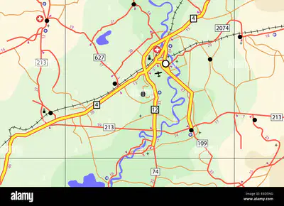
Road Map
Physical Map
Map Types
6
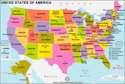
Political Maps can show bodies of water, different sizes of lands, from large continents to small cities.
features of a political map |
1- Major cities are named
2- Uses colors to show states and countries
3- borders are drawn between states and countries
Political Maps
7
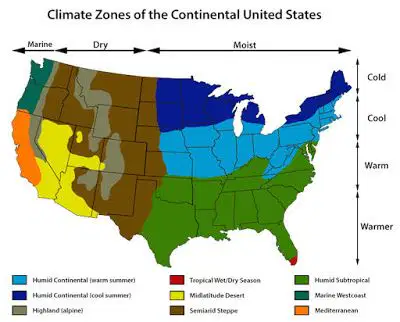
Climate maps shows us weather patterns that have been observed in a given area over a long period of time.
features of a climate map |
1- A climate map shows information about the climate of an area.
2- By looking at a climate map, you can see the areas that receive more rainfall and areas that have dry weather.
Climate Map
8
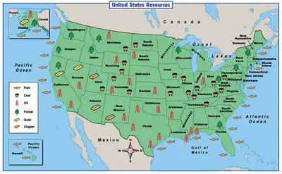
Resource maps show the different resources present in the area.They show the kind of crops that are grown and the minerals found in places.
features of a Resource map |
1- Symbols and letters are used to depict the activity or resource present in the area for examplea tree on a resource map represent A Forrest
Resource Map
10
Physical Map
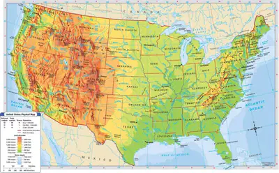
Physical maps show us where to find mountains, forests, rivers, lakes and many more landforms.
features of a Physical maps |
1- Physical maps can show us landforms.
11
A globe is a round model of Earth..
It shows all the land and water on Earth.
The blue part on the globe shows water. (Oceans)
The brown and green parts show land. ( Continents)
Globe

12
Longitudes and latitudes


13
Latitude
Lines on a map that run parallel to the equator
Used to locate positions between north & south
They run horizontal like the rungs of a ladder.

14
Longitude
Lines on a map that run perpendicular to the equator
Used to locate positions between east and west
They run vertical on the globe

15
Equator
EQUATOR is an imaginary line that runs across the middle of the Earth like a belt.
it runs east and west
Horizontal lines parallel to the equator are lines of latitude.

16
TIME ZONES

17
Time Zones
Because sunlight will reach different parts of the world at different times, the Earth is divided into Time Zones.
A Time Zone is an area where all clocks are set to the same time.
Earth has 24 Time Zones because Earth takes 24 hours to rotate one time.

18
Time Zone Math
When we travel across Time Zones, we need to change our clocks.
Each Time Zone we travel west, we move our clock one hour earlier.
Each Time Zone we travel east, we move our clock one hour later.

19
Asteroid Belt
Most orbit the Sun between Mars and Jupiter
The asteroid belt is divided into an inner belt and an outer belt.

20
Asteroids
Asteroids are found in our solar system
Asteroids can be both very small and very big
Typically made of rock and metal.

21
Comets
A small solar system body that orbits the Sun.
Comets are made of frozen gas and dust.

22
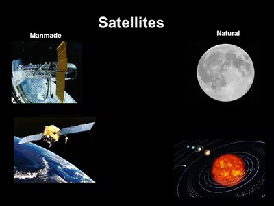
a satellite is an object that orbits (goes around) a planet.
There are several hundred natural satellites, or moons, in our Solar System.
Thousands of artificial (human-made) satellites have also been launched since 1957.
satellite
23
Multiple Choice
1. If it is 04:00 in Atlanta and Lima is 1 hour behind, what time is it in Lima?
03:00
05:00
24
Multiple Choice
2. If it is 13:30 in London and Tokyo is 8 hours ahead, what time is it in Tokyo?
18:30
20:30
21:30
Maps
Every map is different, but most maps have at least three main components in common.
Map title
Map key
compass rose
Show answer
Auto Play
Slide 1 / 24
SLIDE
Similar Resources on Wayground

19 questions
Physical Maps
Presentation
•
3rd Grade
19 questions
Ancient Rome Geography
Presentation
•
7th Grade
19 questions
Jamestown: Reasons for Colonization
Presentation
•
4th Grade
19 questions
Thematic Maps
Presentation
•
6th - 8th Grade
19 questions
John Adams
Presentation
•
8th Grade
19 questions
Suffrage
Presentation
•
8th - 10th Grade
19 questions
[6a] ECONOMIC SYSTEMS: LATIN AMERICA (SS6E1a) Lesson
Presentation
•
6th Grade
20 questions
Japan Vocabulary
Presentation
•
7th Grade
Popular Resources on Wayground
10 questions
HCS SCI 03 Summer School Review 4

Quiz
•
3rd Grade
11 questions
HSMS - Standard Response Protocol
Quiz
•
6th - 8th Grade
16 questions
1.1-1.2 Quiz Review
Quiz
•
9th - 12th Grade
12 questions
Exponent Expressions
Quiz
•
6th Grade
20 questions
Adding and Subtracting Integers
Quiz
•
6th - 7th Grade
11 questions
Northeast States
Quiz
•
3rd - 4th Grade
10 questions
Characterization
Quiz
•
3rd - 7th Grade
10 questions
Common Denominators
Quiz
•
5th Grade