
Wildlife Maps
Presentation
•
Biology
•
9th - 12th Grade
•
Practice Problem
•
Medium

Jessica Zamudio
Used 7+ times
FREE Resource
28 Slides • 16 Questions
1

2

3

4

5

6

7

8

9

10

11

12

13

14

15

16

17

18

19

20

21

22

23

24

25

26

27

28

29
Multiple Choice
30
Multiple Choice
31
Multiple Choice
32
Labelling
33
Multiple Choice

In the following township, what section lies to the south of Sec. 12?
34
Multiple Choice

35
Multiple Choice

In the following township what sections lie immediately to the north and to the south of Sec. 8?
36
Multiple Choice
37
Multiple Choice

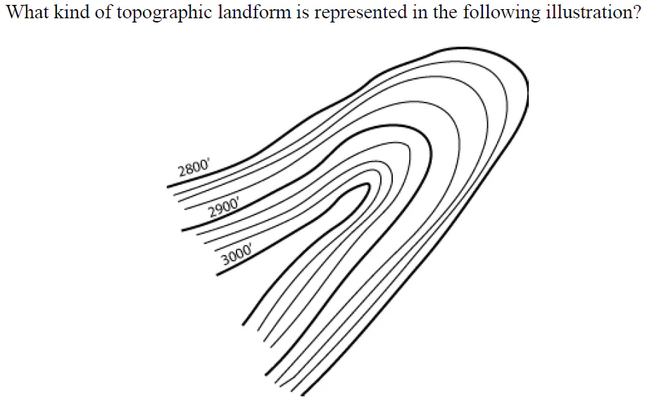
What kind of topographic landform is represented in the following illustration?
38
Math Response
39
Multiple Choice

What are the bold contours called?
40
Multiple Choice

What kind of topographic landform is represented in the following illustration?
41
Math Response
42
Multiple Choice
What kind of topographic landform is represented in the following illustration?
43
Multiple Choice
44
Multiple Choice
Show answer
Auto Play
Slide 1 / 44
SLIDE
