
Air Temperature
Presentation
•
Science
•
8th Grade
•
Hard

James Gonzalez
FREE Resource
27 Slides • 36 Questions
1


2
Multiple Choice

Measures air temperature.
3
Multiple Choice

Measures air pressure.
4
Multiple Choice

Measures relative humidity, using the cooling effect of evaporation.
5
Multiple Choice

Measures the amount of rain that has fallen over a specific time period.
6
Multiple Choice

Measures the water vapor content of air or the humidity.
7
Multiple Select

Why do you see precipitation near the L? (select 2 answers)
8
Multiple Choice

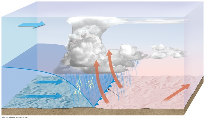
You would expect to see clouds forming and possible precipitation
9
Multiple Choice
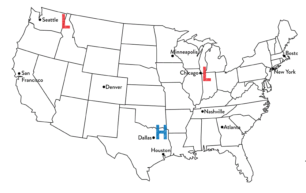
Tim said that Chicago is most likely to experience rainy weather. Jennifer thinks that Dallas is most likely to experience rainy weather.
Which student is correct?
10
Multiple Choice

What type of weather is Minneapolis most likely experiencing?
11
Multiple Choice

What type of weather is Denver most likely experiencing? Notice the type of front that has just passed through.
12
Multiple Choice

Which location is most likely experiencing warmer temperatures and higher humidity?
13
Multiple Choice

The Jet Stream is a global pattern of atmospheric movement that influences patterns in local weather. Rain and even severe thunderstorms are often associated with the passage of a cold front. Based on this information, and that provided in the weather map, which city shown will most likely experience precipitation in the next few days?
14
Multiple Choice
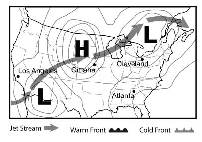
The Jet Stream is a global pattern of atmospheric movement that influences patterns in local weather. In general, one can expect clear skies with a high pressure area and cloudier conditions in areas of low pressure. Based on this information, and that provided in the weather map, which city shown most likely is currently experiencing clouds but will see clearer skies in the near future?
15
Multiple Choice
16


17
Multiple Choice
18


19
Multiple Choice
20


21
Multiple Choice
22


23
Multiple Choice
24


25
Multiple Choice
26


27
Multiple Choice

28


29
Multiple Choice

30


31
Multiple Choice

32


33
Multiple Choice

34


35
Multiple Choice
36


37
Multiple Choice
38


39
Multiple Choice

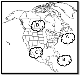
Which type of air would you find at air mass B?
40


41
Multiple Choice
42


43
Multiple Choice

44


45
Multiple Choice
46


47
Multiple Choice
48


49
Multiple Choice
50


51
Multiple Choice
52


53
Multiple Choice
54


55
Multiple Choice
56


57
Multiple Choice
58


59
Multiple Choice

The table shows the air temperature and dewpoint at each of four locations, A, B, C, and D. Based on these measurements, which location has the greatest chance of precipitation?
60


61


62


63


Show answer
Auto Play
Slide 1 / 63
SLIDE
