Search Header Logo
Map Features

Map Features

Assessment

Presentation

Social Studies

6th Grade

Hard

Created by

Joseph Anderson

FREE Resource

10 Slides • 45 Questions

1

media

Map & Globe Skills

2

Multiple Select

Question image

What is this?

1

That's a map

2

Yep, definitely a map

3

Obviously it's a map

4

Wow Ms. Post doesn't even know what a map is!

3

Multiple Select

Question image

Okay, now what's this?

1

Still a map

2

Also a map

3

Ms. Post, are you okay? It's a map...

4

media
media

If these are all maps, why do they look so different?

media
media
media
media

5

Open Ended

Question image

Why do you think we have so many maps that all look different?

6

media
media

Types of Maps

Different types of maps show different information.

It would be too much to try and fit everything on a single map!

media

7

media
media
media
media

These are the two most common maps we study in Humanities.

Physical Map

A map that shows
landforms.

Political Map

A map that shows countries,
cities, or states.

8

Categorize

Options (8)
Question image
Question image
Question image
Question image
Question image
Question image
Question image
Question image

Decide whether each map is PHYSICAL or POLITICAL?

PHYSICAL Maps
POLITICAL Maps

9

media
media
media
media

We will also see these types of maps in Humanities as well.

Topographic Map

A map that shows heights of landforms.

Population Map

A map that shows the
population of various places.

10

Multiple Choice

Question image

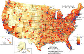
What does the DARK BLUE color on this map probably represent?

1

The country with the tallest mountain

2

The country with the most money

3

The country with the largest population

4

The country Ms. Post likes the most

11

media
media
media

This is called a Key/Legend

An illustration that explains
what the symbols or colors on
a map represent.

12

Hotspot

Click on a Camping/Picnic Area on the map

13

Hotspot

Click on an International Airport on the map

14

Hotspot

Click on a city with a population of 75,000 on the map

15

media
media
media
media

These are your Cardinal and Intermediate directions.

Southeast

​ast

​est

​outh

​orth

​Northwest

​Northeast

Southwest

16

media
media
media

Together these create a Compass Rose.

17

Multiple Choice

Question image

What state is NORTH of UTAH?

1

New Mexico

2

Idaho

3

California

4

Texas

18

Multiple Choice

Question image

What state is SOUTH of UTAH?

1

New Mexico

2

Montana

3

California

4

Arizona

19

Multiple Choice

Question image

What state is EAST of UTAH?

1

Colorado

2

Montana

3

California

4

Nevada

20

Multiple Choice

Question image

What state is WEST of UTAH?

1

Kansas

2

Wyoming

3

Nebraska

4

Nevada

21

Multiple Choice

Question image

What state is NORTHWEST of UTAH?

1

Arizona

2

Wyoming

3

Oregon

4

Texas

22

Multiple Choice

Question image

What state is SOUTHEAST of UTAH?

1

Arizona

2

Nevada

3

New Mexico

4

Nebraska

23

media
media

Now let's put your map skills to the test!!!!

Study the map on the next slide and try to remember it!

media
media
media
media

24

media

25

Multiple Choice

Question image

Which Continent is Highlighted?

1

Europe

2

Africa

3

Antartica

4

Australia

26

Multiple Choice

Question image

Which Continent is Highlighted?

1

Africa

2

North America

3

Asia

4

Europe

27

Multiple Choice

Question image

Which Ocean is Highlighted?

1

Indian Ocean

2

Atlantic Ocean

3

Pacific Ocean

4

Arctic Ocean

28

Multiple Choice

Question image

Which Continent is Highlighted?

1

Antarctica

2

Africa

3

Asia

4

North America

29

Multiple Choice

Question image

Which Ocean is Highlighted?

1

Southern Ocean

2

Indian Ocean

3

Arctic Ocean

4

Pacific Ocean

30

Multiple Choice

Question image

Which Continent is Highlighted?

1

South America

2

Asia

3

Europe

4

Australia

31

Multiple Choice

Question image

Which Continent is Highlighted?

1

Australia

2

South America

3

North America

4

Europe

32

Multiple Choice

Question image

Which Continent is Highlighted?

1

South America

2

North America

3

Asia

4

Africa

33

Multiple Choice

Question image

Which Ocean is Highlighted?

1

Southern Ocean

2

Indian Ocean

3

Pacific Ocean

4

Atlantic Ocean

34

Multiple Choice

Question image

Which Continent is Highlighted?

1

North America

2

Europe

3

Antarctica

4

Australia

35

Multiple Choice

Question image

The imaginary line that divides the earth into northern and southern hemispheres.

1

Equator

2

Prime Meridian

3

Hemisphere

36

Multiple Choice

Question image

The imaginary line that divides the earth into eastern and western hemispheres.

1

Equator

2

Prime Meridian

3

Hemisphere

37

Multiple Choice

A _______________ is exactly half of the earth.
1
Equator
2
Hemisphere
3
Tropic of Cancer
4
Arctic Circle

38

Multiple Choice

Question image

A map that shows countries, cities, or states.

1

topographic map

2

political map

3

road map

39

Multiple Choice

Question image

A map showing elevation (surface) using lines.

1

topographic map

2

political map

3

road map

40

Multiple Choice

Question image

A map that shows landforms.

1

physical map

2

road map

3

political map

41

Multiple Choice

Question image

Identify this map.

1

Population density map

2

Physical Map

3

Road map

42

Multiple Choice

How many continents are there?
1
4
2
1
3
5
4
7

43

Multiple Choice

Which of the following is NOT a continent?
1
Africa
2
North America
3
Germany
4
Europe

44

Multiple Choice

Question image
How many oceans are on the Earth?
1
7
2
4
3
5
4
2

45

Multiple Choice

What are the Cardinal Directions?

1

North, South, North East, South East

2

North, South, East, West

3

East, East West, South West, North East

4

West, North, South West, North West

46

Multiple Choice

Question image

A diagram that shows cardinal or intermediate directions

1

Legend

2

Compass Rose

3

Continent

4

GPS

47

Multiple Choice

Which is not a basic/cardinal direction

1

North

2

Southwest

3

East

4

South

48

Multiple Choice

Which is not an intermediate direction?

1

Southwest

2

Southeast

3

North

4

Norhtwest

49

Multiple Choice

Question image

What is north of the picnic area?

1

woods

2

soccer field

3

swimming pool

4

playground

50

Multiple Choice

Question image
What is south of the woods?
1
soccer field
2
playground
3
swimming pool 
4
picnic area

51

Multiple Choice

Question image
What is west of the ice cream stand?
1
playground
2
swimming pool
3
picnic area
4
woods

52

Multiple Choice

Question image

To go from Eddie's house to the school, you travel ______.

1

north

2

south

3

east

4

west

53

Multiple Choice

Question image

Which direction do you need to go to get from the post office to the school?

1

northeast

2

southeast

3

southwest

4

northwest

54

Multiple Choice

Question image

1

It is northwest of Mexico City.

2

It is northeast of Mexico City.

3

It is south of Mexico City.

4

It is southeast of Mexico City.

55

Multiple Choice

Question image
1

Goodland

2

Salina

3

Wichita

4

Topeka

media

Map & Globe Skills

Show answer

Auto Play

Slide 1 / 55

SLIDE