
Unit 1 Class Review
Presentation
•
Geography
•
9th - 12th Grade
•
Easy

Eric Rodgers
Used 5+ times
FREE Resource
6 Slides • 54 Questions
1

2
Open Ended
3

4
Labelling
5
Match
6
Match
7
Dropdown
8
Match
9
Open Ended
10
Multiple Choice

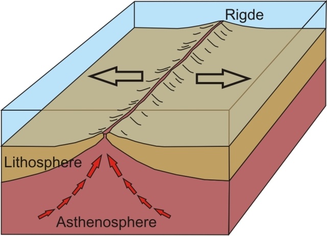
The illustration above demonstrates –
11
Match
12
Labelling
13
Drag and Drop

14
Multiple Choice

What continent can be found at this location 30°S, 145°E: _______________
15
Fill in the Blanks
16

17
Labelling
18
Multiple Choice

Identify the percent of Earth's surface that is covered in water.
19
Multiple Choice

In what layer of the Earth do people live?
20
Match
21
Multiple Choice

This sphere is created by the three other spheres and is composed of all the living things.
22
Multiple Choice

What is the name of the original supercontinent?
23
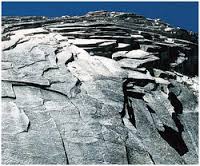
Open Ended

What does the photo represent?
24
Labelling
25

26
Open Ended
27
Multiple Choice
28
Multiple Choice

29
Multiple Choice

30
Multiple Choice
31
Multiple Choice
32
Multiple Select
33
Open Ended
34
Multiple Choice
35
Dropdown

36
Multiple Choice

37
Multiple Choice

38
Match
39

40
Multiple Choice

Based on the diagram, how does the Earth-Sun relationship affect the climate of different regions of the world?
41
Multiple Choice
42
Dropdown
43
Multiple Choice

How would this barrier affect the climate on the leeward side?
44

45
Open Ended

What does the photo represent -
46
Multiple Choice
47
Labelling
48
Hotspot
49
Multiple Choice
50
Hotspot
51
Hotspot
52
Multiple Choice
53
Multiple Choice
54
Multiple Select
55
Multiple Choice
56
Multiple Choice
57
Dropdown
58
Multiple Choice

The greenhouse effect is a natural process
59
Multiple Choice
60
Match
Show answer
Auto Play
Slide 1 / 60
SLIDE
