The 3 Types of Maps: Political, Physical, Thematic 6th Grade
Authored by Gregory Smith
Geography, Social Studies
6th Grade
Used 20+ times

AI Actions
Add similar questions
Adjust reading levels
Convert to real-world scenario
Translate activity
More...
Content View
Student View
11 questions
Show all answers
1.
MULTIPLE CHOICE QUESTION
1 min • 1 pt
A map showing mountains, rivers, oceans, elevation is what type of map?
2.
MULTIPLE CHOICE QUESTION
1 min • 1 pt
A map showing the climate zones of North America is which type of map?
3.
MULTIPLE CHOICE QUESTION
1 min • 1 pt
A map showing boundaries of countries is what type of map?
4.
MULTIPLE CHOICE QUESTION
1 min • 1 pt
What part of the map tells us directions?
5.
MULTIPLE CHOICE QUESTION
1 min • 1 pt

This is a physical map. How can we tell?
It shows land features and elevation.
It shows country borders.
It shows major cities.
It shows climate.
6.
MULTIPLE SELECT QUESTION
1 min • 1 pt

This is a physical map. How can we tell?
It has landforms like mountain ranges labeled on it.
It shows elevation.
It shows major cities.
It shows state boundaries.
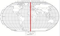
7.
MULTIPLE CHOICE QUESTION
1 min • 1 pt

What is the name of this line at 0 degrees latitude?


Access all questions and much more by creating a free account
Create resources
Host any resource
Get auto-graded reports
Continue with Google

Continue with Email
Continue with Microsoft
or continue with

%20(1).png)
Apple
Others
Already have an account?
