Geography and Mapping Concepts
Interactive Video
•
Geography, History
•
5th - 8th Grade
•
Practice Problem
•
Hard

Amelia Wright
FREE Resource
Read more
10 questions
Show all answers
1.
MULTIPLE CHOICE QUESTION
30 sec • 1 pt
What tools did workers use to build the Transcontinental Railroad in the 1860s?
Cranes and bulldozers
Electric drills
Hammers, shovels, and explosives
Modern machinery
2.
MULTIPLE CHOICE QUESTION
30 sec • 1 pt
Where did the two railroads meet to complete the Transcontinental Railroad?
Promontory Point, Utah
Sacramento, California
Omaha, Nebraska
Saint Joseph, Missouri
3.
MULTIPLE CHOICE QUESTION
30 sec • 1 pt
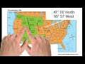
What are the extra numbers in the coordinates called?
Degrees
Hours
Minutes
Seconds
4.
MULTIPLE CHOICE QUESTION
30 sec • 1 pt
How many minutes are there in one degree of latitude or longitude?
90
60
45
30
5.
MULTIPLE CHOICE QUESTION
30 sec • 1 pt
Which coordinate indicates a location's distance north or south of the Equator?
Meridian
Altitude
Latitude
Longitude
6.
MULTIPLE CHOICE QUESTION
30 sec • 1 pt
What was the primary purpose of the Pony Express?
Carrying passengers
Delivering mail
Exploring new territories
Transporting goods
7.
MULTIPLE CHOICE QUESTION
30 sec • 1 pt
How long did it typically take for mail to travel from Saint Joseph, Missouri, to Sacramento, California, via the Pony Express?
10 days
5 days
20 days
15 days
Access all questions and much more by creating a free account
Create resources
Host any resource
Get auto-graded reports
Continue with Google

Continue with Email
Continue with Classlink
Continue with Clever
or continue with
Microsoft
%20(1).png)
Apple
Others
Already have an account?
Similar Resources on Wayground

11 questions
Harriet Tubman's Journey to Freedom
Interactive video
•
5th - 8th Grade
8 questions
Map and Compass
Interactive video
•
6th - 9th Grade
11 questions
Understanding Weather Maps and Indicators
Interactive video
•
6th - 7th Grade
11 questions
Understanding Australian Daylight Saving Time
Interactive video
•
6th - 7th Grade
6 questions
Understanding Horsepower
Interactive video
•
6th - 8th Grade
6 questions
Understanding UK Border Control Questions
Interactive video
•
6th - 7th Grade
11 questions
Navigating Directions to King Street
Interactive video
•
4th - 6th Grade
11 questions
Understanding 'Loose' and 'Lose'
Interactive video
•
6th - 7th Grade
Popular Resources on Wayground
15 questions
Fractions on a Number Line
Quiz
•
3rd Grade
10 questions
Probability Practice
Quiz
•
4th Grade
15 questions
Probability on Number LIne
Quiz
•
4th Grade
20 questions
Equivalent Fractions
Quiz
•
3rd Grade
25 questions
Multiplication Facts
Quiz
•
5th Grade
22 questions
fractions
Quiz
•
3rd Grade
6 questions
Appropriate Chromebook Usage
Lesson
•
7th Grade
10 questions
Greek Bases tele and phon
Quiz
•
6th - 8th Grade
Discover more resources for Geography
10 questions
Seasons and Earth's Tilt
Quiz
•
7th Grade
50 questions
U.S. 50 States Map Practice
Quiz
•
5th - 8th Grade
12 questions
Russia, Central Asia, & the Caucasus
Quiz
•
6th Grade
20 questions
Geography of Europe
Quiz
•
6th Grade
36 questions
Southeast States and Capitals*
Quiz
•
5th Grade
10 questions
38a, b, c: Voluntary trade in Africa
Quiz
•
7th Grade
17 questions
Latitude and Longitude
Quiz
•
5th Grade
22 questions
Western States and Capitals
Quiz
•
5th Grade