Exploring the Geography of Ancient China
Interactive Video
•
History
•
6th - 10th Grade
•
Practice Problem
•
Medium

Lucas Foster
Used 56+ times
FREE Resource
10 questions
Show all answers
1.
MULTIPLE CHOICE QUESTION
30 sec • 1 pt
What does geography mean through a historian's lens?
The history of different countries
The study of ancient artifacts
The physical environment and its influence on economy and culture
The study of maps and locations
2.
MULTIPLE CHOICE QUESTION
30 sec • 1 pt
Which mountain range houses the tallest peak in the world?
Andes Mountains
Rocky Mountains
Himalayan Mountains
Kunlun Mountains
3.
MULTIPLE CHOICE QUESTION
30 sec • 1 pt
What is the average height of the Tibet plateau?
16,000 feet
14,000 feet
12,000 feet
10,000 feet
4.
MULTIPLE CHOICE QUESTION
30 sec • 1 pt
Which desert in northwest China is known for its cold climate?
Gobi Desert
Taklamakan Desert
Kalahari Desert
Sahara Desert
5.
MULTIPLE CHOICE QUESTION
30 sec • 1 pt
Which river is known as the Yellow River?
Mekong River
Yangzi River
Huang He
Nile River
6.
MULTIPLE CHOICE QUESTION
30 sec • 1 pt
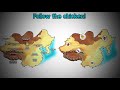
In the game 'Where's the Chicken', where did the chicken end up the first time?
Kunlun Mountains
Yellow Sea
Tibet Plateau
Himalayan Mountains
7.
MULTIPLE CHOICE QUESTION
30 sec • 1 pt
What was a common grain grown and eaten in North China?
Corn
Millet
Barley
Wheat
Access all questions and much more by creating a free account
Create resources
Host any resource
Get auto-graded reports
Continue with Google

Continue with Email
Continue with Microsoft
or continue with

%20(1).png)
Apple
Others
Already have an account?
