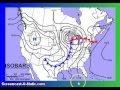
Analyzing Weather Maps: Isobars and Isotherms
Interactive Video
•
English
•
6th - 8th Grade
•
Practice Problem
•
Medium

Jackson Turner
Used 28+ times
FREE Resource
Read more
10 questions
Show all answers
1.
MULTIPLE CHOICE QUESTION
30 sec • 1 pt
What do isotherms represent on a weather map?
Precipitation levels
Temperature variations
Wind speed
Air pressure levels
2.
MULTIPLE CHOICE QUESTION
30 sec • 1 pt
What does the term 'isobar' refer to?
Lines indicating equal wind speed
Lines indicating equal air pressure
Lines indicating equal humidity
Lines indicating equal temperature
3.
MULTIPLE CHOICE QUESTION
30 sec • 1 pt
How are isobars spaced when indicating strong winds?
Widely spaced
Irregularly spaced
Closely spaced
Evenly spaced
4.
MULTIPLE CHOICE QUESTION
30 sec • 1 pt
What weather condition is indicated by closely packed isobars?
High temperatures
Stormy weather
Calm weather
Clear skies
5.
MULTIPLE CHOICE QUESTION
30 sec • 1 pt
What does closely spaced isobars indicate about wind speed?
No wind
Variable winds
Light breezes
Strong winds
6.
MULTIPLE CHOICE QUESTION
30 sec • 1 pt
What does a cold front typically bring?
Warmer temperatures
Decreased precipitation
Storms and lower temperatures
Stable weather conditions
7.
MULTIPLE CHOICE QUESTION
30 sec • 1 pt
What is indicated by a high-pressure area on a weather map?
Stormy weather
Calm winds and stable conditions
High precipitation
Low temperatures
Access all questions and much more by creating a free account
Create resources
Host any resource
Get auto-graded reports
Continue with Google

Continue with Email
Continue with Classlink
Continue with Clever
or continue with
Microsoft
%20(1).png)
Apple
Others
Already have an account?
Similar Resources on Wayground

14 questions
Space Recap (tutorial)
Interactive video
•
8th Grade
6 questions
Understanding the Federal Reserve's Interest Rate Decisions
Interactive video
•
9th - 10th Grade
10 questions
Copy of Forms of Energy- 5 Forms of Energy
Interactive video
•
5th Grade
6 questions
The Run: Part 2-Refueling
Interactive video
•
7th Grade
Popular Resources on Wayground
15 questions
Fractions on a Number Line
Quiz
•
3rd Grade
20 questions
Equivalent Fractions
Quiz
•
3rd Grade
25 questions
Multiplication Facts
Quiz
•
5th Grade
22 questions
fractions
Quiz
•
3rd Grade
20 questions
Main Idea and Details
Quiz
•
5th Grade
20 questions
Context Clues
Quiz
•
6th Grade
15 questions
Equivalent Fractions
Quiz
•
4th Grade
20 questions
Figurative Language Review
Quiz
•
6th Grade
Discover more resources for English
20 questions
Context Clues
Quiz
•
6th Grade
20 questions
Figurative Language Review
Quiz
•
6th Grade
5 questions
Legends, Leaders, & Changemakers: Maya Angelou
Interactive video
•
6th - 8th Grade
10 questions
Figurative Language
Quiz
•
6th Grade
20 questions
Ethos, Pathos, Logos Practice
Quiz
•
6th - 7th Grade
20 questions
Main Idea and Supporting Details
Quiz
•
7th Grade
15 questions
Main Idea and Supporting Details.
Quiz
•
4th - 11th Grade
20 questions
Figurative Language Review
Quiz
•
8th Grade