Exploring Scale Drawings and Maps in 7th Grade
Interactive Video
•
Mathematics
•
6th - 8th Grade
•
Practice Problem
•
Medium
+1
Standards-aligned

Sophia Harris
Used 2+ times
FREE Resource
Standards-aligned
10 questions
Show all answers
1.
MULTIPLE CHOICE QUESTION
30 sec • 1 pt
What is the purpose of using a scale on a map?
To measure the size of the map
To find the best routes
To determine the color of the map
To estimate actual distances between locations
2.
MULTIPLE CHOICE QUESTION
30 sec • 1 pt
What formula is used to relate distance, rate, and time?
Distance = Mass x Acceleration
Distance = Rate x Time
Distance = Rate / Time
Distance = Time / Rate
Tags
CCSS.8.EE.C.7B
3.
MULTIPLE CHOICE QUESTION
30 sec • 1 pt
How do you calculate the speed if the distance and time are known?
Divide distance by time
Subtract time from distance
Add distance to time
Multiply distance by time
4.
MULTIPLE CHOICE QUESTION
30 sec • 1 pt
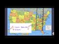
What scale factor is used to calculate the distance from State College to Orlando?
5.2
3.25
1.6
300
Tags
CCSS.7.G.A.1
5.
MULTIPLE CHOICE QUESTION
30 sec • 1 pt
What is the actual distance from State College to Orlando calculated using the map scale?
975 miles
300 miles
5.2 miles
1.6 miles
Tags
CCSS.7.G.A.1
6.
MULTIPLE CHOICE QUESTION
30 sec • 1 pt
How long will it take to travel from State College to Orlando at 40 miles per hour?
975 hours
40 hours
24.375 hours
1 hour
Tags
CCSS.6.RP.A.3B
7.
MULTIPLE CHOICE QUESTION
30 sec • 1 pt
What is the average speed for a 124-mile trip that takes 2 hours?
62 miles per hour
248 miles per hour
124 miles per hour
2 miles per hour
Tags
CCSS.6.RP.A.3B
Access all questions and much more by creating a free account
Create resources
Host any resource
Get auto-graded reports
Continue with Google

Continue with Email
Continue with Classlink
Continue with Clever
or continue with
Microsoft
%20(1).png)
Apple
Others
Already have an account?
