Geographical and Astronomical Position of Indonesia
Interactive Video
•
Geography
•
7th - 10th Grade
•
Practice Problem
•
Hard

Emma Peterson
FREE Resource
Read more
10 questions
Show all answers
1.
MULTIPLE CHOICE QUESTION
30 sec • 1 pt
What is the purpose of determining the astronomical and geographical position of a region?
To measure the area size
To establish the location based on latitude and longitude
To determine the climate
To identify the population
2.
MULTIPLE CHOICE QUESTION
30 sec • 1 pt
Between which longitudes is Indonesia located?
90°E to 140°E
95°E to 141°E
85°E to 135°E
100°E to 150°E
3.
MULTIPLE CHOICE QUESTION
30 sec • 1 pt
What is the range of latitudes that define the tropical region in the world?
30°N to 30°S
10° to 20°
0° to 10°
23.5°N to 23.5°S
4.
MULTIPLE CHOICE QUESTION
30 sec • 1 pt
What is the average annual rainfall in Indonesia?
2500 mm
2000 mm
1000 mm
1500 mm
5.
MULTIPLE CHOICE QUESTION
30 sec • 1 pt
What is the average temperature in Indonesia?
22.5°C
20.3°C
24.8°C
26.3°C
6.
MULTIPLE CHOICE QUESTION
30 sec • 1 pt
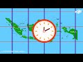
How many time zones does Indonesia have?
One
Two
Four
Three
7.
MULTIPLE CHOICE QUESTION
30 sec • 1 pt
Which islands are included in the Western Indonesian Time Zone?
Sumatra, Java, Kalimantan Barat, Kalimantan Tengah
Java, Kalimantan Timur, Papua
Sumatra, Nusa Tenggara, Maluku
Sumatra, Bali, Sulawesi
Access all questions and much more by creating a free account
Create resources
Host any resource
Get auto-graded reports
Continue with Google

Continue with Email
Continue with Classlink
Continue with Clever
or continue with
Microsoft
%20(1).png)
Apple
Others
Already have an account?
