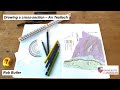
Geological Cross-Section Techniques
Interactive Video
•
Science, Geography
•
9th - 12th Grade
•
Practice Problem
•
Hard

Liam Anderson
FREE Resource
Read more
10 questions
Show all answers
1.
MULTIPLE CHOICE QUESTION
30 sec • 1 pt
What is the first step in drawing a cross-section using a topographic base?
Plotting the topographic profile
Drawing the section line
Setting up the scale
Marking geological boundaries
2.
MULTIPLE CHOICE QUESTION
30 sec • 1 pt
Why is it important to set the scale on graph paper before plotting?
To ensure the cross-section is drawn at the same scale as the map
To make the drawing look neat
To avoid errors in geological boundaries
To save time during plotting
3.
MULTIPLE CHOICE QUESTION
30 sec • 1 pt
What is the contour spacing used in the video for plotting the topographic profile?
25 meters
100 meters
50 meters
200 meters
4.
MULTIPLE CHOICE QUESTION
30 sec • 1 pt
What tool is used to measure the section length on the map?
Map strip
Protractor
Ruler
Compass
5.
MULTIPLE CHOICE QUESTION
30 sec • 1 pt
What is the purpose of adding color to the geological units on the profile?
To make the profile visually appealing
To differentiate between different geological units
To highlight the topographic features
To indicate the depth of each unit
6.
MULTIPLE CHOICE QUESTION
30 sec • 1 pt
Which geological unit is represented by the color gray in the video?
Metamorphic rocks
Sandstone group
Quartzite
Annelid formation
7.
MULTIPLE CHOICE QUESTION
30 sec • 1 pt
What is an outlier in geological terms as described in the video?
An isolated patch of rock separated from the main outcrop
A rock layer that is more eroded than others
A rock layer that is deeper than others
A rock layer that is thicker than others
Access all questions and much more by creating a free account
Create resources
Host any resource
Get auto-graded reports
Continue with Google

Continue with Email
Continue with Classlink
Continue with Clever
or continue with
Microsoft
%20(1).png)
Apple
Others
Already have an account?
Popular Resources on Wayground

7 questions
History of Valentine's Day
Interactive video
•
4th Grade
15 questions
Fractions on a Number Line
Quiz
•
3rd Grade
20 questions
Equivalent Fractions
Quiz
•
3rd Grade
25 questions
Multiplication Facts
Quiz
•
5th Grade
22 questions
fractions
Quiz
•
3rd Grade
15 questions
Valentine's Day Trivia
Quiz
•
3rd Grade
20 questions
Main Idea and Details
Quiz
•
5th Grade
20 questions
Context Clues
Quiz
•
6th Grade
Discover more resources for Science
25 questions
Naming Ionic and Covalent Compounds
Quiz
•
9th Grade
20 questions
Mendelian Genetics Review
Quiz
•
9th Grade
10 questions
Exploring Weathering, Erosion, and Deposition Processes
Interactive video
•
6th - 10th Grade
10 questions
Exploring Mendelian Genetics and Punnett Squares
Interactive video
•
6th - 10th Grade
10 questions
Exploring Light and Waves Concepts
Interactive video
•
6th - 10th Grade
20 questions
The Cell Cycle and Mitosis
Quiz
•
9th Grade
35 questions
DNA Structure and Replication
Quiz
•
10th Grade
89 questions
Unit 1 (Ch 2 & 3) Test Review - Water/Ocean Currents
Quiz
•
9th - 12th Grade