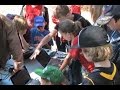
Exploring Richlum Fish Hatchery
Interactive Video
•
Biology, Science, Geography, Computers, Education
•
7th - 8th Grade
•
Practice Problem
•
Hard

Olivia Brooks
FREE Resource
Read more
8 questions
Show all answers
1.
MULTIPLE CHOICE QUESTION
30 sec • 1 pt
What tools did the students use during their field trip to the Richlum Fish Hatchery?
Binoculars and compasses
GPS devices, digital cameras, and netbooks
Microscopes and telescopes
Smartphones and tablets
2.
MULTIPLE CHOICE QUESTION
30 sec • 1 pt
What geographical concepts were the students learning about during the activity?
Altitude and depth
Latitude and longitude
Weather patterns
Time zones
3.
MULTIPLE CHOICE QUESTION
30 sec • 1 pt
What was the focus of the students' learning in terms of species?
Studying marine life in oceans
Understanding extinct species
Learning about species found in the specific area
Identifying endangered species worldwide
4.
MULTIPLE CHOICE QUESTION
30 sec • 1 pt
What kind of evidence did the students photograph during their field trip?
Weather changes
Animal tracks, debris, and nesting sites
Plant growth
Water quality
5.
MULTIPLE CHOICE QUESTION
30 sec • 1 pt
After collecting data points, what did the students do with the information?
They discarded it
They uploaded it to a cloud server
They downloaded it to netbooks for analysis
They shared it on social media
6.
MULTIPLE CHOICE QUESTION
30 sec • 1 pt
How did the students use the GPS and netbooks after collecting data?
To communicate with other schools
To map out their findings and plan further data collection
To play educational games
To watch educational videos
7.
MULTIPLE CHOICE QUESTION
30 sec • 1 pt
What was the ultimate goal of the students' data collection and mapping activities?
To publish a research paper
To win a science competition
To understand the importance of tracking species for conservation
To create a travel guide
Access all questions and much more by creating a free account
Create resources
Host any resource
Get auto-graded reports
Continue with Google

Continue with Email
Continue with Classlink
Continue with Clever
or continue with
Microsoft
%20(1).png)
Apple
Others
Already have an account?
