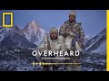
Understanding the Siachen Conflict and Cartographic Errors
Interactive Video
•
Geography, History
•
10th - 12th Grade
•
Practice Problem
•
Hard

Sophia Harris
FREE Resource
Read more
10 questions
Show all answers
1.
MULTIPLE CHOICE QUESTION
30 sec • 1 pt
What was the main challenge faced by Brigadier Bilal's forces during the operation in the Karakoram mountains?
Lack of ammunition
Extreme altitude and weather conditions
Insufficient manpower
Communication breakdown
2.
MULTIPLE CHOICE QUESTION
30 sec • 1 pt
What event led to the initial territorial disputes between India and Pakistan?
The Afghan War
The Indo-China War
The Cold War
The British partition of India
3.
MULTIPLE CHOICE QUESTION
30 sec • 1 pt
What was the significance of Hodgson's Line in the Siachen conflict?
It was a natural boundary
It was a military strategy
It was a cartographic error that influenced territorial claims
It was a peace treaty
4.
MULTIPLE CHOICE QUESTION
30 sec • 1 pt
Who was responsible for the creation of Hodgson's Line?
A British surveyor
An Indian geographer
A U.S. assistant geographer
A Pakistani cartographer
5.
MULTIPLE CHOICE QUESTION
30 sec • 1 pt
What was the primary cause of non-combat deaths in the Siachen conflict?
Avalanches and extreme weather
Air strikes
Sniper attacks
Landmines
6.
MULTIPLE CHOICE QUESTION
30 sec • 1 pt
How did the U.S. government maps contribute to the Siachen conflict?
By depicting troop movements
By showing a completed boundary that favored Pakistan
By providing military intelligence
By highlighting natural resources
7.
MULTIPLE CHOICE QUESTION
30 sec • 1 pt
What was the outcome of the prolonged military standoff in the Siachen region?
A United Nations intervention
A decisive victory for India
A decisive victory for Pakistan
A ceasefire agreement
Access all questions and much more by creating a free account
Create resources
Host any resource
Get auto-graded reports
Continue with Google

Continue with Email
Continue with Microsoft
or continue with

%20(1).png)
Apple
Others
Already have an account?
