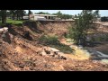
The Science Behind Sinkholes and Their Geological Impact
Interactive Video
•
Science, Geography, Other
•
9th - 10th Grade
•
Practice Problem
•
Hard

Patricia Brown
FREE Resource
Read more
9 questions
Show all answers
1.
MULTIPLE CHOICE QUESTION
30 sec • 1 pt
Who is the speaker in the video and what is his profession?
Randall Orndorff, a geologist with the U.S. Geological Survey
Michael Johnson, an engineer with the Department of Transportation
John Doe, a meteorologist with the National Weather Service
Jane Smith, a biologist with the Environmental Protection Agency
2.
MULTIPLE CHOICE QUESTION
30 sec • 1 pt
What are karst terrains primarily composed of?
Metamorphic rocks
Non-soluble rocks like granite
Soluble rocks like limestone, gypsum, and salt
Igneous rocks
3.
MULTIPLE CHOICE QUESTION
30 sec • 1 pt
What percentage of the United States is underlain by karst terrain?
10%
20%
40%
30%
4.
MULTIPLE CHOICE QUESTION
30 sec • 1 pt
Which state is almost entirely underlain by limestone?
New York
Florida
Texas
California
5.
MULTIPLE CHOICE QUESTION
30 sec • 1 pt
What are man-induced sinkholes often caused by?
Natural erosion
Earthquakes
Urban infrastructure like pipelines and sewer lines
Volcanic activity
6.
MULTIPLE CHOICE QUESTION
30 sec • 1 pt
What happens when cracks develop in aging sewer lines and water mains?
They improve water flow
They lead to soil leaking into the voids, causing collapse
They cause flooding
They have no significant effect
7.
MULTIPLE CHOICE QUESTION
30 sec • 1 pt
What tool does the U.S. Geological Survey use to understand where sinkholes occur?
Weather maps
Seismic activity charts
Geologic maps
Satellite images
Access all questions and much more by creating a free account
Create resources
Host any resource
Get auto-graded reports
Continue with Google

Continue with Email
Continue with Microsoft
or continue with

%20(1).png)
Apple
Others
Already have an account?
