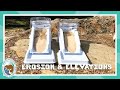
Erosion and Elevation: Exploring Water's Impact on Landscapes
Interactive Video
•
Science, Geography, Physics
•
4th - 5th Grade
•
Practice Problem
•
Hard

Patricia Brown
FREE Resource
Read more
10 questions
Show all answers
1.
MULTIPLE CHOICE QUESTION
30 sec • 1 pt
What should you focus on when observing the water's effect on sand in the experiment?
The amount of sand used
The color of the sand
The speed and slope
The temperature of the water
2.
MULTIPLE CHOICE QUESTION
30 sec • 1 pt
In the experiment with two river models, what was the main difference between them?
The type of sand used
The color of the models
The elevation of the models
The amount of water added
3.
MULTIPLE CHOICE QUESTION
30 sec • 1 pt
What is a topographic map primarily used to show?
Population density
Elevations
Types of vegetation
Weather patterns
4.
MULTIPLE CHOICE QUESTION
30 sec • 1 pt
What do the lines on a topographic map represent?
Temperature variations
Different types of soil
Elevation levels
Water flow directions
5.
MULTIPLE CHOICE QUESTION
30 sec • 1 pt
How can you tell if an area is steep on a topographic map?
The lines are colored differently
The lines are closer together
The lines are wavy
The lines are numbered
6.
MULTIPLE CHOICE QUESTION
30 sec • 1 pt
What does it mean when the lines on a topographic map are farther apart?
The area is underwater
The area has a gentle slope
The area is very steep
The area is densely populated
7.
MULTIPLE CHOICE QUESTION
30 sec • 1 pt
What is the elevation difference between two lines if one is at 300 feet and the other at 250 feet?
100 feet
75 feet
50 feet
25 feet
Access all questions and much more by creating a free account
Create resources
Host any resource
Get auto-graded reports
Continue with Google

Continue with Email
Continue with Classlink
Continue with Clever
or continue with
Microsoft
%20(1).png)
Apple
Others
Already have an account?
