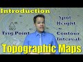
Navigating Topographic Maps and Understanding Contour Lines
Interactive Video
•
Geography, Science, Mathematics
•
6th - 8th Grade
•
Practice Problem
•
Hard

Patricia Brown
FREE Resource
Read more
10 questions
Show all answers
1.
MULTIPLE CHOICE QUESTION
30 sec • 1 pt
What is the primary focus of today's lesson on topographic maps?
Exploring map legends
Learning about map scales
Understanding contour lines
Identifying physical features
2.
MULTIPLE CHOICE QUESTION
30 sec • 1 pt
What do contour lines on a topographic map represent?
The temperature of the area
The distance between two points
The height above sea level
The direction of the wind
3.
MULTIPLE CHOICE QUESTION
30 sec • 1 pt
Why are some contour lines thicker and darker than others?
To indicate different types of terrain
To show the direction of water flow
To represent index contour lines
To highlight areas of high elevation
4.
MULTIPLE CHOICE QUESTION
30 sec • 1 pt
How is the contour interval determined on a topographic map?
By counting the number of hills
By using a compass
By measuring the distance between two points
By dividing the elevation difference by the number of lines
5.
MULTIPLE CHOICE QUESTION
30 sec • 1 pt
What is a spot height on a topographic map?
A symbol for a mountain peak
A point indicating the exact height of a location
A representation of a forest area
A marker for a river source
6.
MULTIPLE CHOICE QUESTION
30 sec • 1 pt
What is another name for a trig point?
Height indicator
Contour beacon
Triangulation station
Elevation marker
7.
MULTIPLE CHOICE QUESTION
30 sec • 1 pt
What is the significance of the number below a trig point symbol?
It indicates the distance to the nearest city
It represents the number of contour lines
It marks the age of the map
It shows the exact height above sea level
Access all questions and much more by creating a free account
Create resources
Host any resource
Get auto-graded reports
Continue with Google

Continue with Email
Continue with Classlink
Continue with Clever
or continue with
Microsoft
%20(1).png)
Apple
Others
Already have an account?
